Good evening…
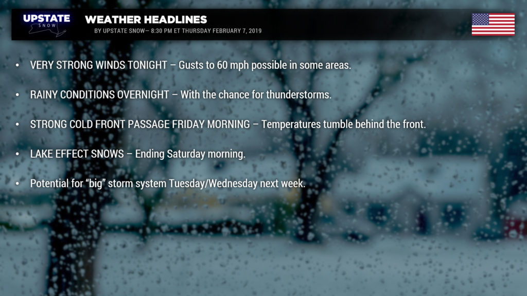
A rainy night is setting in; at the time of this writing, radar shows widespread rain across most of the state south of a line from Watertown to roughly Albany. Rain will continue to lift north and east, overspreading the entire state. Portions of western NY remain under a Flood Watch through Friday morning for runoff flooding and the potential for ice jams. This includes Allegany, Cattaraugus, Chautauqua, Erie, Genesee, Livingston, Monroe, Niagara, Orleans, and Wyoming Counties.
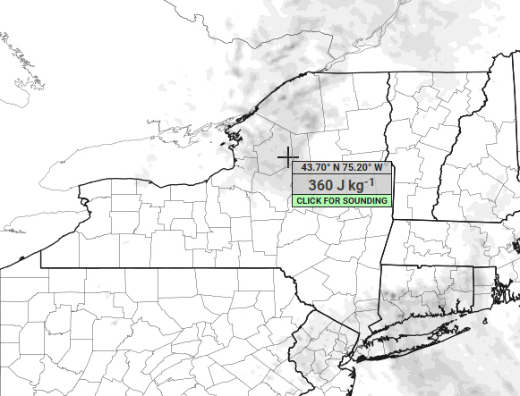
Our high-res modeling shows a few beats of instability over portions of northern NY… so don’t be surprised to hear some thunder overnight.
A HIGH WIND WARNING has been posted for the typical high wind corridor from Lake Erie and the Niagara Frontier to Rochester…as well as for Jefferson County. We’re looking at sustained winds 25-35 mph with gusts to 60 mph possible. A WIND ADVISORY has been posted for much of the rest of northern NY, the Mohawk Valley, and the Capital District for wind gusts up to 50 mph possible. The “parent” low pressure system responsible for our weather conditions has rapidly strengthened — the two main branches of the jet stream essentially joining forces. This sets up an IV infusion of Monster energy drink for our storm system. As the storm lifts northeast into Quebec, and in the process takes another shot of Monster energy…. the meteorological term “bombogenesis” comes into play here. (Typically this occurs with rapidly strengthening Nor’easters, but in this case, it’s cutting to our north and west and explosively strengthening.) At any rate, roaring southwest winds will greet the frontal passage, followed by a shift to the west during the day on Friday.
This really is an impressively strong storm system.
At any rate, with these strong winds, the thaw, the muddy ground, and some moderate rainfall tonight — this could spell trouble for shallow-rooted trees, power lines, any diseased/damage trees, etc. Plan on at least scattered power outages tonight into Friday.
Speaking of the cold front… it will push across the state on Friday. Timing appears to be earlier than originally anticipated. We’re looking at the pre-dawn hours for western NY… to mid-morning for eastern NY. A line of “convective showers” (some heavier showers with gusty winds) will probably accompany the front. Temperatures will tumble behind the frontal passage. Our “highs” will come very early, of course, and any leftover rain will switch to snow showers. We’re honestly not expecting there to be a lot of moisture leftover behind the front. However…. as we move into the afternoon and evening, a plume of lake effect snow is expected to become established east of Lake Ontario. This will hit the usual target areas… the Tug, portions of Oswego, Jefferson, Lewis counties, and this will likely extend east through central and northern Oneida and central Herkimer county. Some snows will also fall east of Lake Erie, but ice cover will tend to limit that.
Here’s what we’re looking at for snowfall going through 7 AM Saturday. Last evening we gave a “ballpark guesstimate” of 4-8 for the Tug, and we believe that’s a reasonable expectation given the dynamics, moisture, wind flow, so forth, so on, etc., and etc. A 2-4 snowfall is a good bet east of Lake Erie. Random snow showers over other portions of the state may drop an inch or two of new snow.
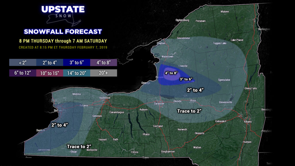
High pressure takes control Saturday into Sunday afternoon with dry conditions and seasonable temperatures.
Our next system will push across the state later Sunday afternoon into early Monday. Meh… this doesn’t look like anything to get too excited about, but some light snow / snow showers may drop a couple of inches of new accumulation across the state Sunday night.
Our attention then firmly focuses on the middle of next week and a potential major storm system. The modeling this evening looks absolutely nothing like it did yesterday, and honestly, tomorrow will probably be a complete flop again. Right now the guidance shows one system lifting north from the northern Ohio Valley into Michigan, and eventually Ontario. BUT… a second low takes shape somewhere along the NC or Virginia coast and lifts northward toward Cape Cod by next Wednesday. Should this scenario verify, we’re looking at the potential for a big snowstorm… or a “snow – to – mix – back – to – snow” event……… it’s just way too early to make any kind of definitive call. But yeah, all eyes will be on Tuesday/Wednesday next week for some big business here.


