Good evening! We apologize for running late with tonight’s post.
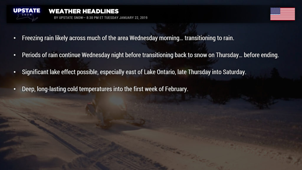
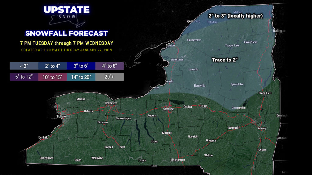
Winter Weather Advisory up for nearly all of the state for Wednesday… for mixed precipitation and freezing rain… and some snow accumulation in the far north, close to the Canadian border. A real mess is headed our way for Wednesday.
High pressure that brought the frigid air this morning will shift east and allow a storm system to track into the Great Lakes during the day tomorrow. This will lift a warm front over the area… following which a richly moist and “warm” flow from the southwest will become established. This warmer, moist air flowing over the colder air hanging tough will result in the outbreak of precipitation from south to north at or around daybreak. This will initially start out as some light snow/sleet for areas south of the Thruway, with light snow to the north… but quickly transition to a period of freezing rain… and a glazing of ice is expected just about all locations.
As we work through the day, temperatures will rise to the mid and upper 30s, and all freezing rain transitions to rain from south to north/northeast. Some of the typical areas like the eastern ADKs and eastern Catskills may hang on for a little while longer, but those areas, as well, will become all rain.
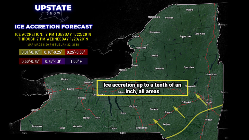
These low pressure systems always have a trailing cold front, and this one will be no different… except a second area of low pressure will spawn on the front. Not only will this enhance the moisture moving northward, but it will work to virtually stop the movement of the frontal boundary. At this time it appears that the front will hang up pretty much directly over the center of the state from north to south. Western NY may experience rain/snow showers transitioning to all snow late Wednesday night… but east of I-81, expect cold rain through the night. It is what it is.
The front will finally push eastward Thursday and precipitation changes to all snow everywhere before coming to an end. There may be some new accumulations, particularly western and west-central NY.
Precipitation totals (any snow, ice, plus rain) through early Thursday afternoon may be up to an inch… the highest totals should come across the Susquehanna region an the Catskills… where some models show up to 1.25 inches liquid equivalent total. There will be some snowmelt and compaction… as well as some runoff. The deep snowpack will help limit this, as well as a return to Arctic cold as we go into Thursday night.
Speaking of the return of Arctic air, a mainly westerly wind flow will pick up Thursday night into Friday, with the lake cannons coming alive. This will be aided and abetted by some disturbances pinwheeling through the Great Lakes. An Arctic cold front will drop down over the state by Friday… and this could set the stage for some heavy lake effect snow on Friday… particularly east of Lake Ontario thanks to the near due-west-to-east wind flow … that’s a lot of water for that deep, cold air to flow over. Lake effect should continue into Saturday as well until high pressure pushes overhead, pushing the Arctic front back north into Canada.
It is definitely going to stay cold. The Arctic air arriving late Thursday will be here to stay… at minimum into the first week of February. ALL modeling and indices point to a long period of temperatures similar to what we experienced after the snowstorm. Occasional weather systems will keep snow chances… and lake effect… well into next week.
That’s all for tonight, thanks for viewing! Be safe if you have to travel on Wednesday.


