Good evening, snow lovers!
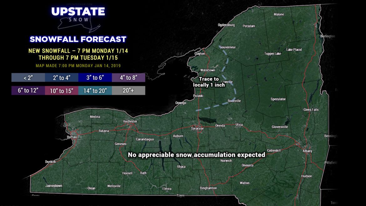
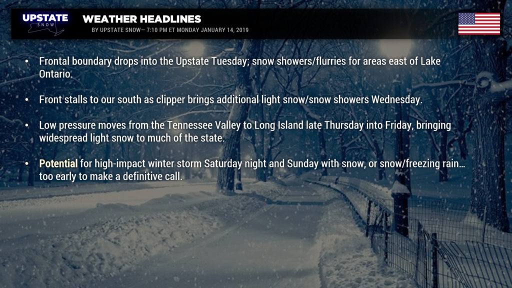
A cold front will drop south across the state tomorrow, and then stall just to our south (keep that in mind for a minute). This will bring a few scattered snow showers primarily just east of Lake Ontario, where lift on the Tug may produce up to an inch of fluffy accumulation.

While this front lags to our south, on Wednesday a clipper will zip just north of the International Boundary; this will bring a bit more widespread coverage of what should be primarily snow showers with perhaps some lake enhancement… but again, emphasis on light. Total snow accumulations through Wednesday evening will be perhaps an inch or two at the most for many of us.
Another shot of very cold air moves in behind this for Wednesday night into Thursday — temperatures by time you get up on Thursday morning are likely to be below zero just about everywhere north of the Thruway… with highs Thursday afternoon ranging from the teens in the North Country to the mid 20s elsewhere.
Remember we said to keep that old front in mind — well that comes into play on Friday. An area of low pressure will “ride the highway” from the Tennessee valley Thursday afternoon through West Virginia, southern Pennsylvania, to a position around Long Island by Friday afternoon. Snow will overspread the state on Friday into Friday night. This won’t be a heavy snowfall at all, perhaps a general 1-3 or maybe 2-4. Highs Friday will be in the upper 20s to around 30 south of the Thruway, lower to middle 20s to the north.
Then our attention turns to what COULD BE a high-impact winter storm this weekend. Models are in … actually relatively scary agreement this far out… that a large, dynamic area of low pressure will organize over the mid-Mississippi Valley by Saturday afternoon… moving to a position off the Jersey coast or just south of Long Island by Sunday afternoon. At the same time, strong areas of high pressure will be located well to our north, northeast Quebec or southwest Newfoundland and Labrador, as well as over the northern Plains. These are important as they will force our storm system to our south and east and keep lots of cold air in place over the Upstate. This sets the stage for a significant snowstorm.
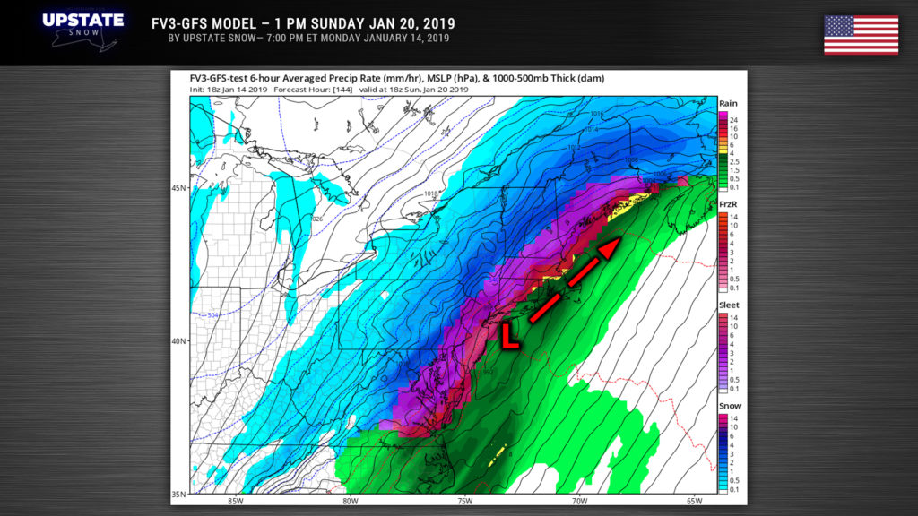
The biggest issue will be the storm track, and we’re still way too far out to really hone this down… this will be the case through about Thursday. The modeling is in pretty good agreement though, and this far out … that’s saying something. The current modeled storm track — if we were to take all of the guidance and lump it together — would be from eastern Kentucky/western Virginia moving northeastward into southeast PA, to virtually right over NYC by Sunday afternoon. This is close enough that a warm “nose” of air in the middle layers of the atmosphere may push its way into at least the Catskills and the Capital District… and where this warm nose occurs would mean a transition to freezing rain. Here is one snapshot of one of the models we’re looking at — valid at 1 PM Sunday.
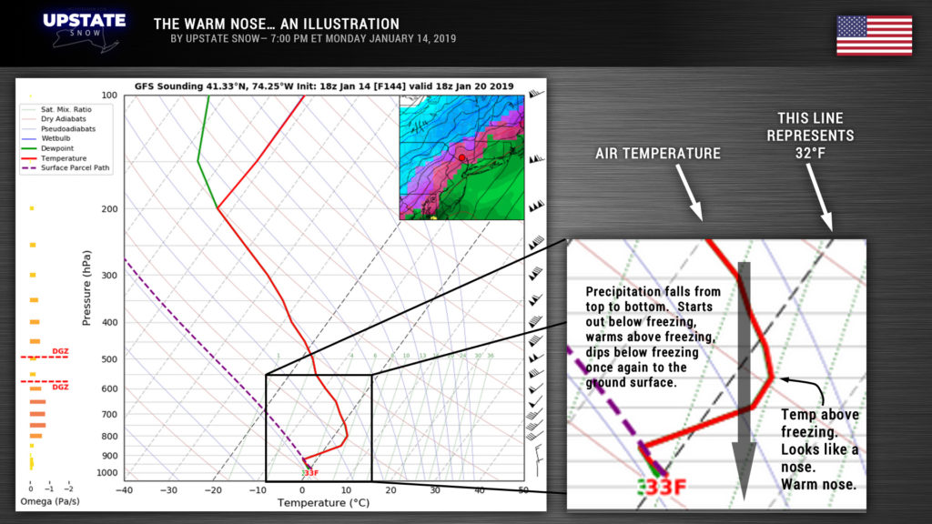
Sidebar—-What is a warm nose? As precipitation falls from the cloud base, it encounters a “layer” – think of layers on a cake – where the air temperature is above 32 degrees. The snowflake melts into a water droplet. As it continues to fall, it encounters a new cold layer close to the ground surface — below 32 degrees. The water droplet becomes “supercooled” — it doesn’t freeze because the cold layer at the surface is too shallow, but instead it freezes on contact with any surface. Anyway, this warm layer is called a warm “nose.”
So at any rate, as is typical with these storms, the exact precipitation type is highly dependent on the storm track. The storm track is… at this point… unknown (despite any model consensus)… and would be a “guess” at this point… up until about 36 hours out. Even then, it could wobble. But this COULD BE what we’ve all been waiting for.
Oh, and after that, longer-term modeling suggests much more cold weather, and a fairly stormy pattern carrying us through the end of the month.

