Good evening!
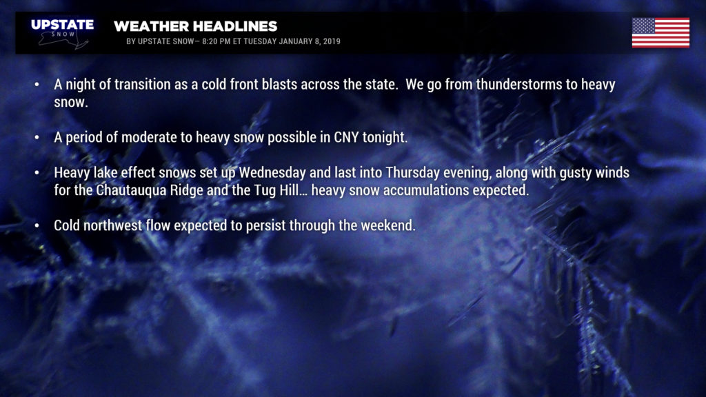
A complicated scenario over the state as this report is being typed… we’re going to go from thunderstorms to heavy snow in a very short period of time. An area of low pressure exists over Lake Huron with a cold front extending southward from it. This cold front will push across the state tonight, bringing in a MUCH COLDER air mass and changing rain over to snow. Some heavy snow is possible through Wednesday morning for portions of central New York, particularly the higher elevations of Cortland, Madison, northern Chenango, NW Otsego, and southern Oneida counties. A period of gusty winds will also accompany this pretty potent front as it crosses the state tonight. Winter Wx Advisories are up for most of CNY and the North Country.
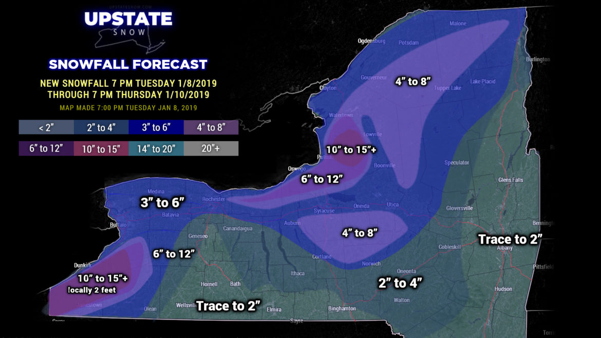
By Wednesday morning, our low really starts to devour the energy drinks off the coast of Maine. This, combined with a large area of high pressure over south-central Canada, will mean a west-to-northwest wind flow, falling temperatures (especially aloft), all kinds of instability, and heavy lake effect snowfall. Winter Storm Watches and Warnings are up several counties in western and northwestern NY for Wednesday into either late Thursday or early Friday. A perfect lake effect scenario, with an upstream connection to Lake Huron, will bring big-time snow totals to the Chautauqua Ridge as well as east/southeast of Lake Ontario (Tug Hill, western ADKs, higher terrain along route 20). The lake effect cannons begin firing tomorrow afternoon and continue into Thursday evening. Oh, and it’s also going to be pretty windy thanks to a very tight “pressure gradient” (difference between the high pressure to our northwest and the deepening storm system to our east). Modeling suggests winds at the surface 35-45 mph, and there’s really no reason to doubt those numbers.
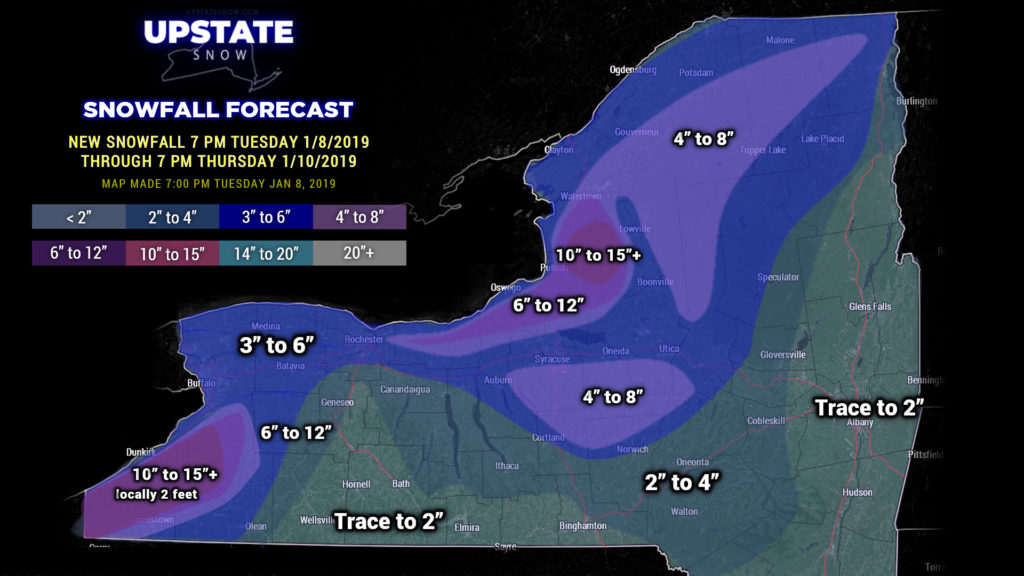
To make life a little more simple, we’re going to break tradition tonight with the snow maps.. and we’re going to post a 48-hour snow totals map. So instead of ending at 7 PM Wednesday, we’re going to go through 7 PM Thursday evening. And looking at model soundings and other details, there is no reason not to go “all in” with this. Now, of course, not everyone is going to see blockbuster snow totals, and trying to pinpoint just where the lake bands become established…. we’d have better luck trying to drive a cat through a car wash. We came up with these amounts based on past experience with very similar setups, along with the latest model data. The highest amounts will be, again, where the bands set up, so not everyone in the darker colors will see those totals… and some isolated spots may actually see a lot more.
The lake effect comes to an end on Friday as high pressure moves over the area, effectively shutting things off. Cold temperatures expected Friday night, below zero in the North Country.
Last night we mentioned the potential for accumulating “synoptic” snows this weekend, as models were pushing low pressure from the Carolinas off the coast. This evening the modeling is still fairly inconsistent, but is trending farther south and east with this, keeping most of the snows out of NY. The pattern, however, stays pretty consistent through the weekend and into early next week with a ridge over the Rockies, troughiness over the east, with a persistent northwesterly flow into at least Monday.

