Good evening!
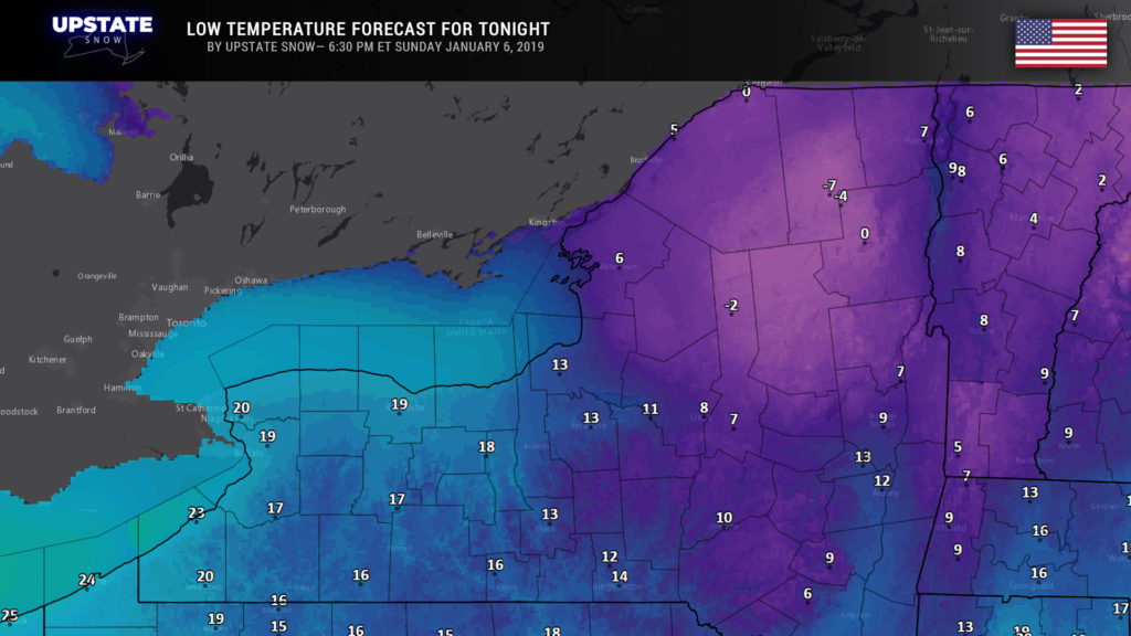
Our next organized weather system will approach Monday afternoon. Before this happens, though, tonight will feature high pressure building over the area, which will bring mainly clear skies tonight and cold temperatures (below zero in the Adirondacks) to the Upstate.
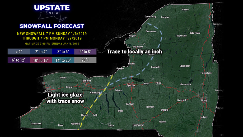
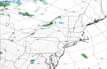
This is important because as we go through Monday, a strong push of warm, moist air will take place. The air locally (on the ground, where you and I live) will be very dry initially. Warm air flowing up and over the cold, dry air trapped at the surface will result in precipitation breaking out in the higher levels of the atmosphere… but not here on terra firma. It will “precipitate” for a while before the this actually DOES reach the ground. As the precipitation falls in this drier colder air, it will a) moisten that air (of course), and b) cool that air even more as the precip evaporates, what we call evaporational cooling. The precipitation that reaches the ground Monday afternoon should be quite light with perhaps a glazing of ice for western NY, with some minor snow accumulations along with ice for the western ADKs to Lake Ontario.
(Note- that map is only through 7 PM Monday)
A second round of precipitation looks to enter the region after suppertime on Monday. By this time temperatures should be above freezing for western NY, but that’s far from a certainty. For most of central, western, and northern New York, look for snow or sleet with freezing rain Monday night, probably switching over to rain everywhere before ending from southwest to northeast during the overnight.
This second wave isn’t going to be anymore interesting or robust than the first, with again a light glazing of ice or perhaps up to an inch of snow with ice before transition to light rain for western New York. Farther to the north, east of Lake Ontario, it’s probable that at least a couple of inches of snow will fall Monday evening into Monday night — this is not included on our snow map.
Temps will rise as we go through Monday night into early Tuesday… before the cold front portion of our system drags through later Tuesday.
Another wave of precipitation will attack the area later Tuesday into Tuesday evening. That much is near certain. However, the devil is in the tiniest of the details as to what falls from the sky, and where. At the start this should be rain, even in the North Country, but should transition back to snow during the overnight into Wednesday morning.
Because of the freezing rain threat, NWS has posted Winter Weather Advisories for the counties east of Lake Ontario, as well as in western New York.
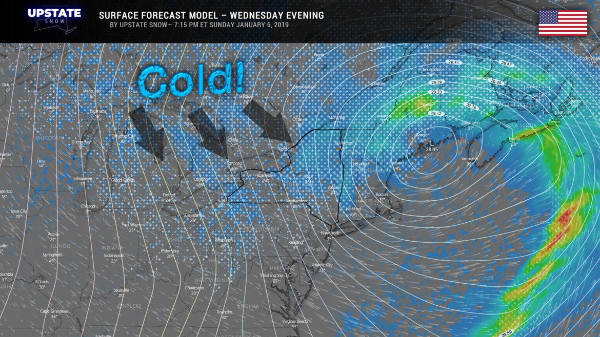
By Tuesday night another area of low pressure develops over Lake Ontario with this renewed push of precip. This low will move to the Gulf of Maine by Wednesday evening and really deepen quite magnificently. This, combined with a big blue high pressure ridge over northern Minnesota, FINALLY means a trough develops over the Great Lakes with little distubances zipping down southeastward. This FINALLY means a true, hard northwesterly flow hits the area. These little disturbances pinwheeling across the area will mean lake effect snow and lake enhanced “synoptic” snows… which, in turn, FINALLY means some fairly decent snow accumulations for portions of the Upstate. It’s way too soon to even begin thinking about “who gets what,” except to say that the highest amounts will be in higher elevations.
This overall weather pattern looks like it will persist through next weekend. We can’t call it “brutal cold” or anything like that… because it will be “seasonable.” At any rate, conditions will be very favorable on Thursday for lake effect snow, especially off of Lake Ontario. Lake effect should cut off as we go into Friday as high pressure … of Arctic origin!! … will move across the Great Lakes later Thursday into Friday. While this means even more cold temperatures, there probably won’t be much in the way of LES as the air becomes very dry by the end of next week.

