Good evening…
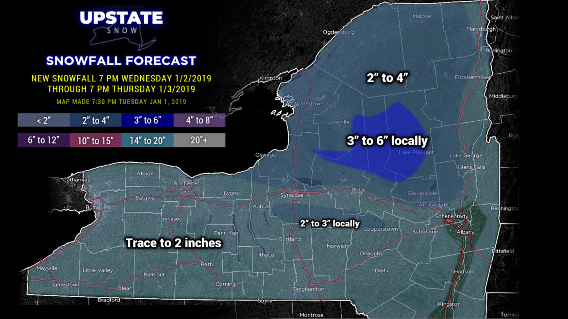
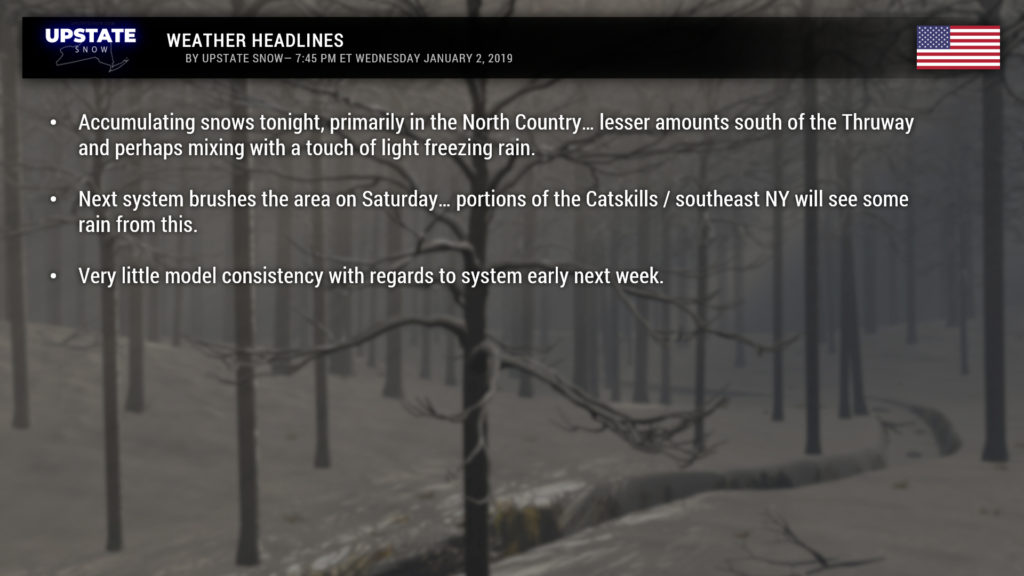
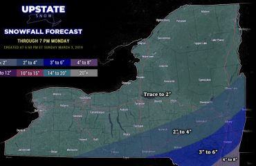
We finally have some accumulating snow to talk about… though it’s not much… but hey it’s something. A clipper system will zip across southern Canada or along the International Border and bring snows mainly north of Route 20, particularly north of the Thruway. Amounts won’t be a lot… but we are painting in some 3- to 6-inch amounts primarily for higher elevations of northern Herkimer and Hamilton counties. This is based on a blend of all the modeling for these areas. South of 20 snow amounts will drop off significantly as there just won’t be much available moisture, and a brief push of “just warm enough” air may cause some very light freezing rain to occur (no precip-type worries over the North Country, plenty of cold air in place for a change).
Our next system of concern is over the weekend, particularly Saturday. The modeling is consistent on a low center moving from the Mississippi Valley into TN/NC and then off the Virginia/Delmarva coast. The question mark here is how far north/west the precip extends… the GFS keeps precip mainly in the SE Catskills toward NYC, etc. The FV3 version of the GFS keeps precip even farther south/east toward NYC. The Canadian wants to throw a little bit of light mixed precipitation or freezing rain along the NY/PA border into the Catskills early Saturday… as does the Icon. The European sends rain much farther north and west, impacting a good portion of eastern and southeastern NY, more or less along and south of I-88. At the same time a little disturbance will drop southeast out of Canada across the state by Saturday night, pushing the main system off the coast and dropping our temps. As for precip… our call is that during the day on Saturday most areas north and west of I-88 SHOULD be mainly dry, perhaps some light passing showers of freezing rain or rain south of 20, east of I-81, depending on the exact track of that original system. Some snow showers may accompany the weaker system as it drops over the area Saturday night, but meh, that’s doubtful. None of the modeling really suggests anything more than … well … barely anything.
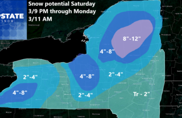
The next player to enter Contestants Row will be a system originating along the US/Canadian border north of Montana… with another low developing over Lake Michigan by next Monday night or early Tuesday. That’s about where any model “agreement” comes to an end. Solutions go from having the low continue to move northeast into Quebec (which, of course, would bring us milder temperatures and more rain), versus moving due-east over the center of the state (resulting in mixed precip, rain, then snow), versus a low moving from southern Michigan roughly along the NY/PA line (which would still result in some rain for portions of the Upstate but a much better chance at some decent accumulating snows in the North Country). So we’re not really going to make a hard call on it at this time other than to expect PROBABLY another shot of mix-to-rain-to-snow event for late Monday through next Tuesday… but confidence is not great.
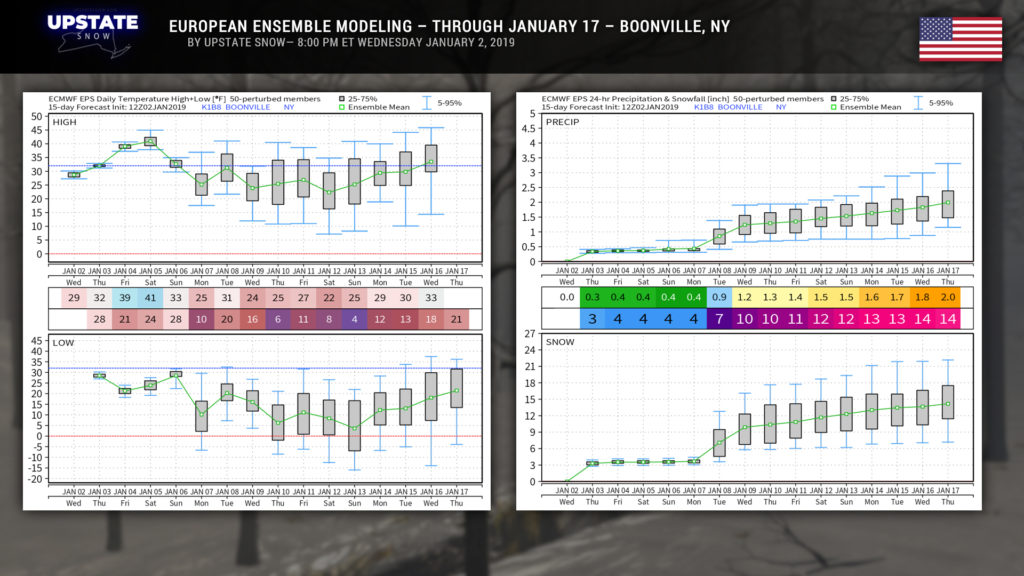
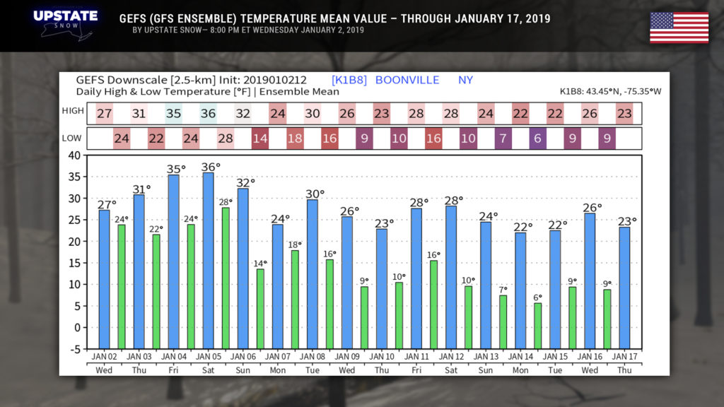
Finally we’ll just put this here so you can get an idea of what the European ensembles are looking at through the 16th, as well as the GEFS (GFS ensembles). Maybe this is good news…

