Good evening!
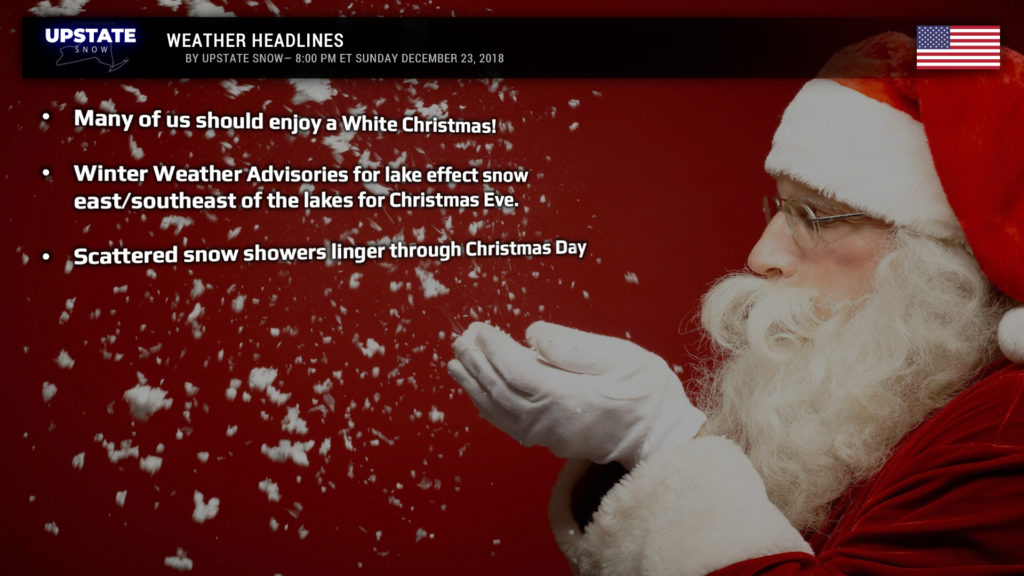
A clipper system moving into the Upstate tonight, combined with a stationary frontal boundary draped more-or-less down the Thruway during the day on Monday, will assure that many of us have a White Christmas.
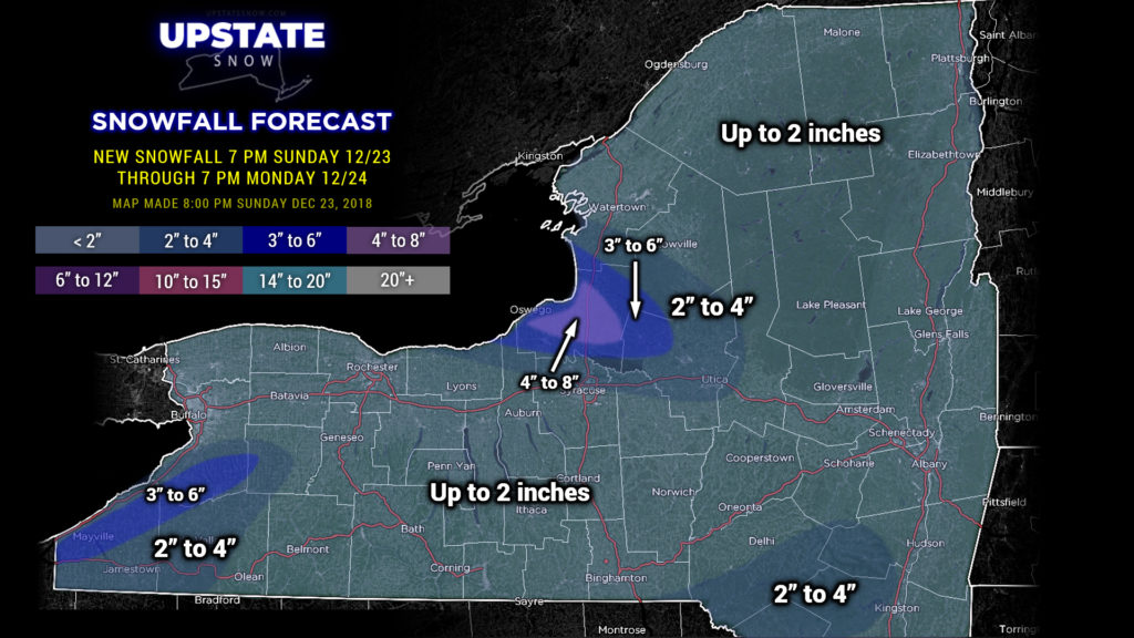
Breaking down the details, the clipper will zip across the state late tonight into Monday, and this in and of itself should drop about an inch of snow. Following this, a west-northwest flow sets up and lake effect snows develop. A Winter Weather Advisory has been posted for areas downeast of the lakes. 2-4 / 3-6 snow amounts east of Lake Erie, and similar amounts east of Lake Ontario… but a bullseye target over Oswego county… up to 8 inches IF our lake effect is modeled accurately. I’m not sure I’m 100% on board with the advisories… one could argue some advisory-level snows could fall in portions of Oneida and Lewis counties as well, but that decision is above my pay grade. Either way, Oswego County looks to win the award for the snows, locally. Modeling indicates that there will be enough instability that some more intense squalls develop tomorrow, especially along I-81 in Oswego County… so take it easy when traveling.
This general trend continues Christmas Eve night. Rudolph shouldn’t have too much trouble guiding Santa’s sleigh across the Upstate… there may be some pockets of additional snow showers and snow squalls but nothing severe or intense. These snow showers should continue into Christmas Day as well… any additional accumulation will be in the higher terrain.
That frontal boundary mentioned a bit earlier lingers into Wednesday before high pressure briefly takes control through Thursday before things get turned upside down on us … AGAIN …
… and AGAIN … this is another “don’t shoot the messenger” moment. A high pressure ridge in the mid- and upper-levels will shift off the coast, opening a highway from the southern plains through the Great Lakes. Details are sketchy this far out and a lot can change, but modeling shows another strong / deep low pressure riding on this highway to our west, from the southern plains or Mississippi Valley (depending on which model you want to play with), driving northward into the Great Lakes, and then northeast through Quebec between late Thursday and next weekend. If this whole nonsense sounds familiar, well, it is. Warm, moisture-laden air from the Gulf would pump northward… again… and precipitation will occur… again… late Thursday through Friday… lingering into Saturday… with colder air slow to filter in behind the system. There will probably be enough cold air that the precip starts out as a period of snow or mixed precip late Thursday night before changing to rain on Friday.
That’s it for tonight! Be safe if you have travel plans on Monday, and thanks for your continued support.


