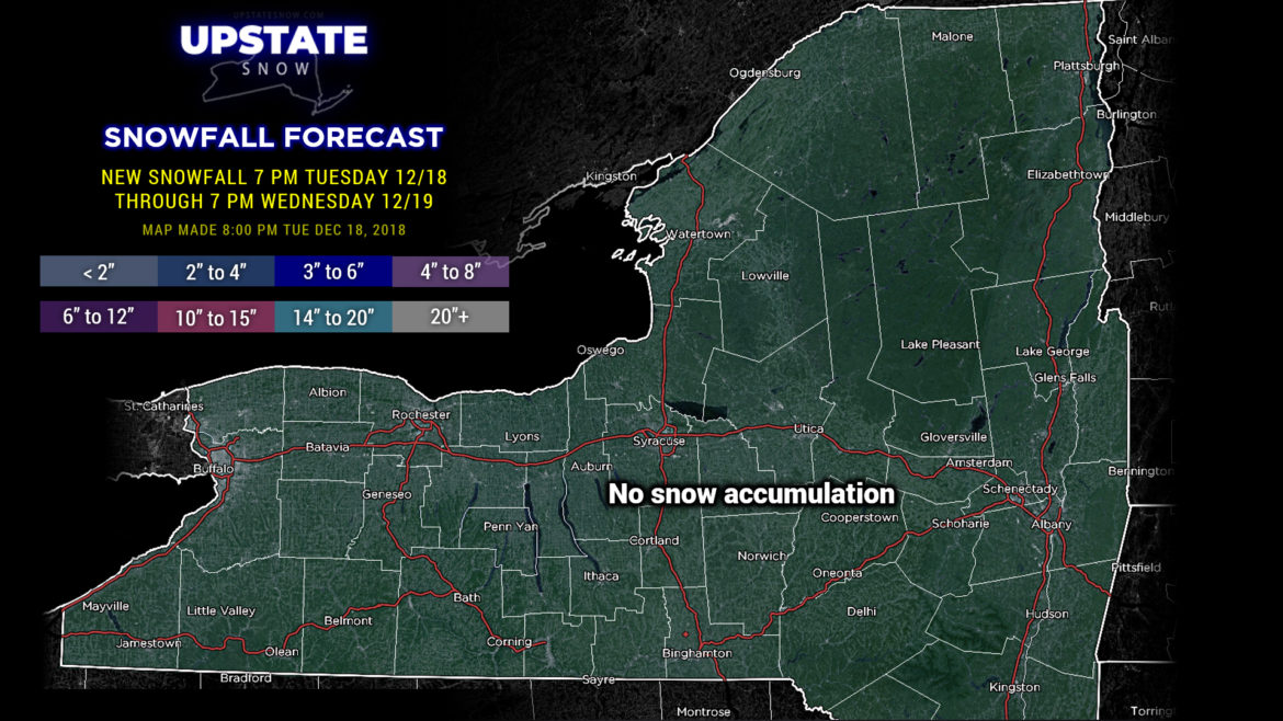
Good evening…
Right… well, please don’t shoot the messenger.
First…
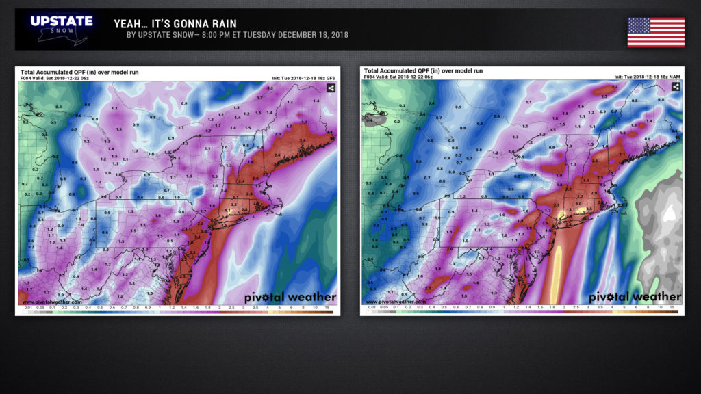
Second… here are some model rainfall projections through 1 AM Saturday. For legal reasons, we can’t display a screenshot of European rain totals, but … spoiler alert … they’re remarkably similar (perhaps even a little worse).
So to break it down, Wednesday and Wednesday night should be dry. We’re going to see temperatures warm up fairly remarkably by tomorrow afternoon… after starting off in the teens and upper singles most of the state will jump into the upper 30s to lower 40s (lower to mid 30s in the ADKs). Clouds will begin to increased Wednesday night.
On Thursday our storm gets organized and lifts northward from the Gulf Coast. By early Friday morning it should be over western North Carolina. Warm air will be surging northward… and with this will come the rains late Thursday afternoon for the NY/PA border counties, pushing northward to encompass the entire state by Thursday evening. The rains will pour down upon us through much of the day Friday… but there’s an interesting little wrinkle. Some of the modeling still suggests a dry slot develops Friday as the storm center pushes almost directly over western NY. This has a couple of ramifications… if it develops, and some breaks of sunshine occur, yeah, those areas may see temps jump into the 60s. With that will come the second ramification… instability… and don’t be surprised if there is some thunder.
By Friday night our storm lifts northward into Canada. ANOTHER wrinkle today… modeling is hinting at a secondary low pressure area developing over eastern PA/New Jersey and lifting north into New England. Coler air will start wrapping in on Friday night and a very slow transition to snow may begin. Temps will continue to fall during the day Saturday so it’s reasonable to expect all areas to go to snow showers… but emphasis is on snow SHOWERS… maybe some light accumulations, but there’s going to be so much water around, so…
More cold air pumps in on a northwest wind flow into Sunday and there may be some lake effect snow… but no big cannons going off.
Now… after ALLLLLLL of this, there is still the CHANCE that some of us will have a White Christmas. Just like last night, modeling takes two separate teams when it comes to Christmas Eve and Christmas Day. The Euro says a clipper system zips across the area with some periods of snow (with SOME accumulation, not a lot). GFS says yeaaah no.
Hang in there… the arrows are pointing at a big pattern change going into January…

