Good evening!
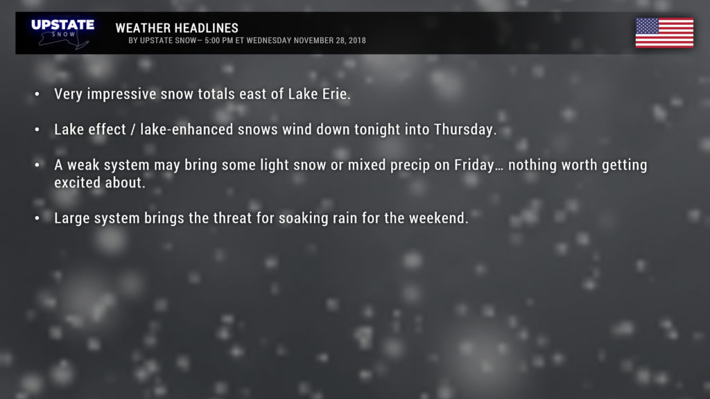
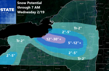
IMPRESSIVE… snow totals reported to NWS from the storm as of the time of this writing. Oh yeah, we underguessed, especially the Chautauqua Ridge. Perrysburg, in Cattaraugus County, wins the WOW award with 35.2 inches of snow as reported to NWS at 3 PM this afternoon. A CoCoRaHS user northeast of Kennedy in Chautauqua County came in with 24.5 inches at 6 AM this morning, so that likely has gone up. 24 inches in Celoron and west-southwest of Randolph as well. Cattaraugus checked in with 22 inches at 8 AM today. Jamestown comes in at 19 inches, as of 11 AM. In Lewis County we have a 9.2-inch total 5 miles SSW of Harrisville (CoCoRaHS), with some 5’s and 6’s in Constableville, Highmarket, Lowville, and Osceola, but these reports are as of early this morning.
In central NY, the other “target spot,” as is the nature of lake-effect snow, results are hit-and-miss, and many reports are from early this morning so likely have changed. Double-digit totals as of this morning included Erieville, in Madison County, with 10.1 inches; 1 mile east of Paris (CoCoRaHS observer) with 12.2 inches, Sauquoit also with 12.2 inches per trained spotter. Other amounts in Oneida County this morning (through about noon) range from 3 to 9 inches depending on location. Locations in Onondaga, Otsego, Delaware, and Cortland county generally ranged from 3 to 9 inches.
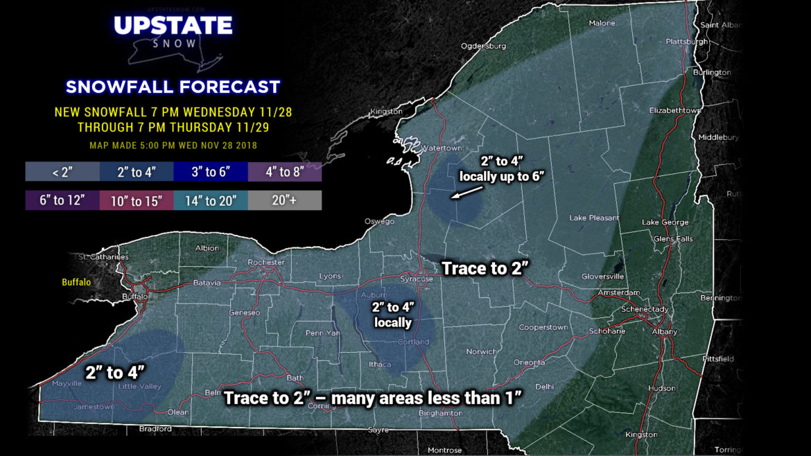
Ok, well the snow is going to wind down through the night and while we may have some renegade snow showers Thursday, the trend will be to dry out. Highest snow totals now over the next 24 hours will be in areas where it’s currently snowing… the Chautauqua Ridge, and across portions of Cayuga, Onondaga, Cortland, and Tompkins counties. Elsewhere, we’ve painted in a “trace to 2 inches” but it will be more on the trace side.
After a mainly dry Thursday afternoon and Thursday night, a quick little system will zip across the state on Friday, which may bring some light precipitation. It looks like it would start out as snow, but I’m concerned about some warming that will take place which would change precip over to rain, or even sleet and freezing rain. Either way, the system is weak, there won’t be much moisture to work with, so it’ll be more of a nuisance than anything else.
For the weekend, no major changes. The exact details are still kind of murky, but generally speaking, a large storm system will lift from the Plains into the Great Lakes by Saturday evening and then up the St. Lawrence through Sunday. Overrunning moisture well ahead of the system will cause showers to develop Saturday morning from southwest to northeast. This could start out as freezing rain depending on how much cold air is trapped near the surface. This cold air quickly scours out as moist air originating from the Gulf of Mexico pumps into New York, so ice accumulations will be nada. The rain moves out of here and there should be a several-hour period of no precipitation Saturday afternoon into Saturday evening.
Moisture with the surface low arrives Saturday night, all rain, and some modeling suggests periods of heavy rain through about noon on Sunday. Experience with these systems also tells us that it will turn quite warm on Sunday… and the GFS model concurs, showing highs Sunday afternoon go into the mid 50s for the Fingerlakes, with upper 40s to lower 50s pretty much elsewhere south of the Thruway… with lower to middle 40s in the Adirondacks.
The trailing cold front will push through the state on Monday, but by that time the cold air filtering in will be “chasing” the precipitation and by Monday night, we’re left with a scenario of just snow showers. There’s a wrinkle in this though, as the latest European model wants to spin up a little weak low just to our south. Maybe perhaps, we’ll see.
There’s still some time to hammer out the details on the weekend system, but in general, it’s going to be a rain event all the way.
Ok gang, that’s it for tonight. Have a good one, take care, and thanks for supporting our site.

