Good evening!
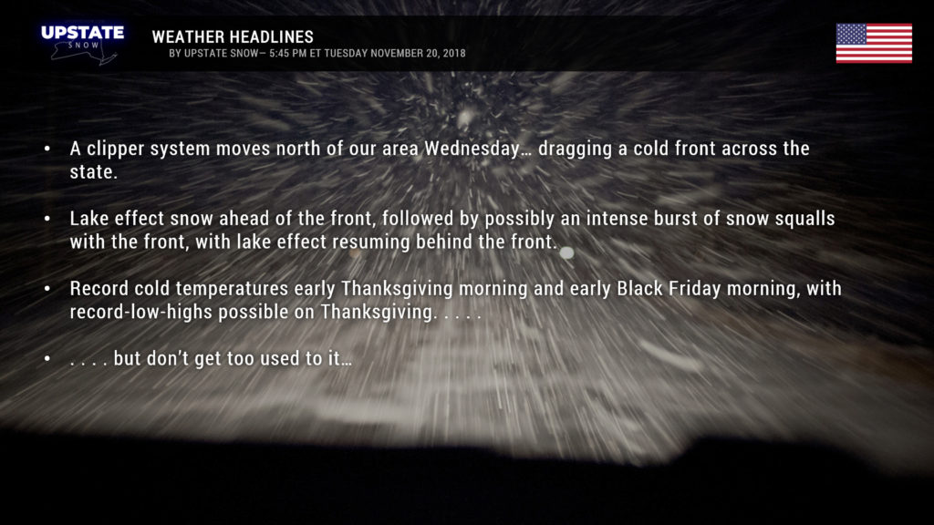
One of the busiest travel days of the year could be met with some difficult driving as a very strong and oddly elongated cold front sinks across the state. High-res models show show an almost “convective” line of snow squalls accompanying the front. We can also expect lake effect snows ahead of and behind the frontal passage.
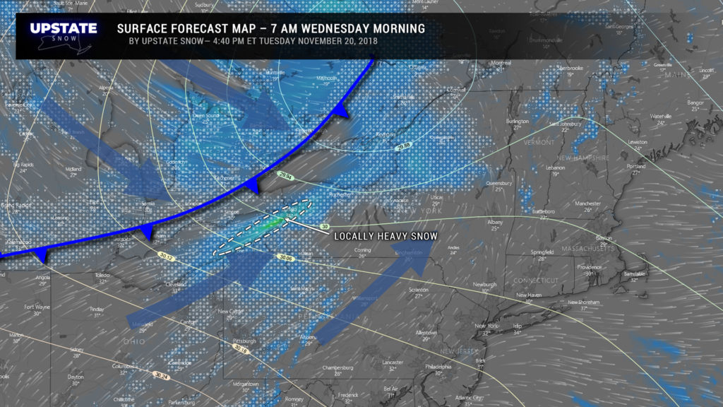
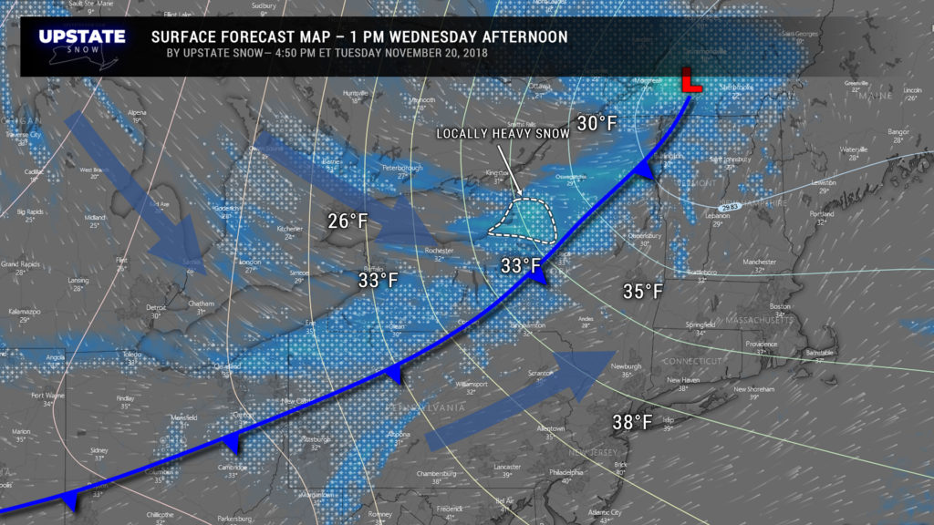
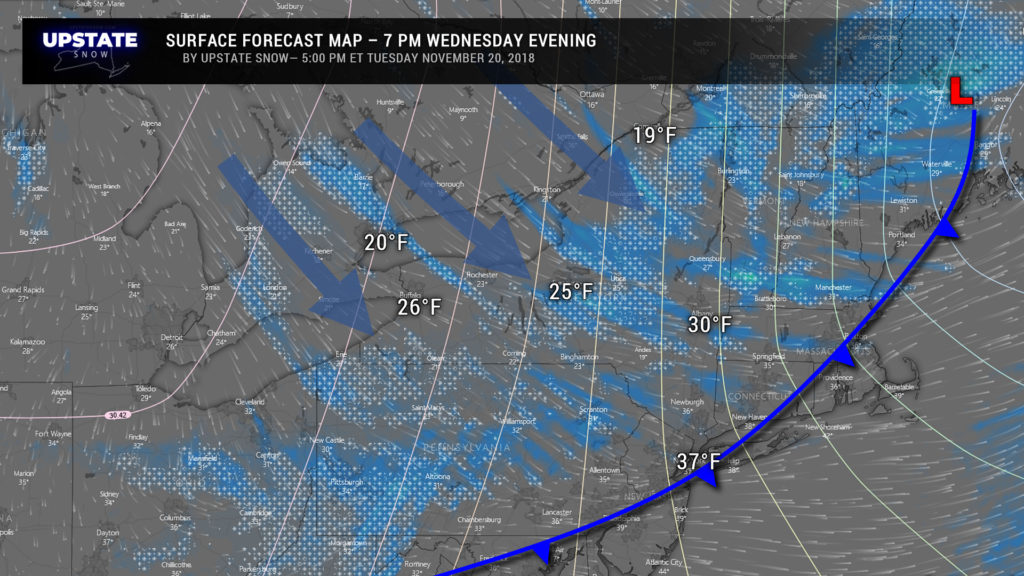
Breaking it down– Early tomorrow morning an area of low pressure will be about 100 miles north of Lake Ontario, with a frontal boundary extending southwest. By early Wednesday afternoon our storm is centered just north of the Vermont/Canadian border with the front kind of slinging backward from roughly Burlington through Utica to the Elmira/Corning area. Ahead of this front a southwesterly wind flow will be taking place… aligning quite nicely with Lake Erie. This will bring lake snows to Buffalo and the south towns through the morning… which will be enhanced by the front. Behind the front, winds shift to the west and then eventually the northwest. This cuts down on the LES off of Lake Erie but aligns nicely with Lake Ontario for a couple of hours Wednesday afternoon. By Wednesday evening, the front is outta here and the Arctic air is starting to pour into the area. Winds will become more northwesterly, shifting the Ontario LES southward to impact Onondaga and Madison counties. The moisture source is somewhat limited though, so LES won’t last long enough to produce any blockbuster accumulations, but still a modest snowfall will occur.
Ok… so how much snow? Well this one is a tough call, and what you get may differ wildly from a neighbor just a few miles up the road. So we decided not to get too cute with our snow map and instead paint “average” or generalities. GFS models are too low for this one, barely painting an inch of snow for most places, with only a couple inches on the Tug. So that’s out the window before we even start. The European is a good launching point, with 2-4 inches for Buffalo and the southtowns and the Chautauqua ridge… I think we’ll extend that 2-4 possibility into Cattaraugus county as well. It also shows a generalized 2-4 from the Thruway north to the Canadian border, lesser amounts though for portions of Hamilton, Warren, Saratoga, Fulton and Schenectady counties. The model paints generally 2 inches or less south of Route 20 and east of a line from roughly Rochester through Hornell into PA. Again, a good launching points. As for the higher-res models, the 18z HRRR run (the 0z, 6z, 12z, and 18z HRRR runs go out to 36 hours) also comes in a bit on the light side, in my opinion, barely painting any accumulations for the Fingerlakes and pretty much from Lake Placid on south. The 18z NAM3k comes in closer to the European model but hardly anything from Albany on south.
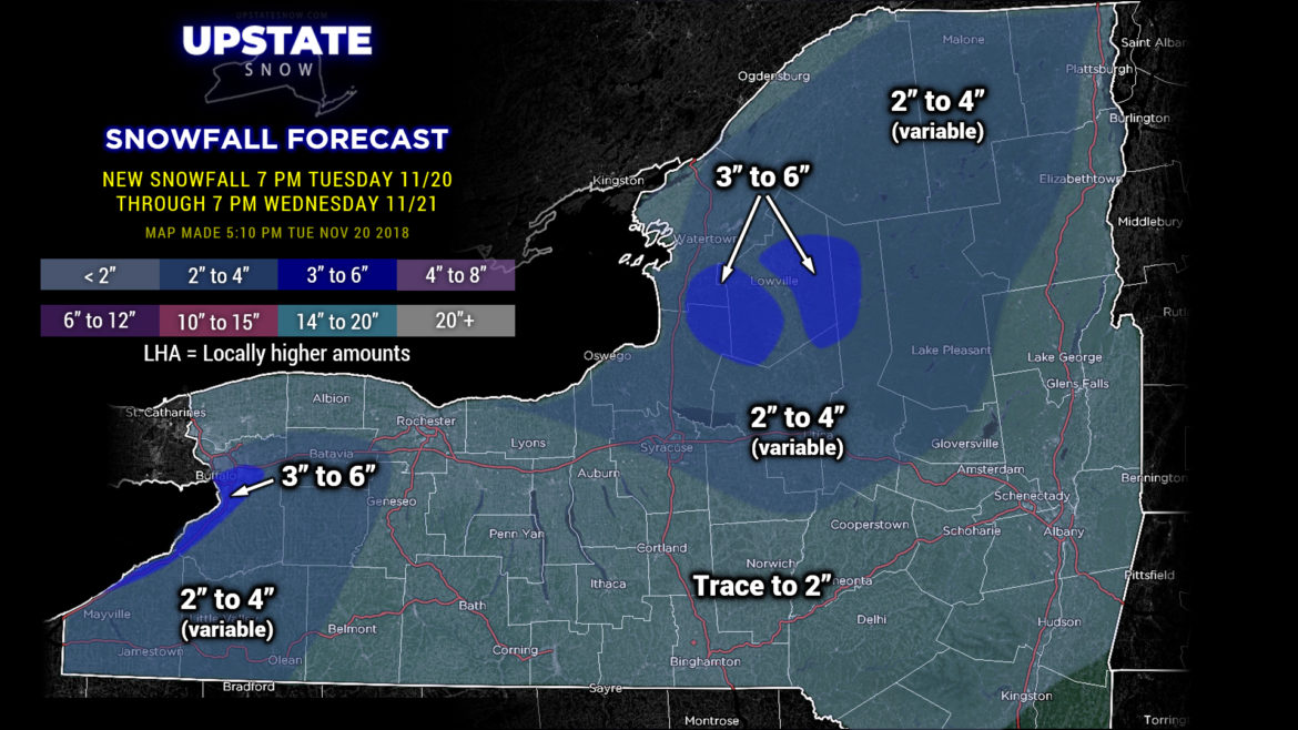
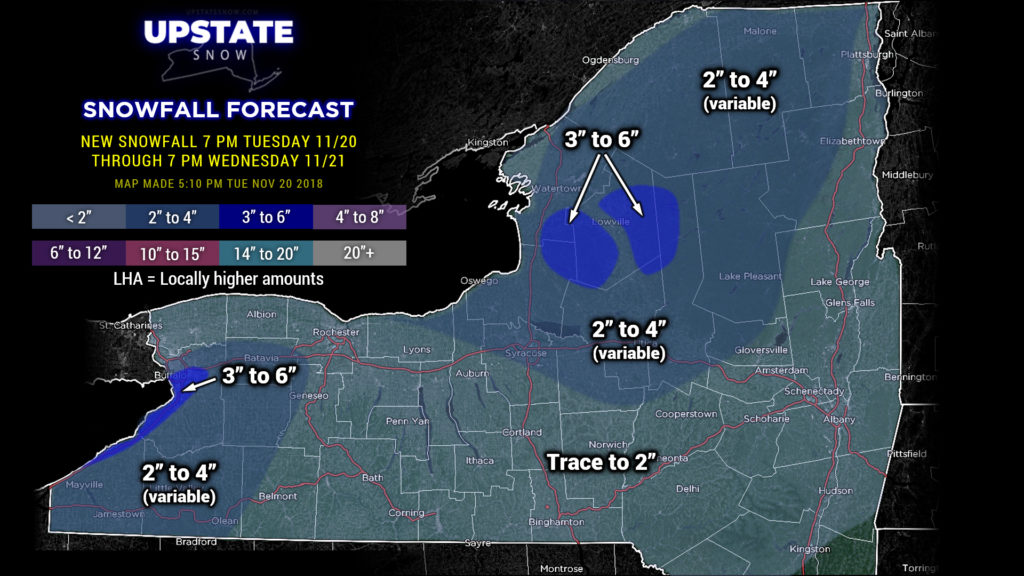
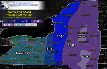
So… taking all of this into consideration, here is OUR snowfall forecast through 7 PM Wednesday evening…
A general “trace to 2 inches” for the vast majority of the state. Again, this will be variable, and some places might not get more than a dusting. Two large areas of 2-4 inch totals: One includes Buffalo out to roughly Scottsville south through Geneseo and then back southwest to Olean. There could be some local areas that pick up 5-6 inches of snow as well.
The other 2-4 area is from northern Wayne county, near Sodus extending southeastward through Onondaga and Madison counties… perhaps the northwest corner of Otsego, then extending northward through the Adirondacks to the Canadian border. This takes into account the lake effect, the squalls from the front, and the proximity to the clipper system responsible for the whole mess.
We put a small stripe of 3-6 for Buffalo and the southtowns right up to the lakeshore, where we believe the highest likelihood exists for higher totals. 3-6 definitely for the Tug Hill and the western Adirondacks… upsloping will help enhance the LES in those areas. It would not be a surprise to see some isolated 7- or 8-inch amounts on the Tug.
Again, these are generalities, and the amounts could vary quite widely from location to location.
Then our story turns to a brief but dramatic cold snap that will bring temps more appropriate for late January into the Upstate. Temps early Thanksgiving morning across much of the Adirondacks will likely be below zero. Single-digit temps portions of western New York, as well as the Susquehanna Region and Catskills. It’ll be even colder when you head out on Black Friday to get those super deals… temperatures possibly 10-15 below zero in the Adirondacks… below-zero temps possible in the hills of Schoharie and Delaware counties, with single-digit temps for much of the rest of the state. High temps on Thanksgiving will struggle to reach 20 for places like Rochester, Buffalo, and Dunkirk, as well as Albany and the southern Hudson Valley. Elsewhere, mid teens will be the rule, with single digits in the Adirondacks.
Unfortunately… we are still looking at a substantial warmup for Saturday through Monday with highs well into the 40s across all but the highest peaks of the Adirondacks. And with this warmup comes precipitation of the liquid variety….

