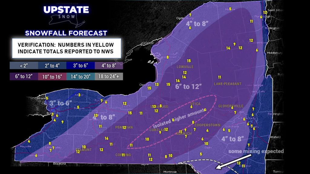
Good evening! Our Nor’easter is outta here now and some melting has occurred given warmer temperatures about the area. On the whole, our call last evening nailed it pretty well with regard to snow totals. The map below is our “final call” forecast map (from last evening) with the actual totals as reported to the NWS (rounded). These are not ALL of the totals reported, the map would be a clustered-up mess and unreadable. Of course, a lot of compacting and melting has occurred, so what’s on the ground right now as you read this may differ quite a bit.
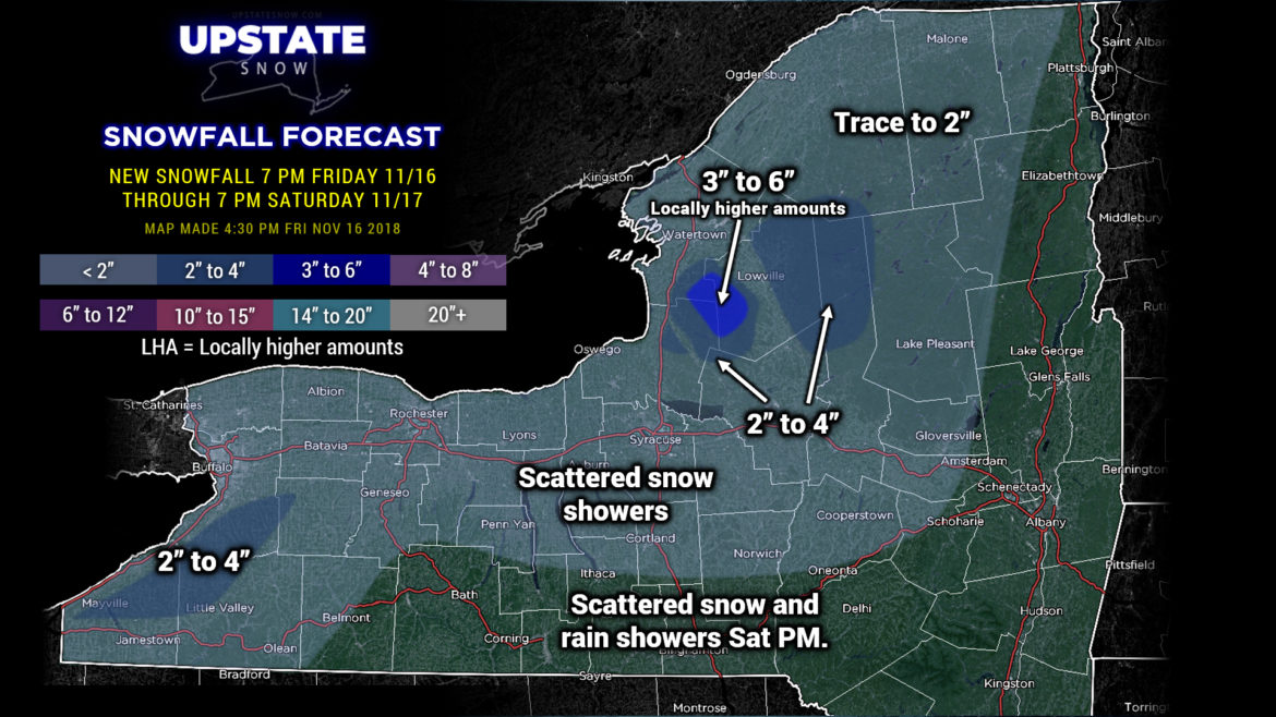
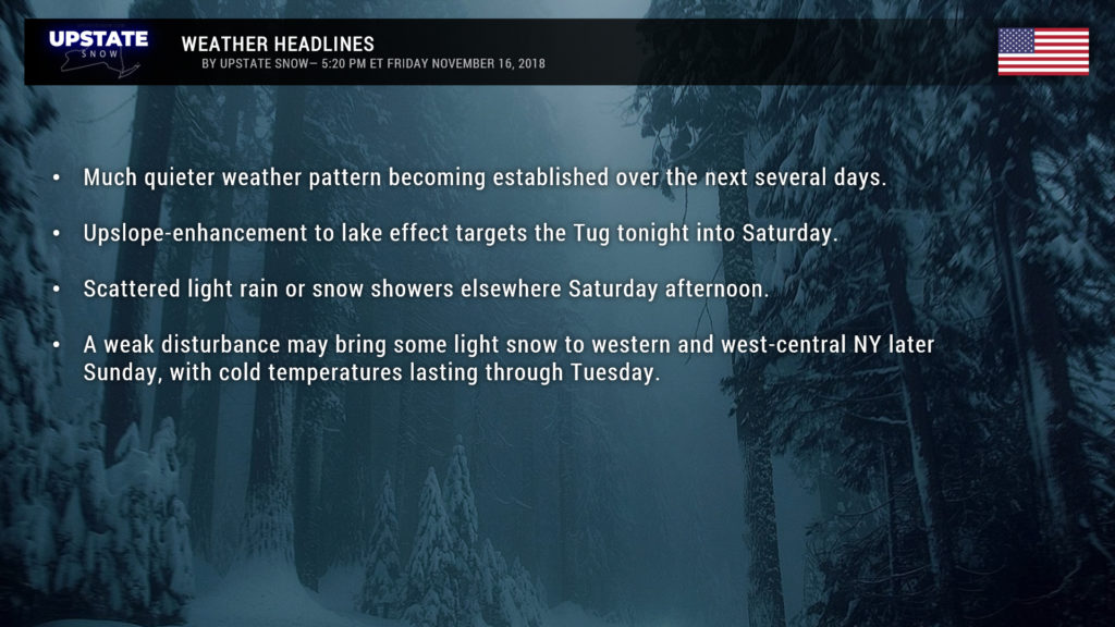
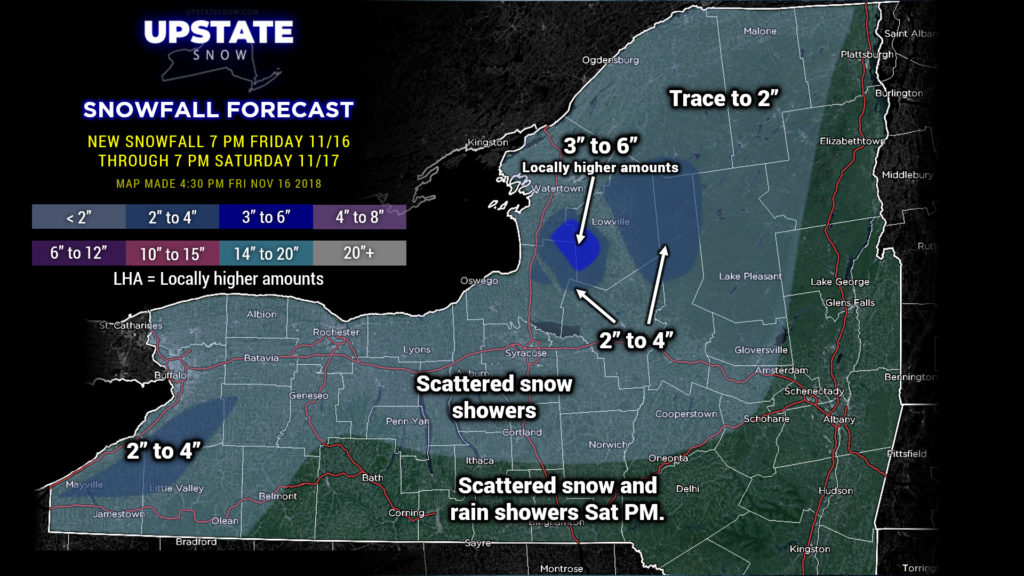
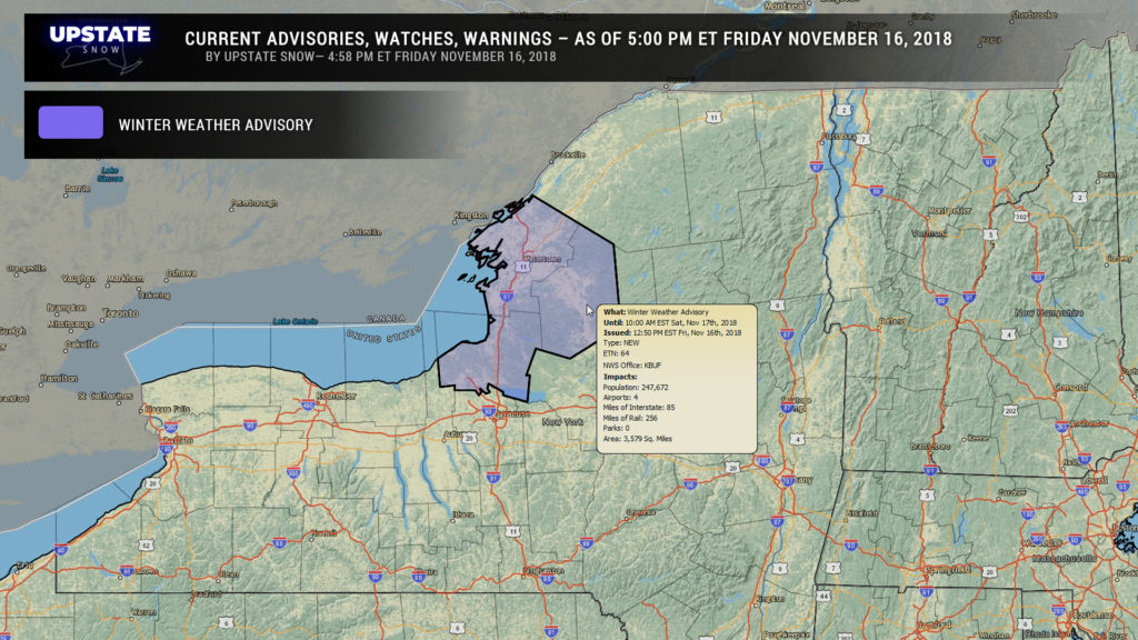
Now our attention turns to some lake effect that will set up late tonight through roughly lunchtime on Saturday. The bullseye on this will be the Tug Hill. A near-due-west wind flow crossing Lake Ontario along with modest moisture will cause snow to fall on the Tug, as well as the western Adirondacks. This lake effect will be aided and abetted by what is known as upsloping (as air rises, it cools, and cannot hold as much moisture–the moisture gets “wrung” out like a sponge over the higher terrain). Some of the modeling suggests the snow showers may oscillate back and forth a little bit, but the true focus will be on the Tug tonight into Saturday. Because of this, NWS has posted Winter Weather Advisories for that area.
Some minor accumulations may continue into tonight off of Lake Erie; we painted a 2-4 swath in there, but that’ll be somewhat scattered.
The rest of CNY can expect scattered rain and snow showers this evening becoming snow showers tonight, and then ending… perhaps a trace to as much as an inch in additional accumulations. Meh.
A weak little system is expected to zip across the Great Lakes and CNY tomorrow afternoon. Temperatures will be a few degrees either side of freezing… perhaps into the mid 30s across the central Southern Tier and Susquehanna Region. Mixed rain and snow showers will be the rule with this, but right now the system looks pretty weak and nothing to call Grandma about.
As we move into Sunday and Monday, another disturbance may bring some snow showers from the Ohio valley and western Pennsylvania into west-central New York. The modeling disagrees on how much snow will fall across the area AND how far north the moisture moves… but if the moisture moves far enough to the north some areas might pick up a fresh inch or two of snow. Following that, a cold front crosses the region early Monday, again with little fanfare, other than some lake effect snow showers.
Playing our story forward into next week… cold air looks to stay in place until about Wednesday. Not much lake effect though because there just doesn’t appear to be a lot of moisture in place.
Looking farther ahead toward Thanksgiving, modeling shows a large area of high pressure becoming established to our south, which would mean a more west-to-east wind flow and, unfortunately, milder temperatures.

