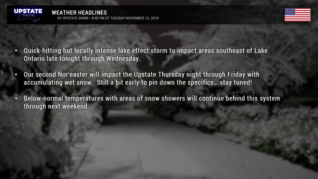
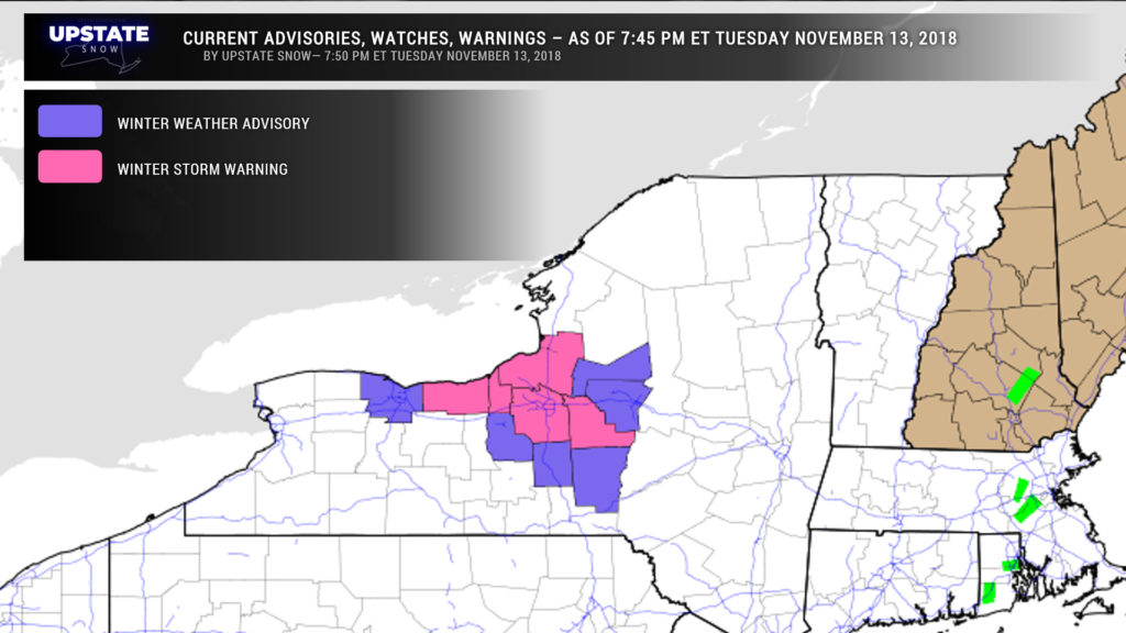
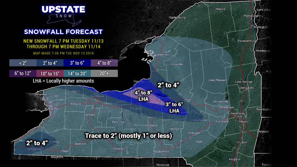
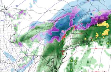
Good evening! Winter Weather Advisories and Winter Storm Warnings have been posted for lake effect snows that will become established tonight through Wednesday. This will be a quick-hitting event… but snows in the main lake band southeast of Lake Ontario will be heavy at times, especially during the overnight and into Wednesday. Modeling suggests a nice band becoming established all the way from Lake Superior (!!) extending southeastward into central NY. There is plenty of instability with this WNW flow over the warm waters… but the moisture profiles, while decent, aren’t all that eye-popping. There is also some static in the modeling suggesting the band may waver a little bit, that perhaps a couple of bands set up. These throw a bit of doubt into our forecast for snow amounts… and we’re going to go somewhat conservative in this regard. This could bust, if the moisture is more abundant and the line becomes virtually stationary, but for now we’ll stick with slightly lower amounts than we were originally going to go with.
Off of Lake Erie, much less in the way of lake effect snow as the bands will be multiple and diffuse thanks to the cold air going over a much shorter space of open water. There are no advisories at all off of Erie for this event.
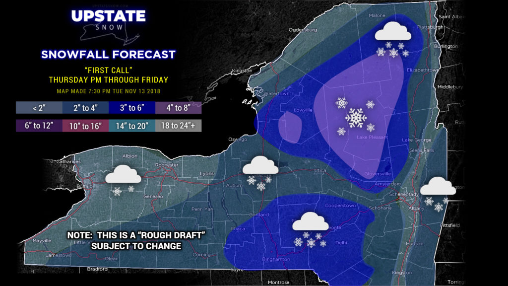
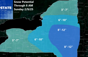
Our attention then turns to the next Nor’easter which will impact the Upstate Thursday night through Friday. In short, this looks like a better snowmaker for most of the state and the models, especially the Euro, hone in on some pretty decent snowfall totals. Of course there are still differences in model solutions on this, and our “first call” map represents something of a “rough draft” which could change fairly substantially before game time.
Essentially… an area of high pressure over New England keeps cold air in our area, while low pressure moves up the eastern seaboard. Indications are that this system will be juuuust a bit farther south and east than the first storm, which also bodes well for an early season winter storm. Things get dicey when we go into Friday and some warmer air tries to pump in from the south, and that is when we could see some transition to rain, especially in western NY as well as the southern tier. Higher elevations of the Catskills and Susquehanna region should stay mostly snow. Once you get north of the Thruway and into the ADKs though, it’s a much higher likelihood that we stay all snow with at least a moderate accumulation expected.
This is reflected on our first call map — highest accumulations in the Adirondacks, with an area of higher amounts across the Catskills and Susquehanna region, and lighter amounts elsewhere. Can’t reiterate this enough—this first call map is exactly that, and could change fairly significantly over the next 24-36 hours. “Stay tuned.”
As we look toward the weekend, troughing continues to be the name of the game, meaning a continuation of below-normal temperatures. Sunday’s temperatures could resemble what we’d normally see in January instead of November. It’s also a pretty good bet we’ll see a continuation of at least scattered snow showers about much of the Upstate.


