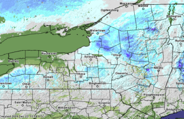
Good evening!
First off, a very happy Veterans Day to all who have served and are currently serving. Thank you for making a choice to serve, to keep us free.
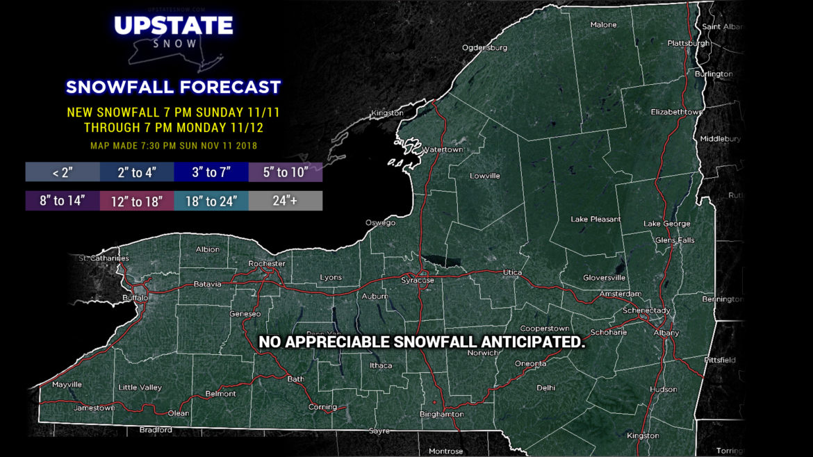
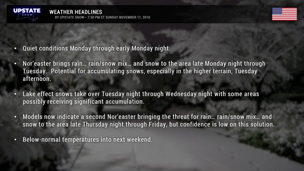
Not looking at any real snow accumulations over the next 24-36 hours across the Upstate. An area of high pressure will move across the mid-Atlantic region and that will keep us dry through Monday night.
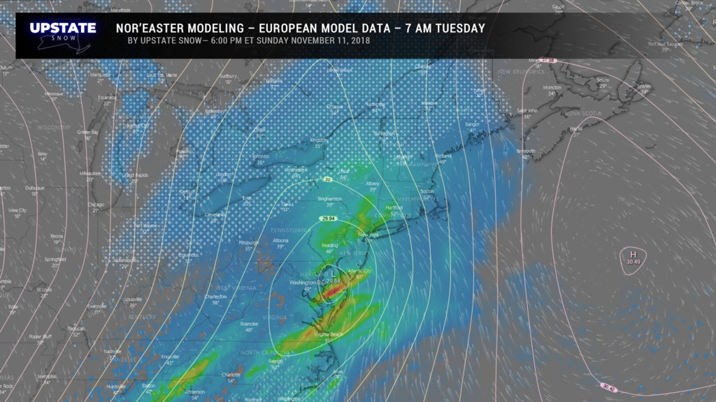
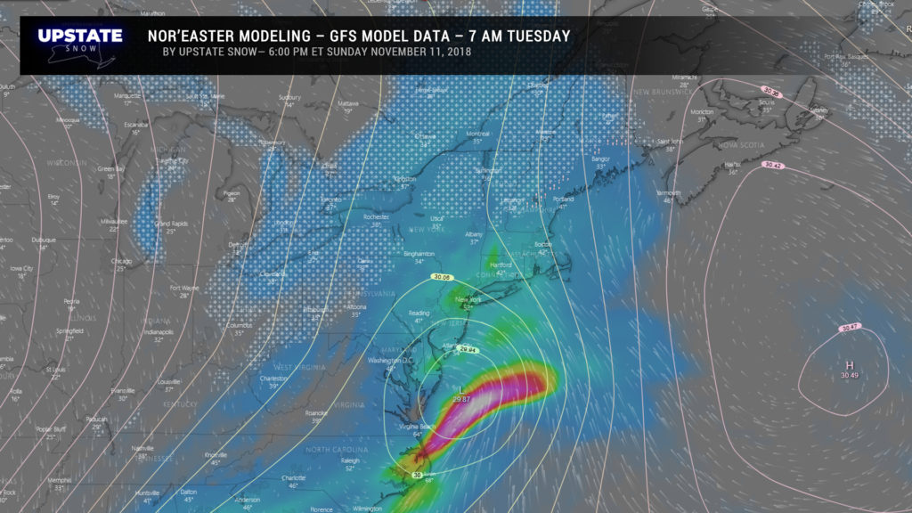
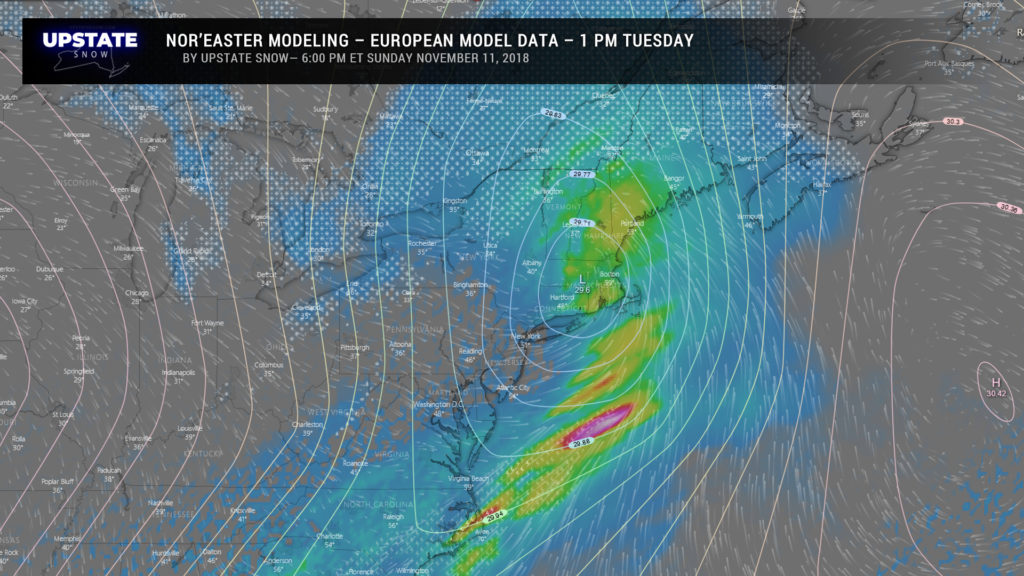
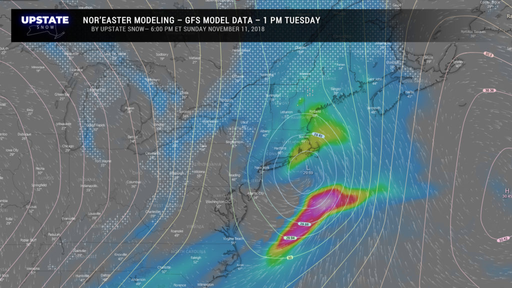
Then things get interesting as models show a large storm system moving northeast along or just off the coast, bringing rain, snow, or a mix of both across our area. If it were January, with a good deal of cold air locked in place, we’d be looking at a blockbuster snowstorm. But it’s not… however, we’ll take what we can get at this point.
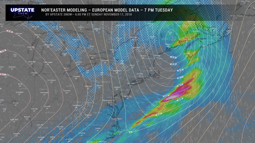
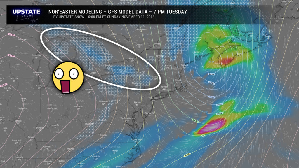
I’ve posted the difference in the Euro and GFS controls so you can get a general idea. As you scroll down, note the title of each slide — Euro at a certain time, GFS at a certain time. Anyway, the temperatures are going to be so borderline… looking at highs in the lower 40s in the valleys, 30s in the higher terrain on Tuesday. Any accumulation will occur later in the day as the deeper colder air starts to fill in behind our storm.
The lake effect machines kick on full-blast Tuesday night through Wednesday on a very cold northwest flow pounding the Upstate. Connections with Lake Huron and the Georgian Bay means the typical areas east/southeast of Lake Ontario could get an appreciable amount of snowfall.
As for the areas east of Lake Erie, well, you’ll get in on the LES as well, but not as much as the winds are going over smaller areas of open water. Still, a shovelable snowfall looks pretty reasonable Tuesday through Wednesday.
There’s a pretty big difference between the Euro and GFS when it comes to snowfall accumulation Tuesday through Wednesday night… the Euro is much heavier with over a foot on the Tug Hill while the GFS says naaah, not going to be THAT much. We’ll probably go with a “first call” of some sort for tomorrow night’s update.
THEN…… our attention turns toward the END of the week. Twenty-four hours ago all looked quiet, “nothing to see here.”
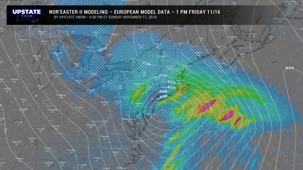
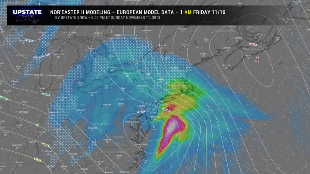
Now…….
Are we sold on this solution? Not really. Notice the two images above are 12 hours apart… so the disagreement is real. It’s just such a sudden change in ALLLLLL of the modeling over 24 hours that we have a hard time buying this, even with double-coupons after winning the lottery. But it’s there, and if it pans out, the chances exist for mixed precipitation / snow the end of the week. Lets wait and see; would love to get some more model agreement before jumping on this one.
On the heels of this would come another round of lake-effect snow and reinforcing shots of cold air.
Winter certainly has roared to life!

