Good evening everyone! First post of the season? Well, we weren’t planning on any posts before November 1, but on this first night of the 2018 World Series, Nature is throwing a bit of a curve ball.
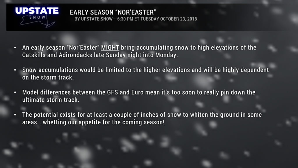
There is the POTENTIAL … POTENTIAL … for some accumulating snows in the higher terrain of the Catskills and Adirondacks Sunday night. Some factors have to come together for this to occur, but it was a good opportunity for me to get something posted to the site.
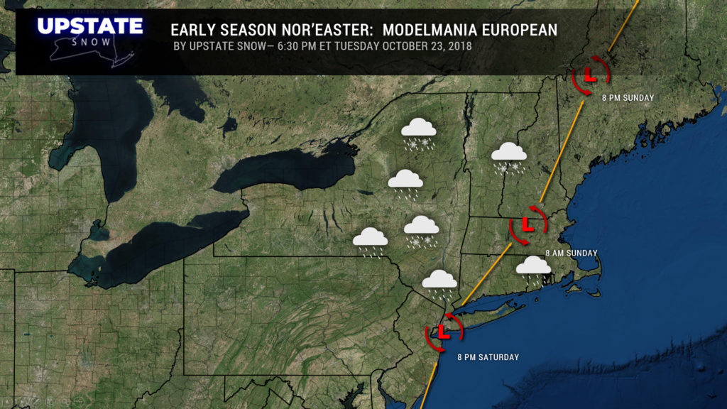
The modeling seems to be in a bit of chaos… especially with the timing. The European is much faster than the GFS. The Euro brings storm center right along the NJ coast and over NYC by Saturday night then toward Boston by Sunday morning, with a second low spinning up across western PA early Monday, and moving through central New York into New England by Tuesday.
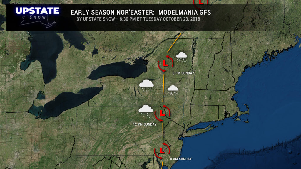
The GFS brings center of low pressure due north through CNY Sunday afternoon/evening.
Euro has a strong high in the north Atlantic, shunting eastward as the nor’easter moves in; the GFS has the ridge (1038) over Newfoundland pushing east as the low moves north into Canada.
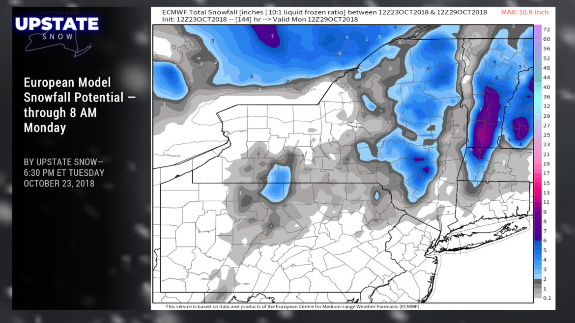
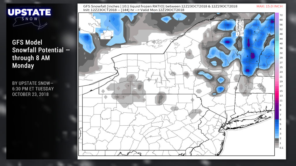
So any snow that falls would definitely be elevation-dependent and HIGHLY DEPENDENT on the storm track. The Euro paints more snowfall for the Catskills and eastern Adirondacks, mainly 6″ or less, as well as an area of 2-5 inches along the NYPA border south of the Fingerlakes. The GFS says meh, maybe 2-4 for portions of the Cats and 2-6 for the eastern Adirondacks.
Of note, the models don’t take into account the warm ground, foliage still on the trees, etc.
But hey… it’s juuuust about time!

