Good evening!
We have some warnings and advisories, let’s do them first.
HIGH WIND WARNING: Niagara, Orleans, Monroe, Wayne, Erie, Genesee, Wyoming, and Chautauqua counties, mainly along the lakeshore along Lake Erie and South of Lake Ontario to about the Thruway. High Wind Warning also posted for northern Cayuga, Oswego, and Jefferson Counties. The warnings are in effect late this evening through late Sunday morning, for winds out of the southwest/west, sustained up to 30 mph with gusts to 60 mph. Strong to potentially damaging winds are expected and may bring down trees and power lines, resulting in scattered power outages. Shallow rooted pines will be at the greatest risk of being toppled. Travel will also become hazardous for high profile vehicles.
LAKESHORE FLOOD WARNING: The Lake Ontario shoreline of Wayne, Northern Cayuga, Oswego, and Jefferson counties. This is from 4 AM to 2 PM Sunday. Strong westerly winds will bring significant wave action and the potential for lakeshore flooding and erosion to the eastern and southeastern shoreline of Lake Ontario…with this risk the greatest where the shoreline is still unstable following last year`s flooding and erosion.
WIND ADVISORY: Lewis, Livingston, Ontario, Cattaraugus, and Allegany counties. This is in effect from late this afternoon through early Sunday morning. Winds will be out of the southwest/west 15-25 mph with gusts to 50 mph. Strong winds are expected and may bring down a few tree branches and power lines, resulting in isolated power outages.
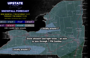
An area of low pressure will move north of the Great Lakes tonight through early Sunday… this will drag a cold front across the state bringing rain showers, changing to snow showers early Sunday. Some snow accumulations are expected… some areas may pick up an inch or two of snowfall for Easter, especially in the higher elevations of the northern Susquehanna Region, and in the higher elevations of the North Country. Not everyone will see snow accumulations though. In a bit of “on second thought,” we’ve taken out the 2″-4″ totals that had been posted for the North Country… just not convinced there’ll be enough energy/moisture around. That being said, we can’t rule out some isolated areas picking up several inches of snow.
Very windy conditions will accompany this frontal passage late tonight through Sunday morning… as noted above, winds could gust as high as 60 mph at times along the lake shores.
Temperatures will take a bit of a tumble Sunday… aided and abetted by the precipitation falling through the atmosphere. As precipitation falls through the column of air, it cools the air around it.
For Sunday night into Monday a system will scoot just south of the state… bringing the potential for some snow as far north as the Catskills. This is likely south of a line from Deposit through Walton, Stamford, to Albany, where several inches may accumulate, again in the higher elevations.
Next in our batting order is a storm system that, in general, will track from the southern Great Lakes into New England Tuesday through Wednesday. Models now are leaning more toward this being waves of rain, and less of a snow threat. That being said, precip could start out early Tuesday in the form of snow as temps closer to the surface will be below freezing.
The current expectation is that a warm front moves through Tuesday, bringing much of the state firmly into the warm sector, followed by a strong cold front sometime Wednesday. Here is where models diverge — both in terms of timing and precipitation-type. The GFS is more aggressive in all realms including storm strength, and the strength of cold air moving in behind the front. It also is a more progressive system, bringing the front through the state by Wednesday afternoon. The model points at the potential for at least a couple of hours of “synoptic” snow (as opposed to, say, lake effect snow showers or what we’ll get tomorrow). This obviously would lead to accumulations, especially in the higher terrain. The European, on the other hand, is weaker, slower, and takes the low farther north/west, meaning much more of a rain event, with snow SHOWERS on the back side Wednesday night. The Canadian model has an onset of snow early Tuesday, quickly going over to rain (possibly heavy rain) as the low moves pretty much straight up the St. Lawrence Valley.
It’ll be hard to get accumulating snows here, outside of the higher terrain, just due to the time of year, the higher sun angle, warmer ground, etc.
Here is the latest snow cover map, per the National Operational Hydrologic Remote Sensing Center – Interactive Snow Information website.
Unless something crazy happens over the next couple of weeks, this will be our final weather blog post for the 2017-2018 season. We would like to say, simply, THANK YOU, for choosing Upstate Snow as your go-to source for weather and trail information. We had good riding, especially after Christmas through January… and then when we thought the very unseasonable warmth and rain in February was the death knell on our season, things came roaring back to life in March. But alas, spring has sprung, and now it’s racing season, baseball season, fair season, golf season.
THANK YOU once again for following our site and supporting our sponsors. We were able to “refresh” the site — actually rebuilt it from the ground-up… a LOT went on behind the scenes. But that’s just the beginning…..


