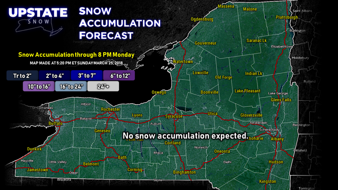
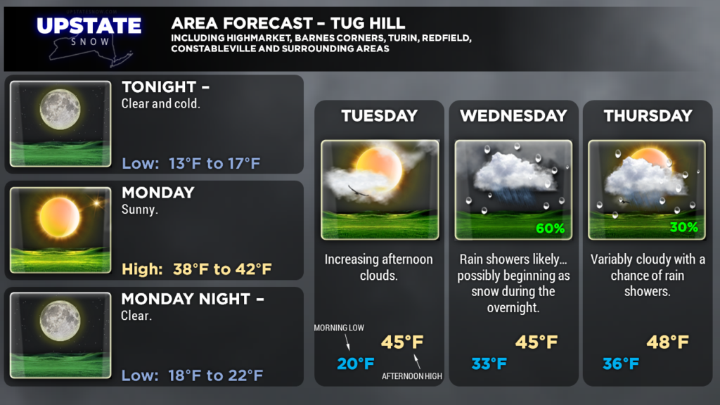
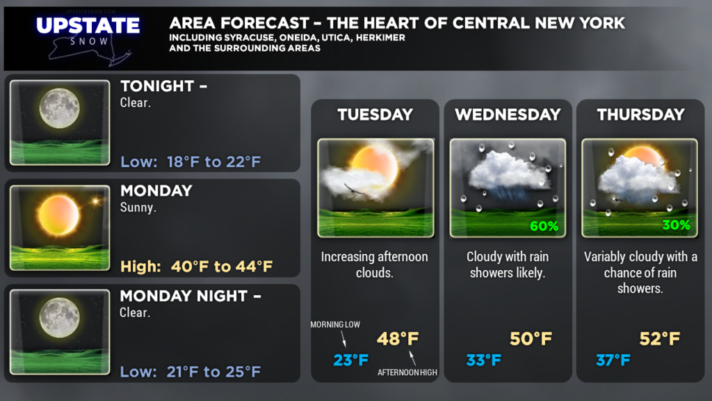
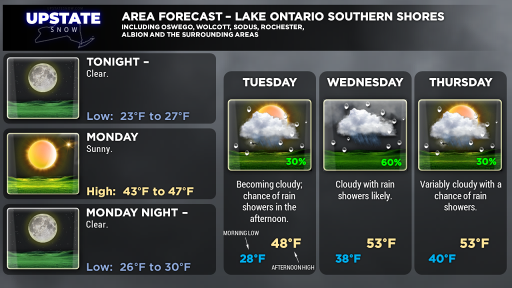
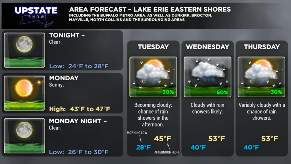
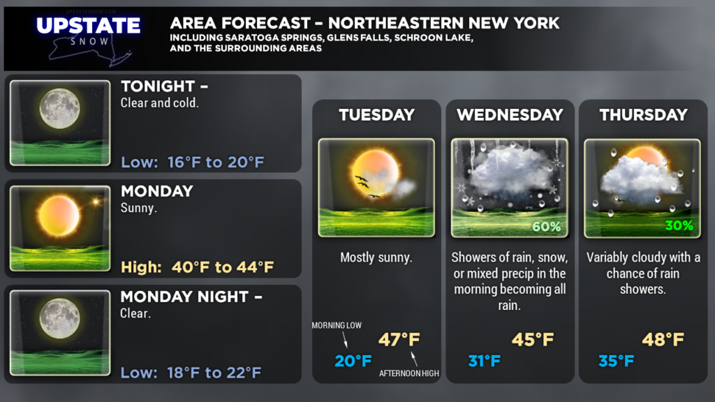
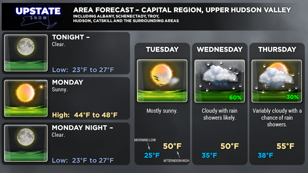
Good evening! A large, sprawling area of high pressure currently centered over central Quebec will eventually shift east-southeastward. We’ll have mainly clear conditions persist through Monday night. No snow accumulation is expected.
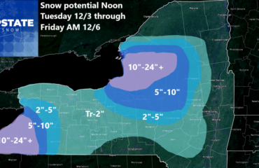
In fact, no snow accumulation is expected across the state through at least early Friday. We’ll get to that in a minute.
The high pressure ridge will start to weaken late Tuesday as our next storm system begins to approach the area. A southwesterly flow of mild, moist air will really pick up by early Wednesday, as a warm front lifts northeast over the region. Expect precipitation to develop late Tuesday night… possibly starting off as a little bit of snow or freezing rain, but this will quickly transition to rain as we get into the warm sector. A cold front will move —ever—so—agonizingly—slowly— eastward (thanks to a strong high pressure ridge over the north-central Atlantic)… so scattered rain showers can be expected Wednesday and Wednesday night. The front should begin a trek across the state Thursday into Friday (but models have timing differences).
Then things get kind of interesting once again as winter says, “no, I don’t think I’m ready to quit just yet.” As mentioned, this cold front will be racing along at the pace of turtles stampeding uphill through peanut butter and mud. From a “big picture” point of view, models show low pressure developing along the southern edge of this front… and riding northeastward along the front. The center of low pressure is expected to move over Pennsylvania and New York between Friday and Saturday (depending on which model you want to believe). Now is where the interesting stuff comes into play. The European model is insistent that the low pressure center “forces” cold front as far east/southeast as a line extending from roughly Bennington, Vermont southwestward through the Catskills and into Pennsylvania. This would bring a slug of moderate rain across the state, switching to snow first across western NY and then across central New York during the day Saturday… with possibly some decent snow accumulations. The GFS is quicker in timing this, but also hangs the frontal boundary back to the west, meaning most of this precipitation would be rain with maybe a brief switch to some wet snow on the back side.
The uncertainty is how an upper-level trough evolves… as well as where the surface low tracks. Of course, a surface low tracking farther east/south would mean a higher chance for snows here over the Easter weekend… and vice-versa if the low tracks west/north. Eventually the upper trough pushes eastward, the surface front pushes eastward, and our winds become more west-to-east (aka “zonal”), both at the surface and in the mid- to upper-levels. This means a drying trend, but a colder trend, and yes possibly some lake-enhanced snow showers for Easter Sunday…!
There’s still an awful lot of uncertainty with this, with quite a few variables at play. It’ll be interesting to see if the models come into better agreement on handling the upper-level energy and this frontal boundary as we go through the week.
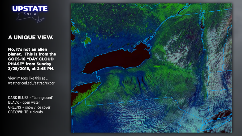
Totally unrelated, but here’s a neat look from above. This is from the GOES-16 “day cloud phase” satellite view – from 2:45 PM this afternoon. The greens indicate snow and/or ice cover — frozen Oneida Lake really stands out in the bright green, as well as the broken chunks of ice along the eastern shore of Lake Erie. You see the disappearing snow cover over the Fingerlakes, but there’s still a fair amount over the Susquehanna Region northward into the Adirondacks. Some of this is obscured by the white colors — that’s cloudiness. Winds blowing from north-northeast to south-southwest rise up the mountains, the air cools and condenses into cloudiness. As the winds continue to blow toward the southwest, downsloping warms the air and the clouds “stop” at that point. The terrain-induced cloudiness also shows up quite nicely in Pennsylvania. The blues are the “bare ground,” and the darkest colors indicate the open bodies of water.
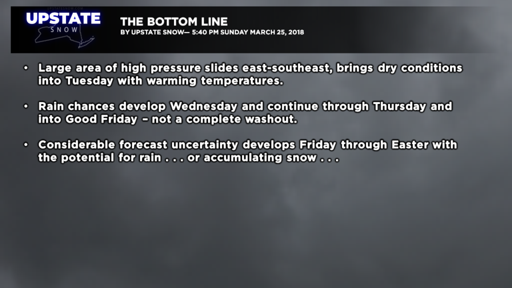
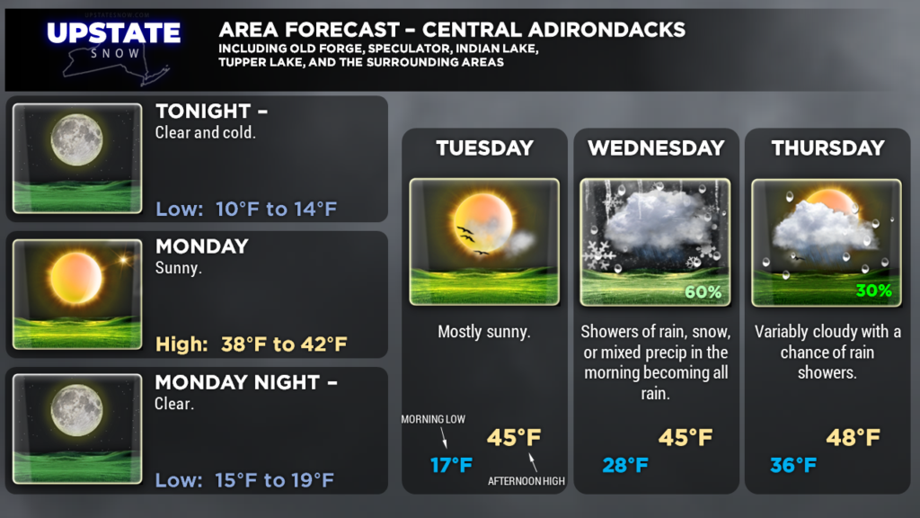
SUMMARY: Dry Monday and Tuesday. Mild daytime highs, but still cold at night. Rain chances begin Wednesday and continue into Friday with mild temperatures… but the forecast becomes fairly uncertain beginning Friday, with the placement of the frontal boundary and surface low pressure.

