Good evening! We’ll have spring riding conditions this weekend but as Southern Tug Hill Sno-Riders posted this morning… the strong March sunshine is going to do a number on trails and in a hurry. This might be the last decent weekend for riding so get out there.
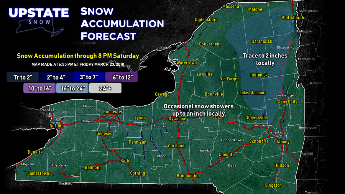
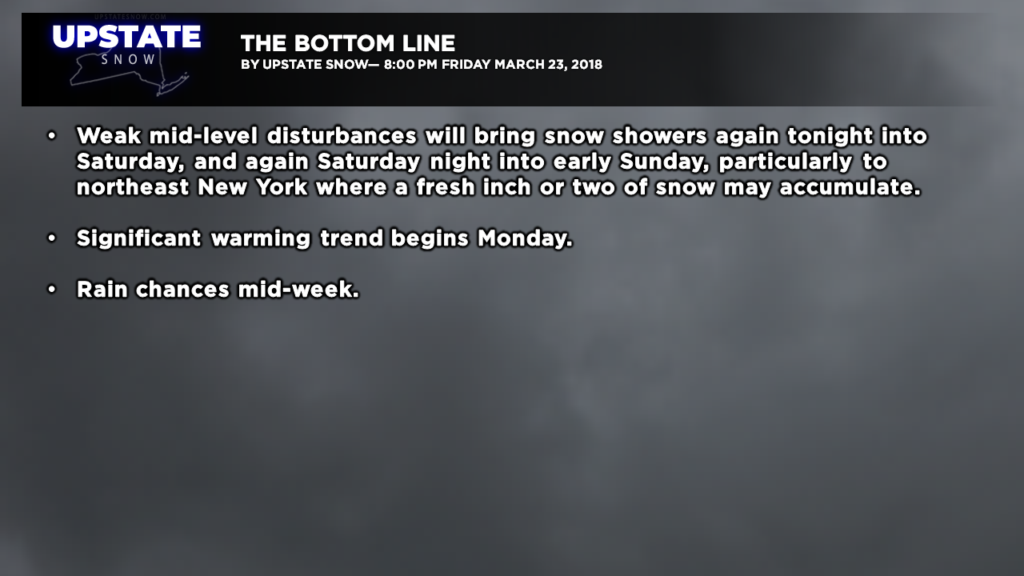
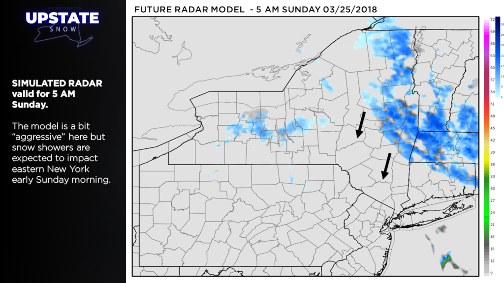
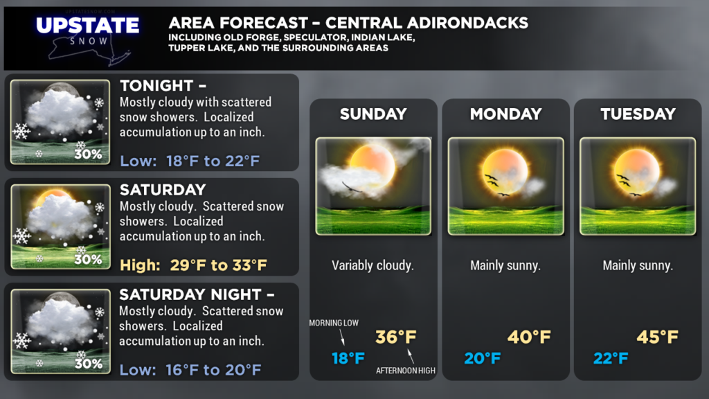
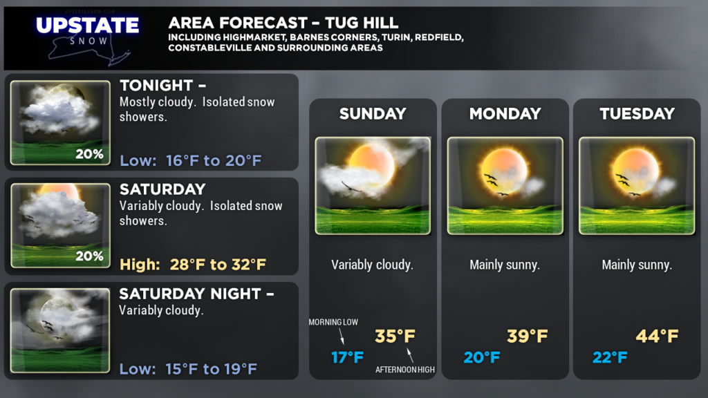
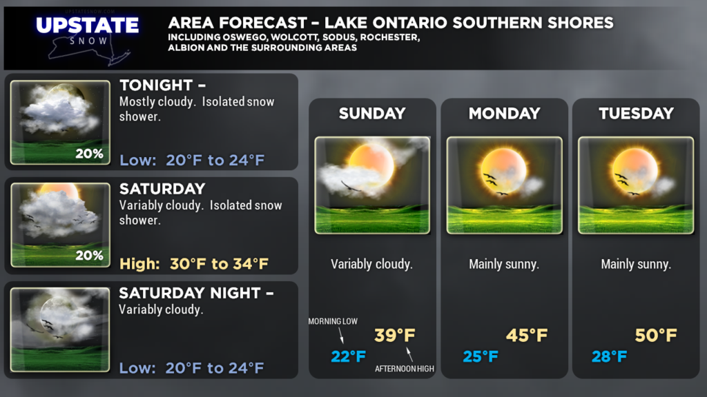
A little atmospheric disturbance will cause some light snow showers to rotate southward over eastern New York late tonight through Saturday night / early Sunday morning. There may be some localized accumulations of up to 2 inches in areas that get repeated snow showers. That’s actually probably being generous at this point.
High pressure builds over the area Sunday and then slides eastward Monday into Tuesday. While it will be clear and cold at night, that strong spring sunshine, coupled with southerly winds, will provide a rather significant uptick in our daytime temperatures.
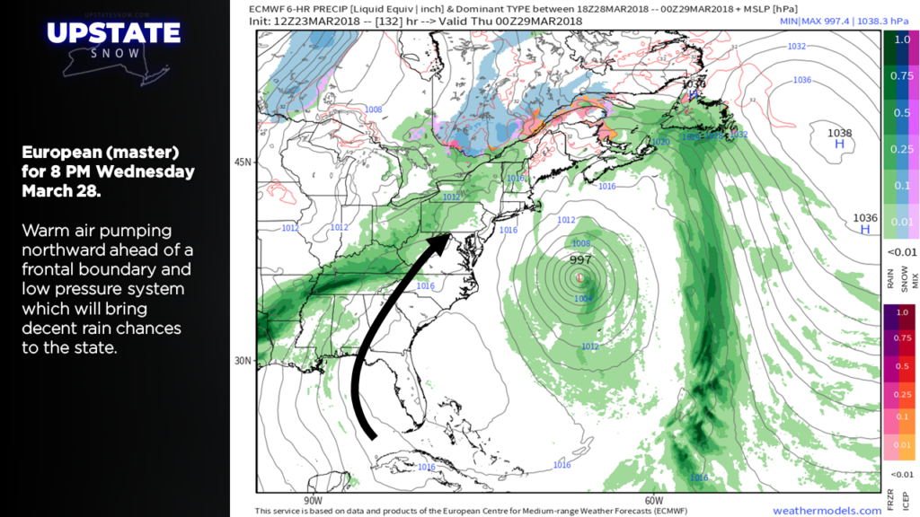
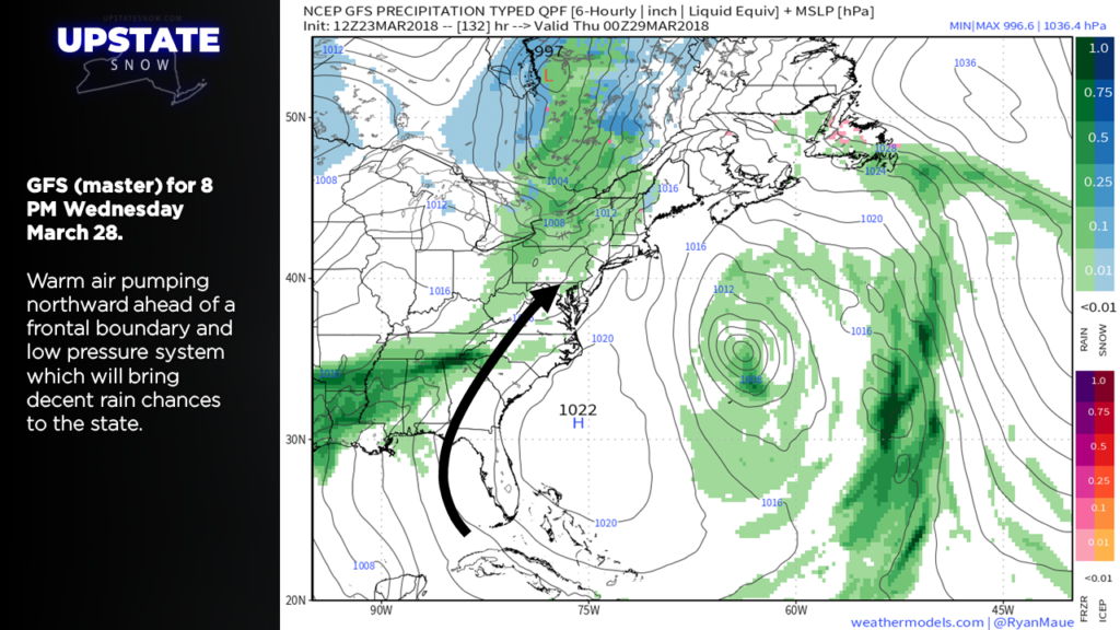
Models show our next storm system to approach and cross the area Wednesday. As mentioned, nighttime temperatures will still be below freezing, so precipitation at the onset Wednesday could be in the form of freezing rain… but we’ll see a transition to all rain everywhere. This doesn’t look like a heavy rain that’s going to cause flooding, but likely a widespread light rain throughout the day. A cold front will move through, but it doesn’t look like it’ll be very “cold” behind it… afternoon highs a few degrees either side of 50 south of the Valley (mid/upper 40s for the Susquehanna region) are expected the rest of the week.
Interestingly… the European model hints at a few chances for accumulating snows over the Easter weekend. As bipolar as Mother Nature has been……. !
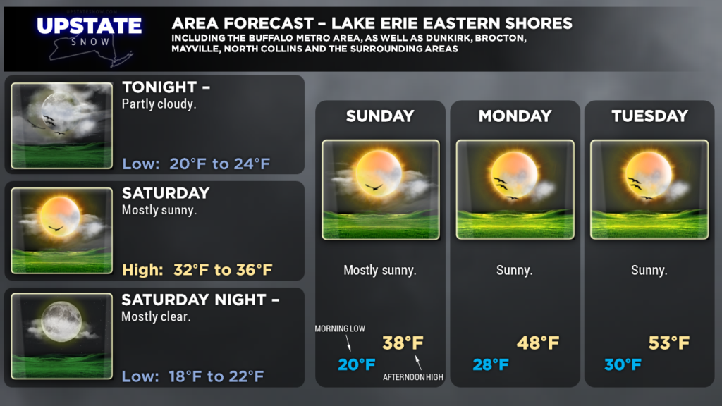
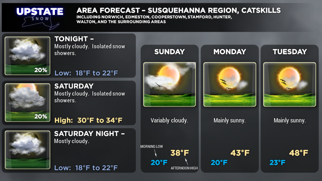
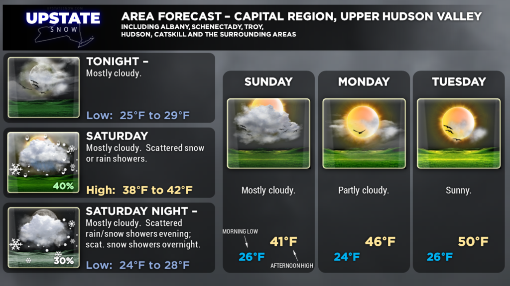
Here are your zone graphics. Have a great Saturday!

