Good Saturday evening! Hopefully everyone has had a chance to get out and enjoy the late-season “#SecondChance” riding. Conditions will remain pretty favorable for the next several days thanks to unseasonably cold temperatures.
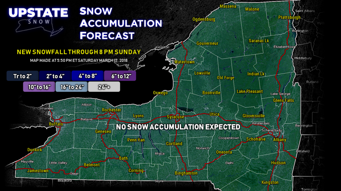
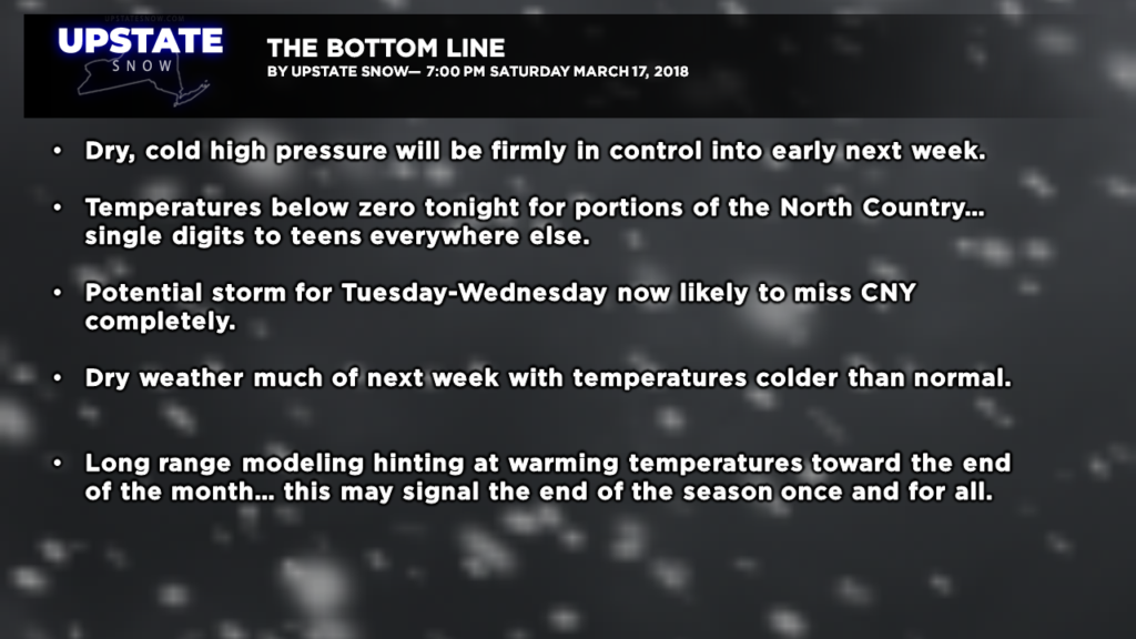
No new snow is expected over the next several days.
There’s really no significant weather on the horizon. The potential storm we’ve been watching for several days for the middle of next week now looks to be a pretty solid “miss” for the state … with models showing snow reaching no farther north than the NY/PA border. We’ll still watch this but we’re pretty confident that high pressure to our north is going to win the battle of wills here and keep us dry and cold.
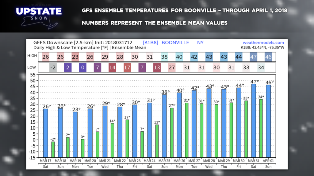
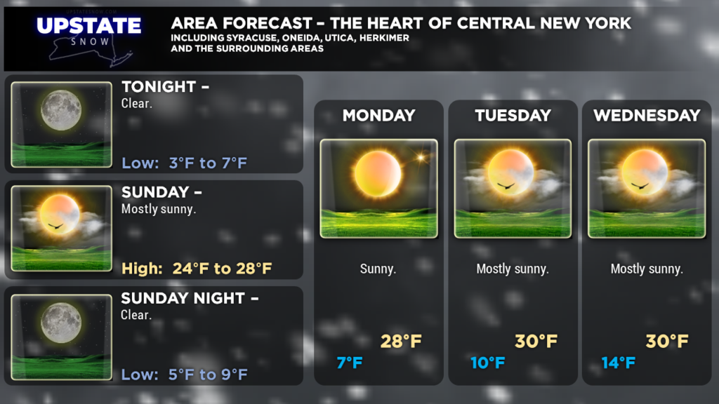
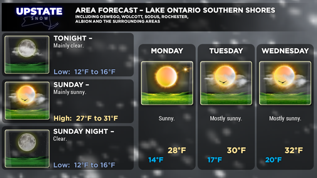
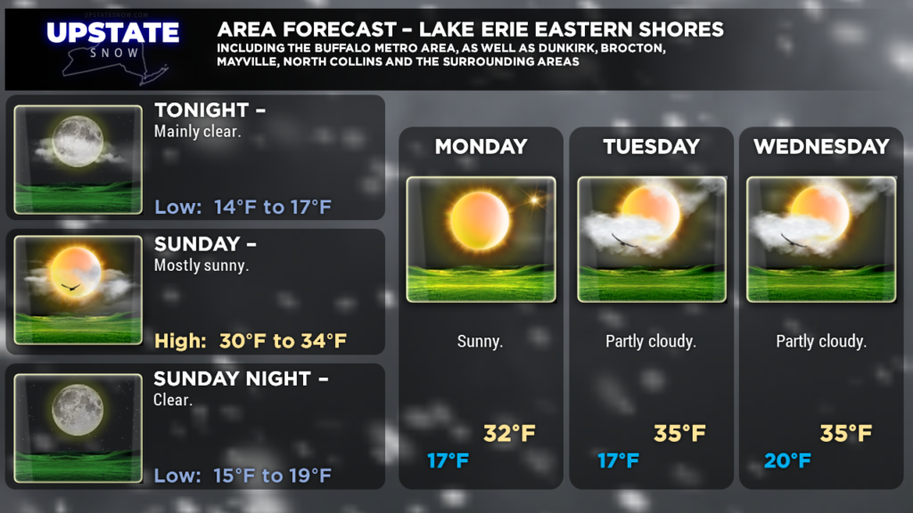
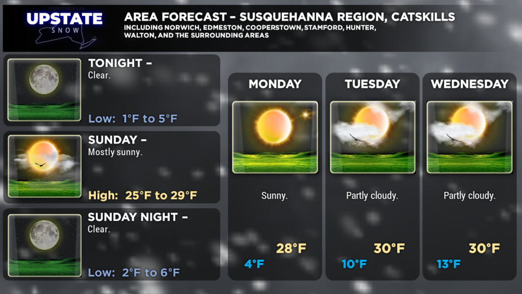
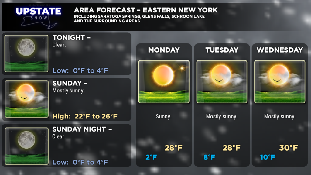
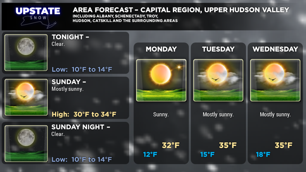
Temperatures should stay below normal through the upcoming week, with highs in the upper 20s to mid 30s, with lows in the teens moderating to the lower 20s. Enjoy it while we have it.
A couple side notes to close out tonight’s brief update — a look at some of the ensemble temperatures through the end of the month points to a pretty decent warming trend beginning NEXT Sunday (the 25th) through the end of the month… if this holds true, it will likely spell the end (once and for all) to our season. We’re going to continue to provide forecast updates through April 1st (no foolin!), and beyond as warranted. There is the **chance** that we could get one last round of accumulating snow in here Friday/Saturday next week before this warmup begins.
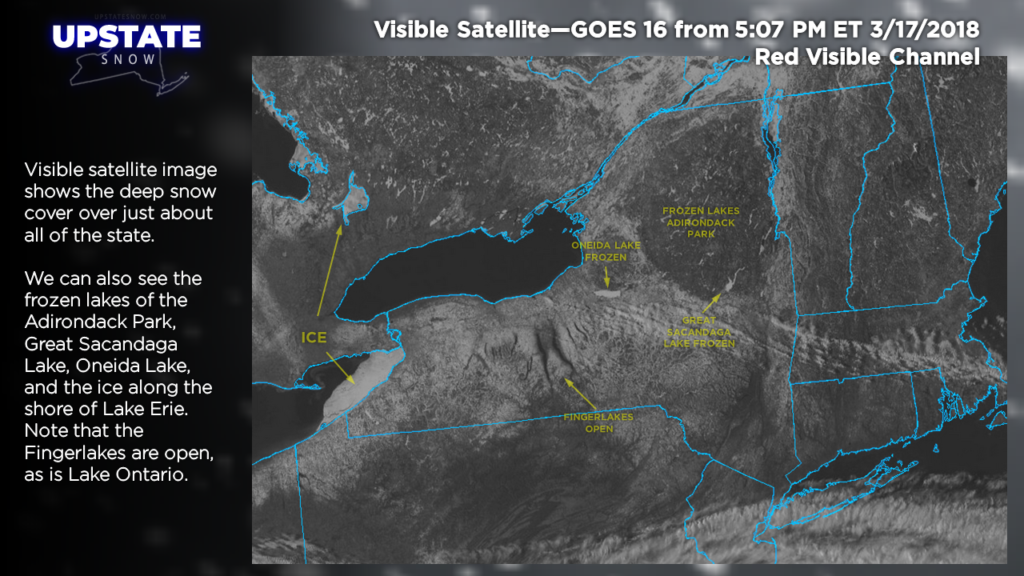
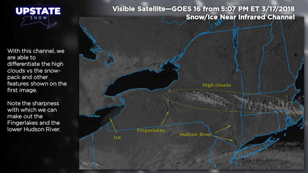
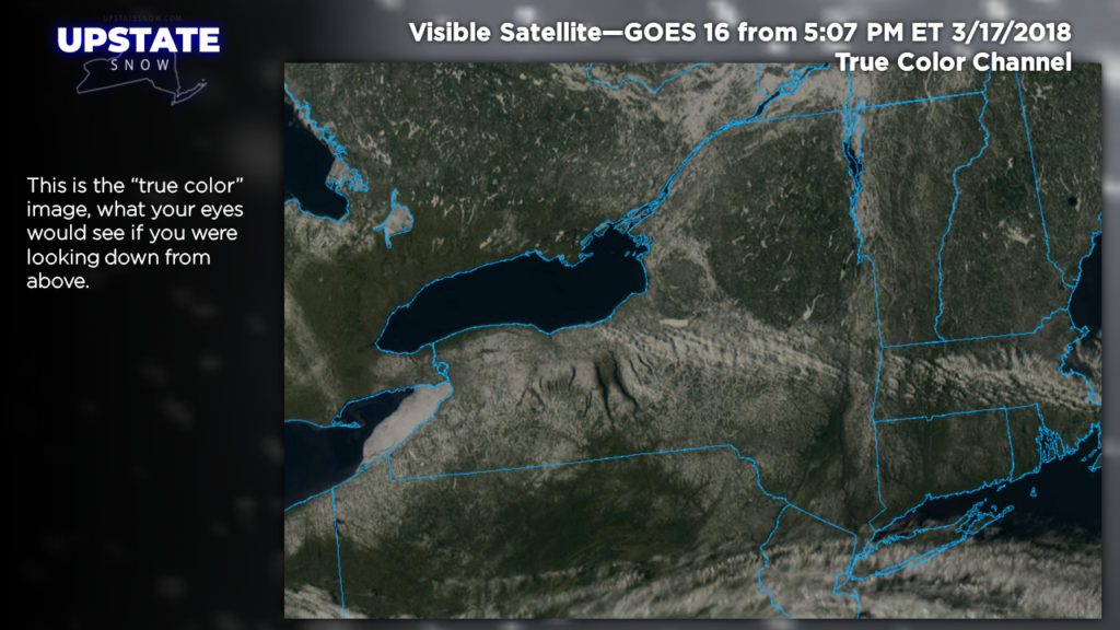
Lastly, check out some satellite images we grabbed earlier today!
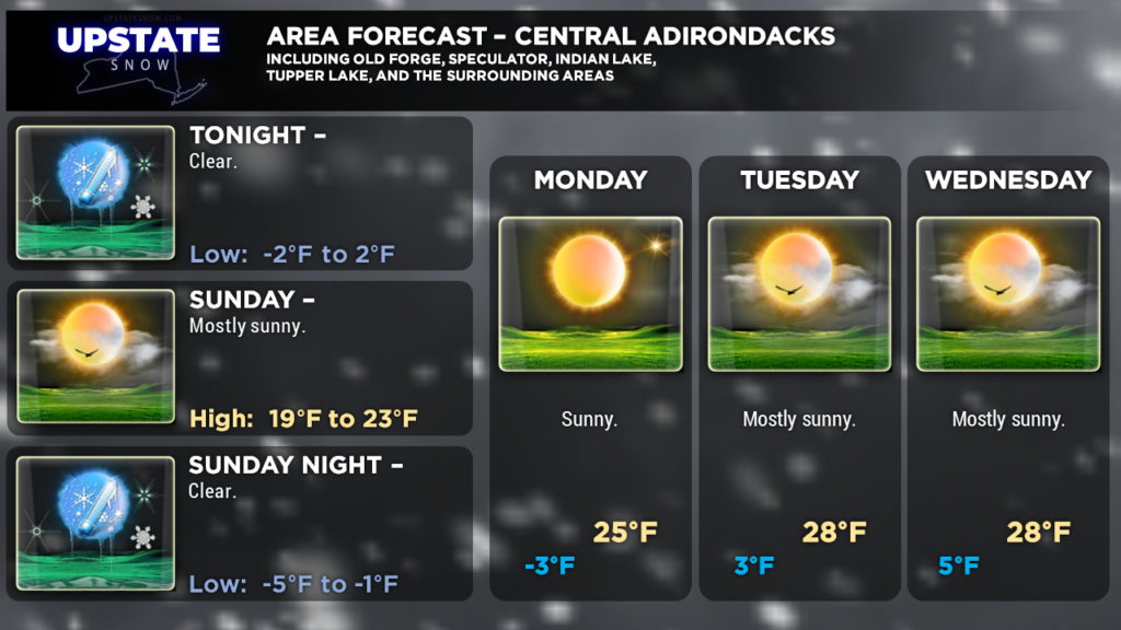
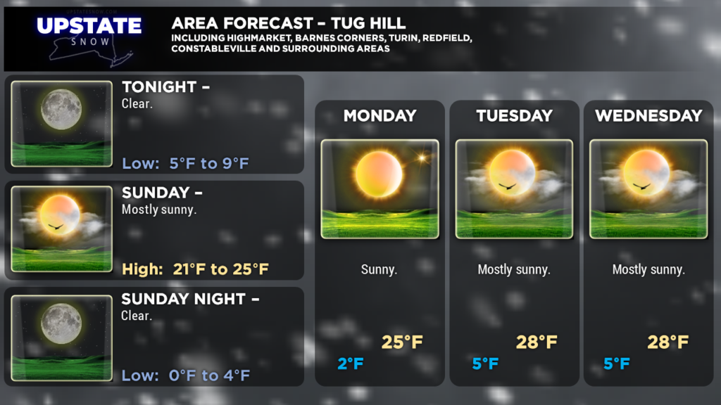
Here are your zone forecasts… pretty much just a temperature forecast the next several days. Enjoy the riding though!

