Good evening!
We had some widely varying snowfall totals over the past 24-36 hours, which was not unexpected, and in fact we mentioned that in our blogs the past few nights.
Here are some of the big winners, as reported to NWS:
Gerry, in Chautauqua County, had a storm total snowfall of 28.0 inches as of 4 PM on Wednesday. In Lewis County, reports as of 7 AM this morning included 1 mile east of Osceola with a 24-hour total of 16 inches; 10 inches 6.2 miles north of Croghan. In Oswego County, the station 8 miles north of Redfield reported a 24-hour total of 21 inches at 7 AM today; 15 inches at Bennetts Bridge, 14 inches at Fulton, 12.3 inches 3.6 miles south-southeast of Lacona.
In Central New York… Cortland was the big winner with a storm total of 20.3 inches as of 8:42 AM today, with 12.8 inches at Marathon. A 24-hour snow total of 7 inches was reported 2 miles WNW of Fosterville, in Cayuga County, at 7:05 AM today. In Otsego County, Unadilla Forks comes in with a 24-hour total of 7.3 inches. Oneida County reports included 5.8 inches at Westmoreland, 5 inches at New York Mills, 3 inches 4 miles SSW of Boonville, and 2 inches 1 mile WNW of Holland Patent.
In Eastern New York, Schoharie County was the big winner with 16.8 inches (storm total) reported in Jefferson, 12 inches in Richmondville, and 10.8 inches in Charlotteville.
For those of you in Northern New York, here are some storm totals (including from the Nor’Easter): Clinton County — Saranac picked up 26.0 inches (report as of 6:41 PM Wednesday); 23 inches at Ellenburg, 20 inches at Altona, 17.7 inches at Morrisonville, 17 inches at Keeseville. Ausable Forks, in Essex County, came in with 25.7 inches, with 19.2 inches at Keene Valley. Franklin County got in on the action as well, with 25 inches at Dickinson (as of noon today), 19.8 inches at Duane Center, 17 inches at Chateaugay, 16 inches in Malone, and 11.5 inches 6 miles north of Saranac Lake. Finally, not to be left out was St. Lawrence County, with 12 inches at Star Lake, 10.7 inches just south of Ogdensburg, and 8.7 inches in Massena.
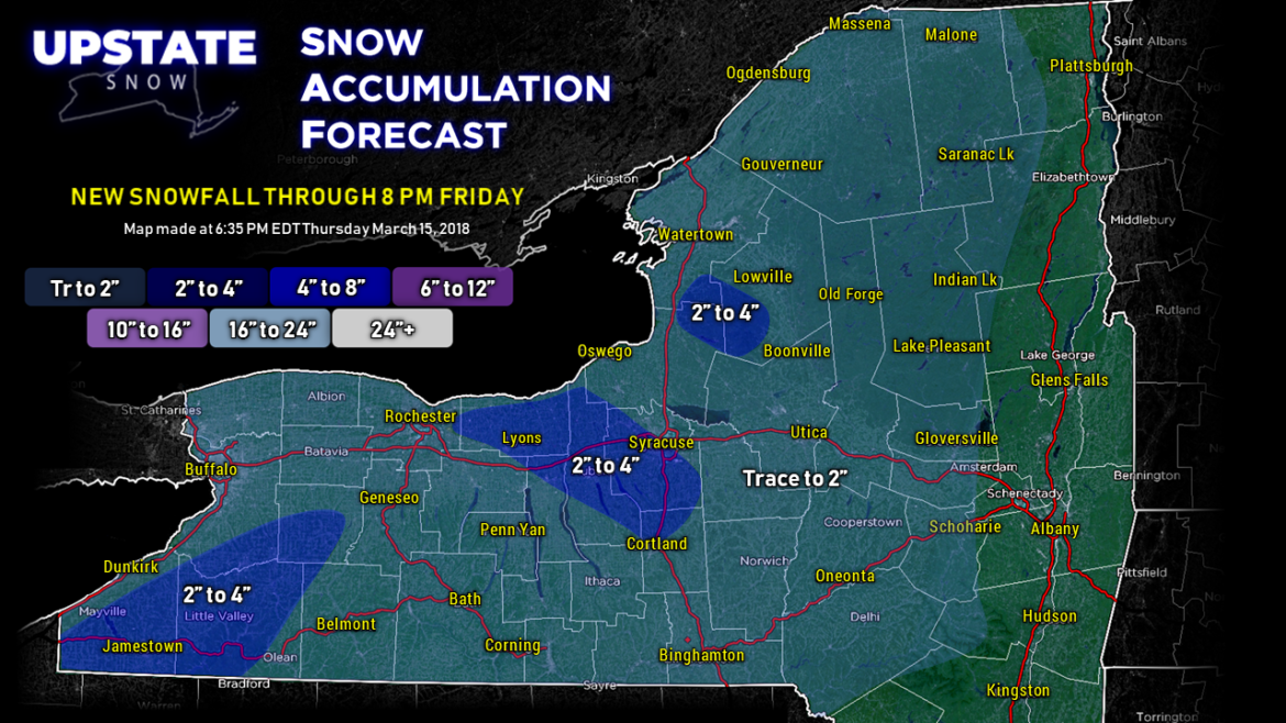
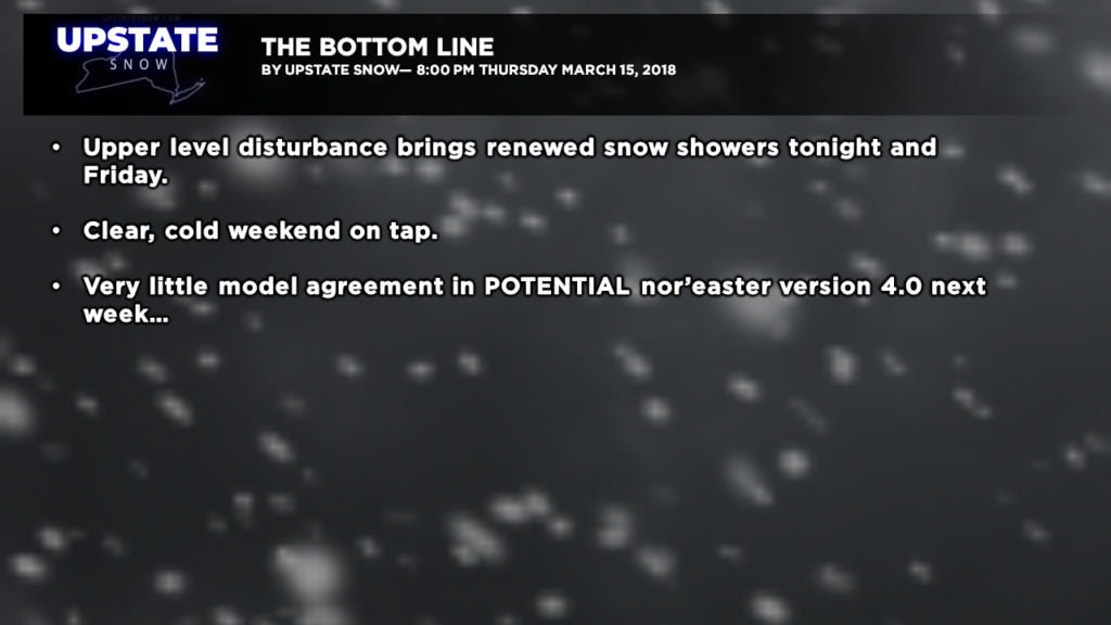
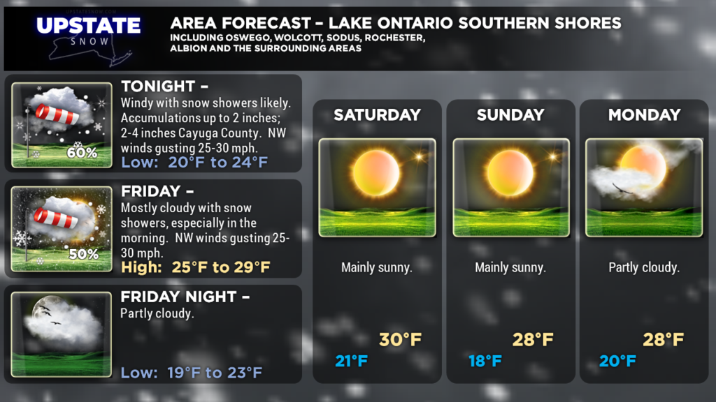
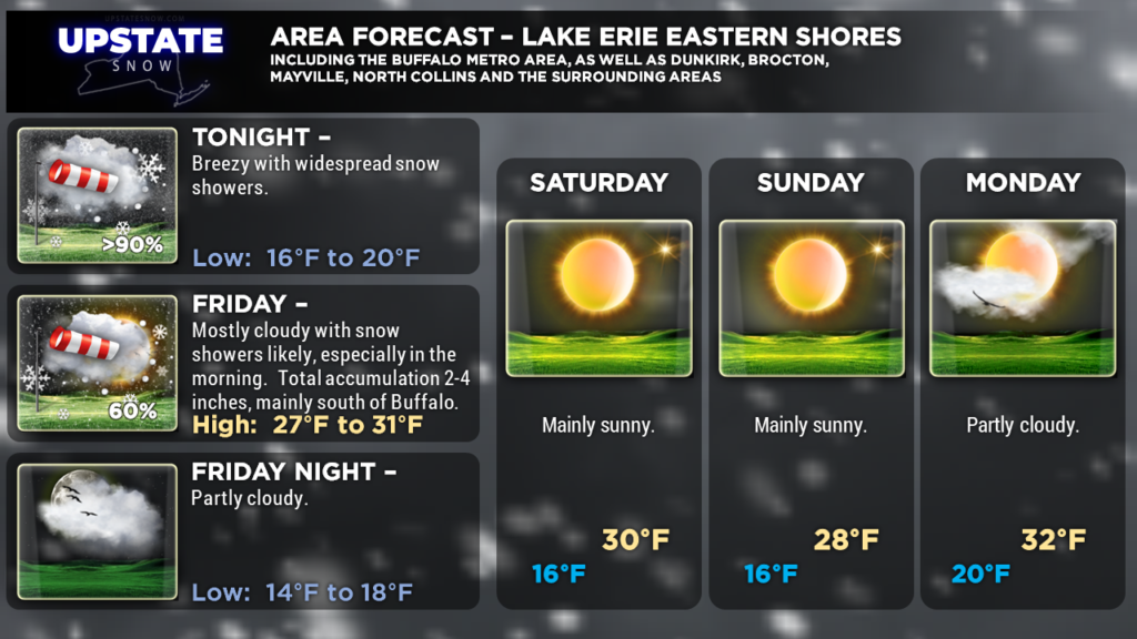
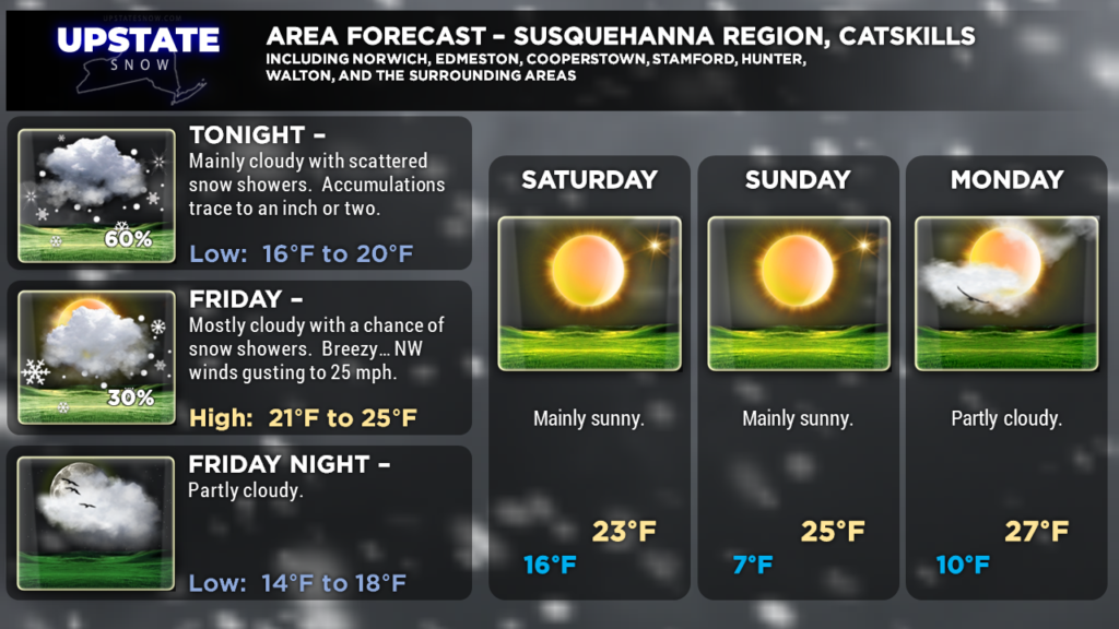
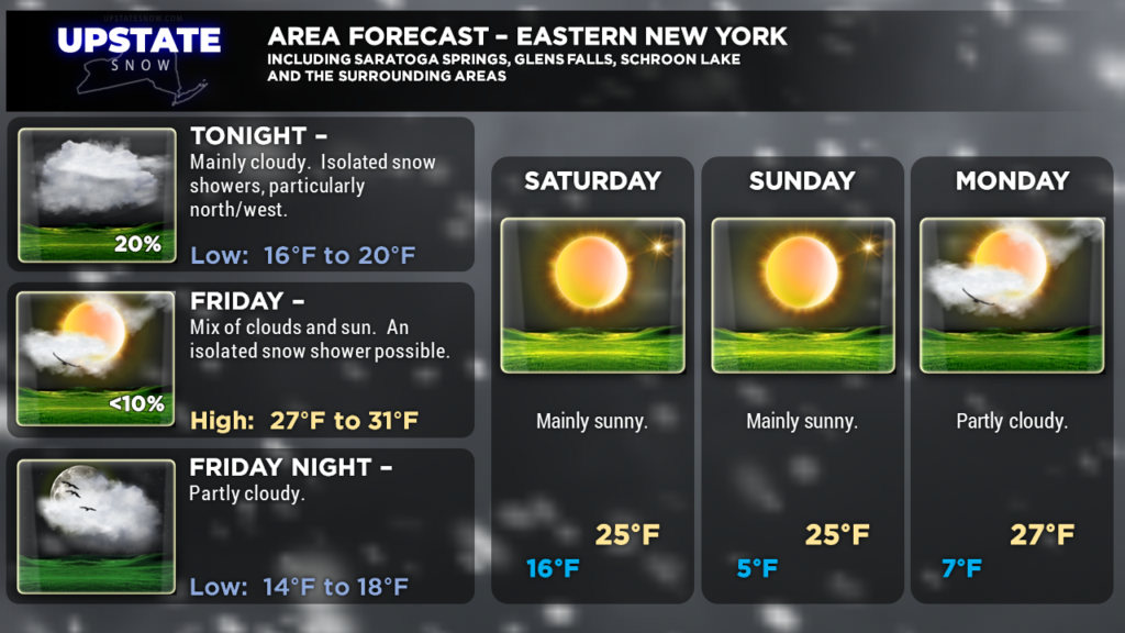
Guess what? We’re not done with accumulating snows! A shortwave, which is a fancy term for “piece of energy,” will rotate south and east over the area as part of a large closed low and trough at about 18,000 feet. Here on terra firma this will mean renewed northwesterly winds picking up more moisture from the lakes. This is not going to be anything even remotely close to what we’ve experienced, but some areas are going to pick up another 2 to perhaps as much as 6 inches of snow tonight through Friday. The highest likelihood of snows include the Tug Hill; an area extending from roughly Rochester ESE through Auburn, Syracuse, to Cortland and DeRuyter (roughly right along and northwest of route 13). Finally much of southern Erie, Wyoming, Cattaraugus, and Chautauqua Counties will get in on some additional accumulating snows tonight through Friday.
High pressure will build across central and southern Canada. This will dry us out… very dry… and we can expect a very sunny weekend with unseasonably cold temperatures… leading to absolutely fantastic riding. This high pressure across Canada has HUGE implications to our forecast for next week…….
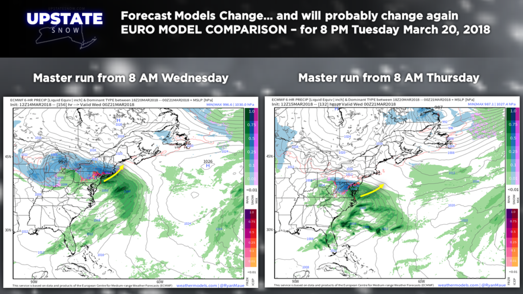
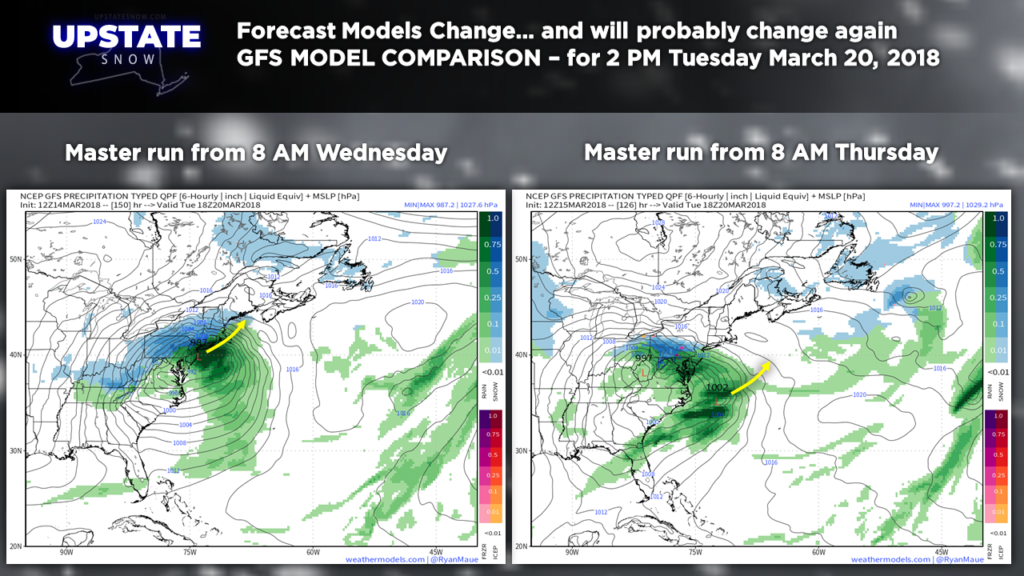
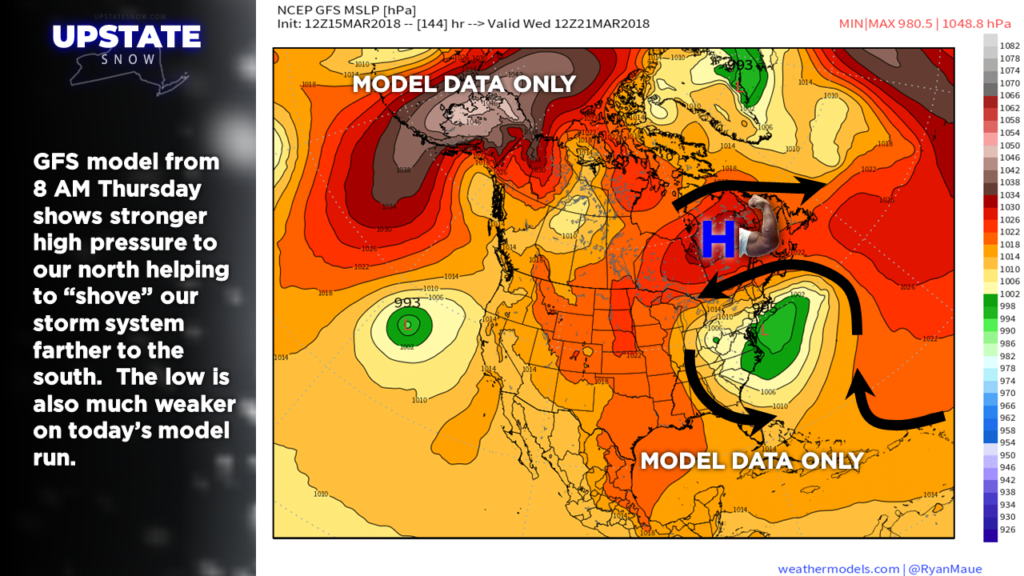
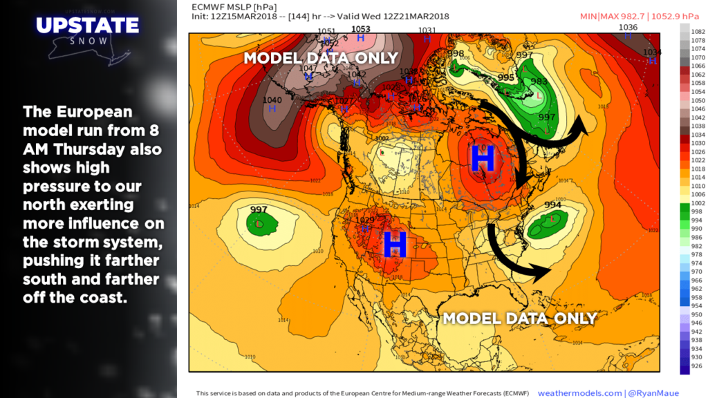
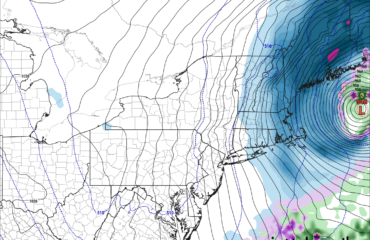
…….as a strong storm system develops over the central plains. All kinds of solutions are still “fair game.” Remember last night we mentioned that the models will tend to go back and forth with their opinions? Well that has indeed been the case today as both the GFS and European models from this morning show a weaker storm located quite a bit south from last night — here are the comparison views:
Remember how I mentioned that high pressure in Canada? Today’s models suggest that high being just a bit closer to us, and a bit stronger, which would indicate a storm system traveling south of us.
Here’s what we DO know: An upper-level low will approach the region by next Tuesday. It has been and always will be that upper level systems drive surface systems. So SOME kind of system will impact the eastern / northeastern US next week.
Now come the question-marks. You see by the image there’s a pretty big difference not only in placement of the surface system, but the timing as well. The GFS in particular has really slammed on the brakes… any impact at all would come more in the Wednesday-Thursday time frame rather than Tuesday-Wednesday. The ensembles are also “all over the place” with regard to placement and timing. Therefore…. as is always, always, always the case 5-7 days out…. it’s way too soon to make any kind of call. If anything screams “stay tuned,” this is it.
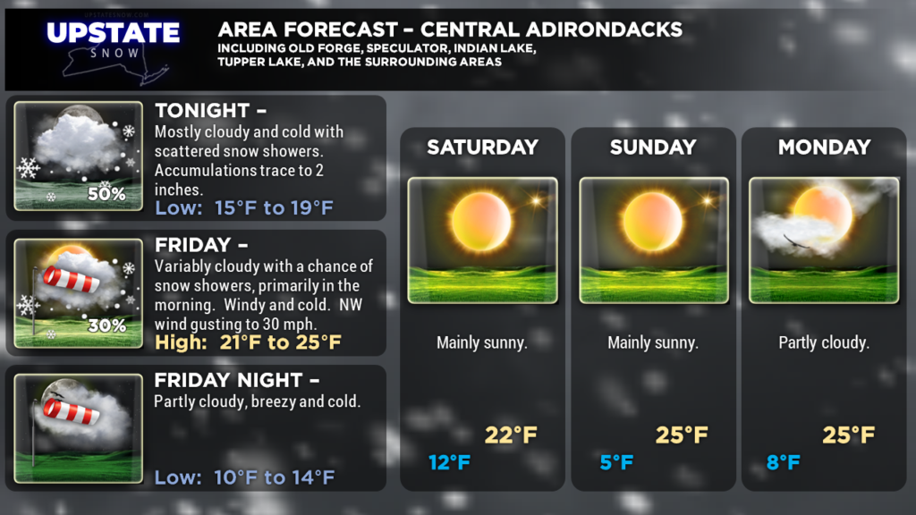
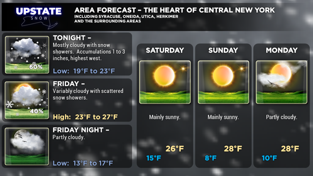
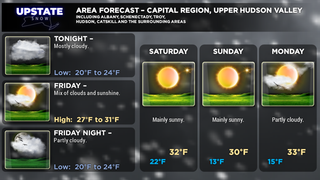
Here are your zone graphics, have a great night! As always, thank you for visiting the site and supporting our sponsors!

