Good evening!
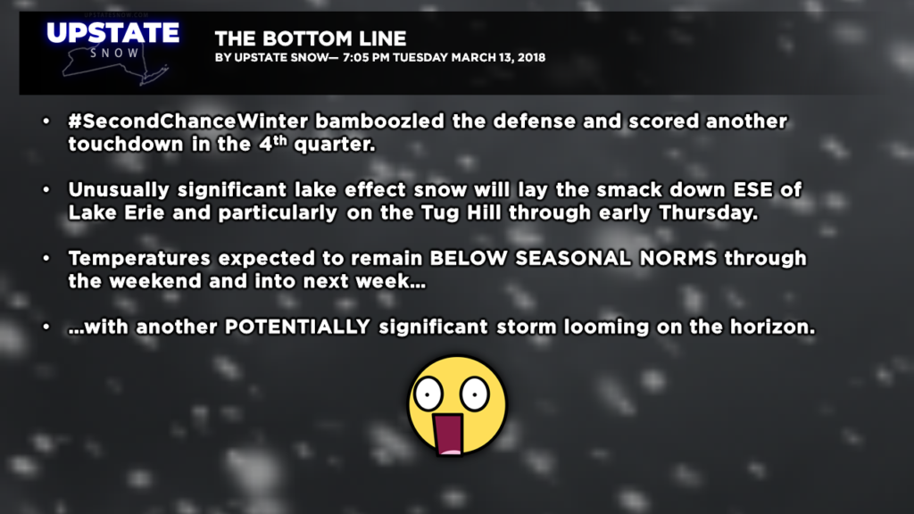
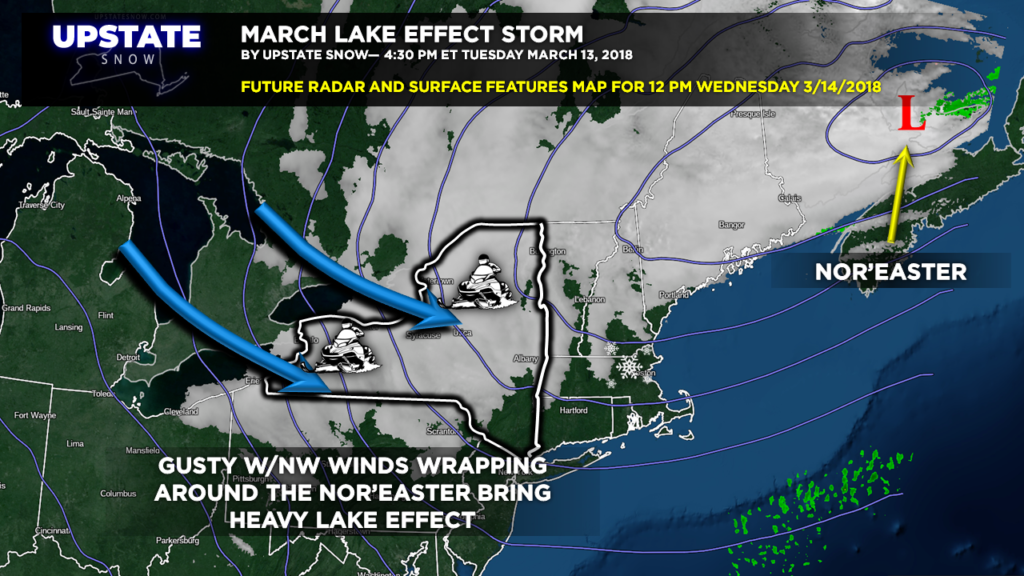
The #SecondChanceWinter pulled off a beautiful long pass and scored a touchdown here in the 4th quarter. The lake effect machines are cranked full blast, aided and abetted by the wraparound moisture from the nor’easter and an upper level low over New England. Wednesday will see widespread heavy snow in the favored lake-enhancement areas… that’s you, Tug Hull, and that’s you, Buffalo Southtowns, Chautauqua, Cattaraugus, and Erie County. A much drier snow, 15:1 ratios, means that we’re really getting a jackpot event for March… rather unusual as a matter of fact.
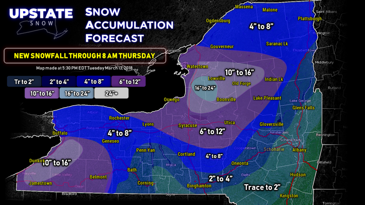
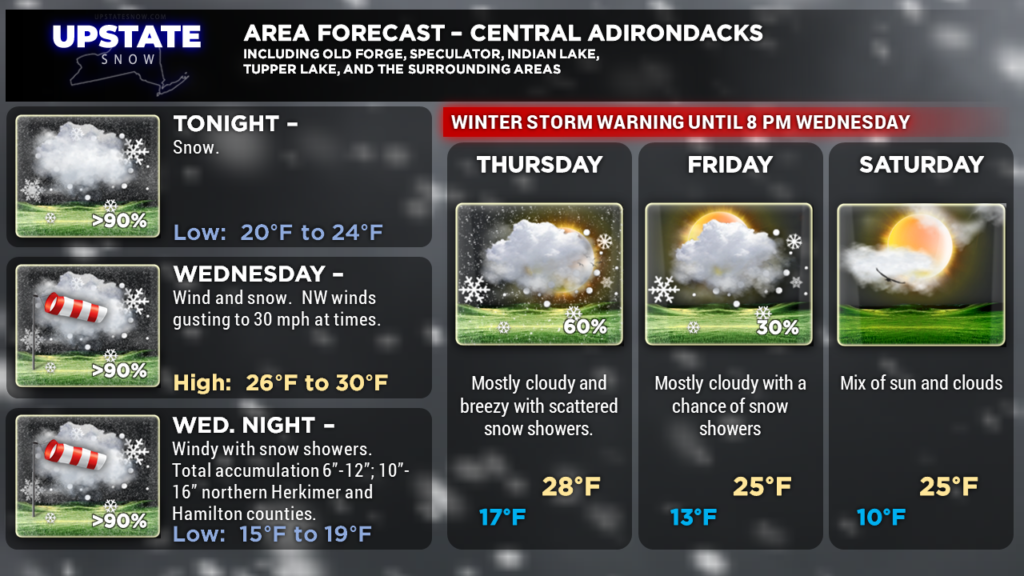
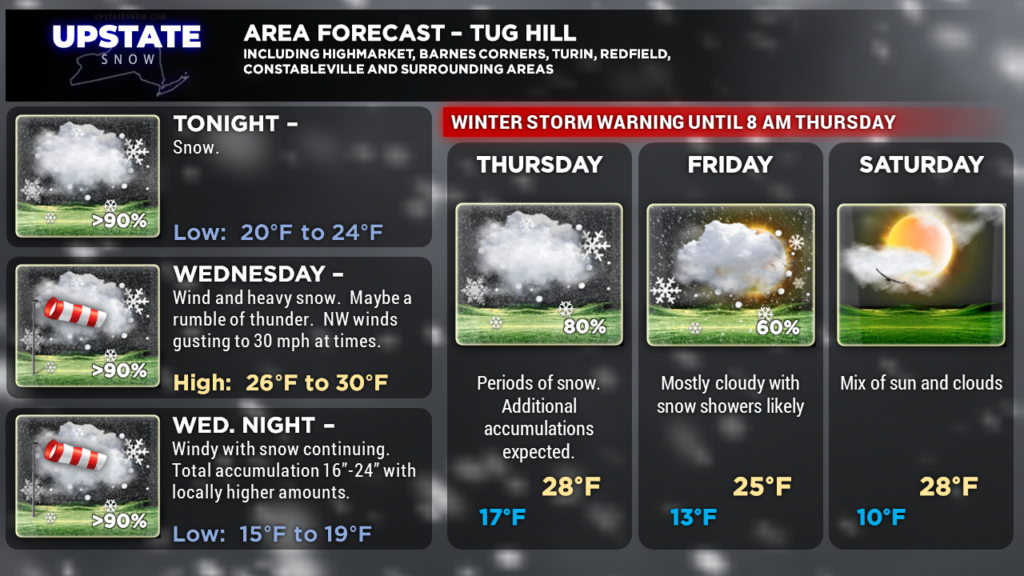
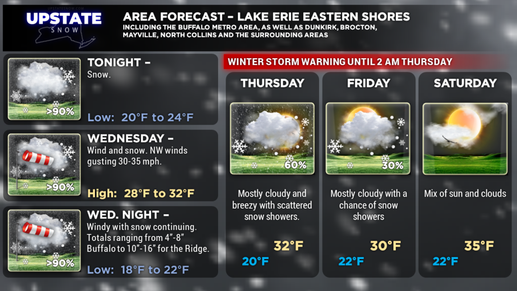
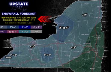
Our snow map illustrates this quite nicely … and this is valid from the time you read this through 8 AM Thursday. (Just a side note, each snowfall map we post has a “through” time listed… typically it’s 7 PM the next night, or 24 hours. You’ll see that on the left, under the logo and title. This “through” time will likely be different than what’s on a generic phone app or other weather sites.) Anyway, we’re painting 16″ to 24″ over the Tug Hill, with 10″ to 16″ just outside of that extending from roughly I-81 well into Herkimer and northern Hamilton Counties. With the abundant moisture and the relatively dry nature of the snow, we see no reason not to hammer-down with snow totals, and it wouldn’t be all that surprising if some isolated area on the Tug picked up even more than what’s shown. We’re also painting in 10″-16″ for much of Chautauqua County, southern Erie County, and northwestern Cattaraugus County, with 6″-12″ amounts extending eastward into Allegany County.
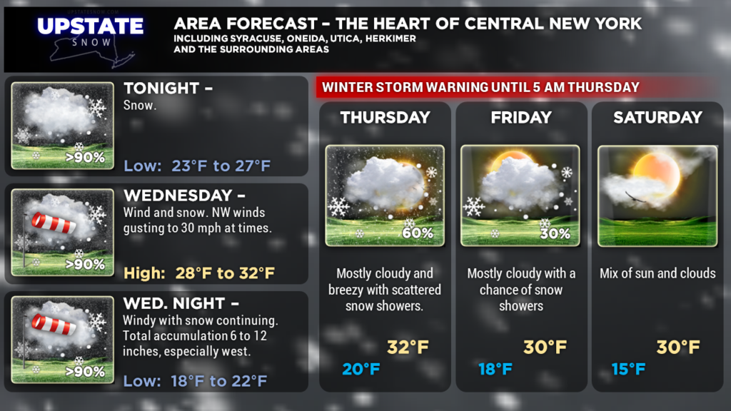
Speaking of 6″-12″ snow totals, you’ll notice that a large portion of the Heart of Central New York is painted in that nice purple color. There’s a bit of a caveat to this — amounts will be variable. Not every single location in that area is going to get 6″-12″ — you may only get 4″ or 5″ but your neighbor a few miles up the road might pick up 10″ or 12″.
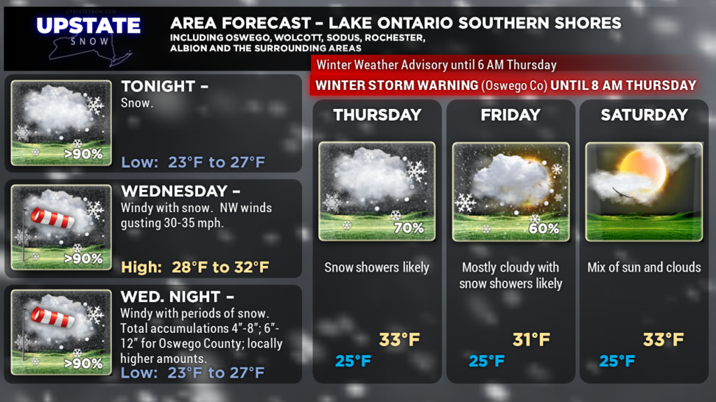
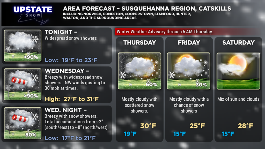
Totals ranging from 4″ to 8″ can be expected just about everywhere else save for the Fingerlakes (sorry!) and areas south and east of I-88, where amounts drop off fairly rapidly.
Hang on to your hats, too, it’s going to be windy. We’re looking at west/northwest winds 20-25 mph with gusts 30-35 mph at times Wednesday afternoon and Wednesday night… some localized wind gusts may push 40 mph. That’s going to create a lot of blowing and drifting snow.
There might possibly be enough instability Wednesday afternoon that a rumble of thunder may be heard east of Lake Ontario. Maybe.
This is a wonderful, unusual lake effect storm for March. As was noted earlier today on the FB page, lake effect is less common in March because temps aloft usually warm out of the range to generate it… and lakes are at their coldest. But in this case it is unseasonably cold… both at the surface and at that all-important 850 mb level (about 5,000 feet off the deck). Oh… and it’s going to stay cold well into next week.
The models keep trending colder, with another shot of Arctic air coming down into the area. Helping to keep us cold will be the abundant snow cover… that’s really not going anywhere any time soon. And guess what? Another potentially significant storm looms on the horizon as we get into next week (Tuesday-ish)… there’s a great deal of model uncertainty so really not going to worry too much about details right now, but this COULD BE… another shot of snow to the area. Stay tuned!
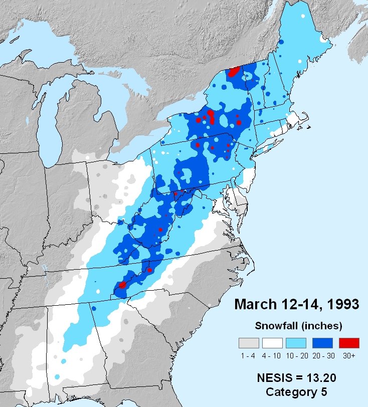
Oh…. and another side note…. this is the 25th anniversary of the “Storm of the Century,” the Blizzard of 1993. Where were you?
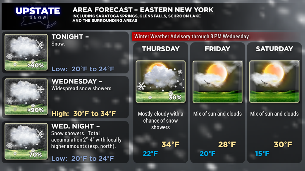
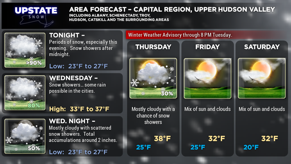
Here are your zone graphics for tonight. Be safe if you have to travel tomorrow. Thanks for supporting our site and sponsors!

