Remember you can click/tap on the images to enlarge.
Good evening gang…
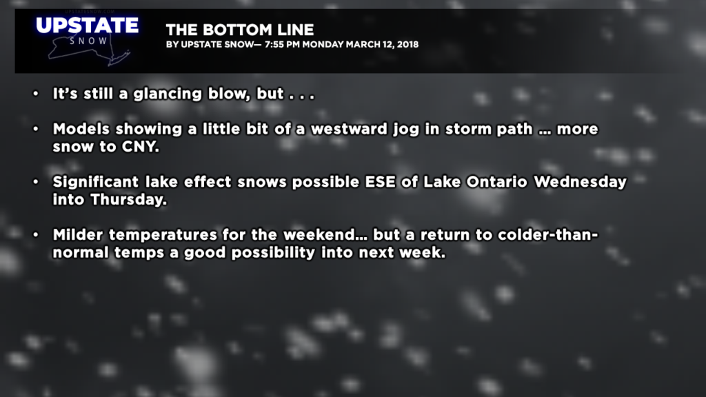
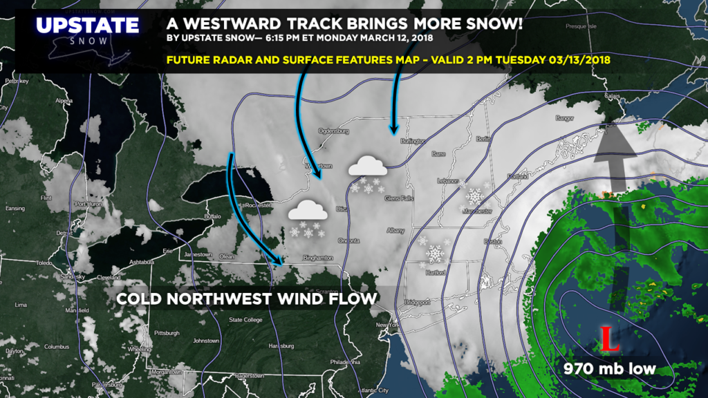
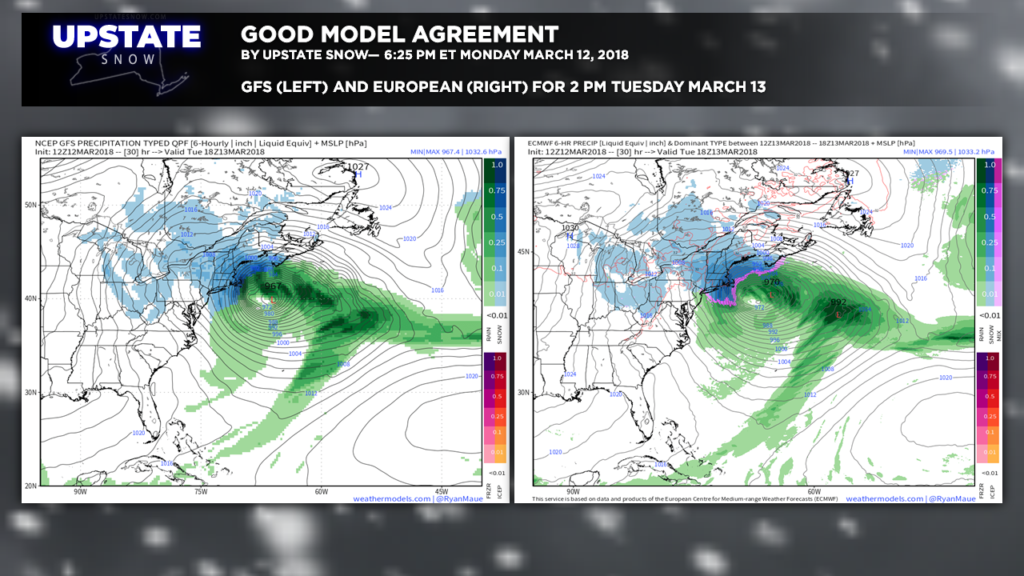
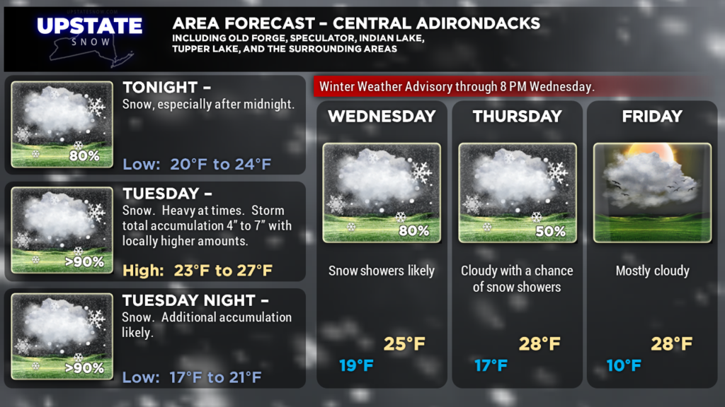
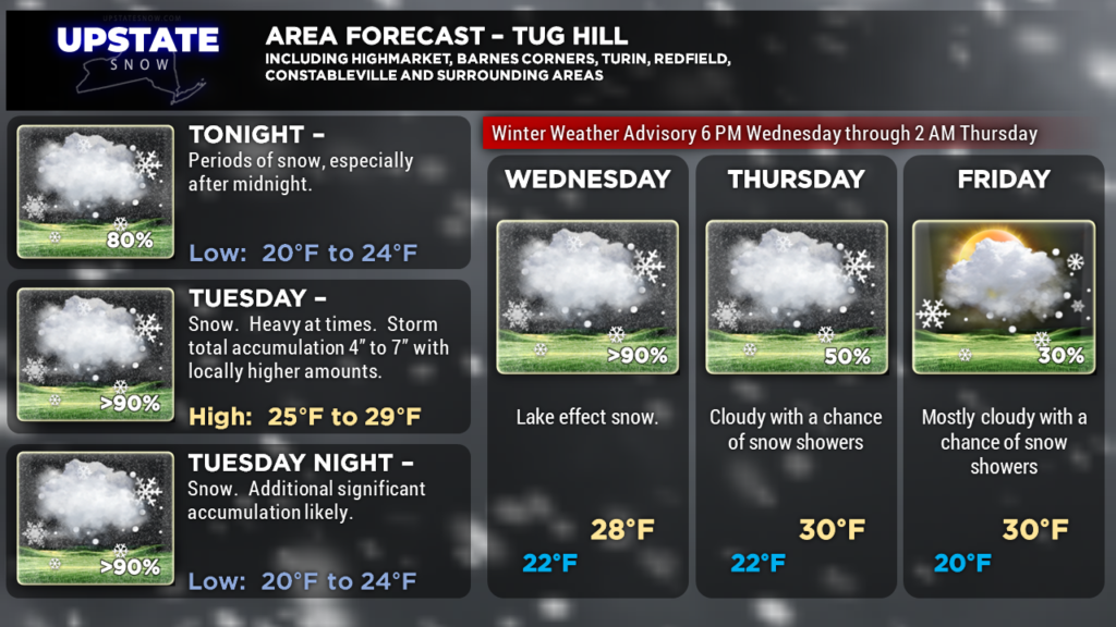
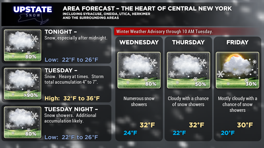
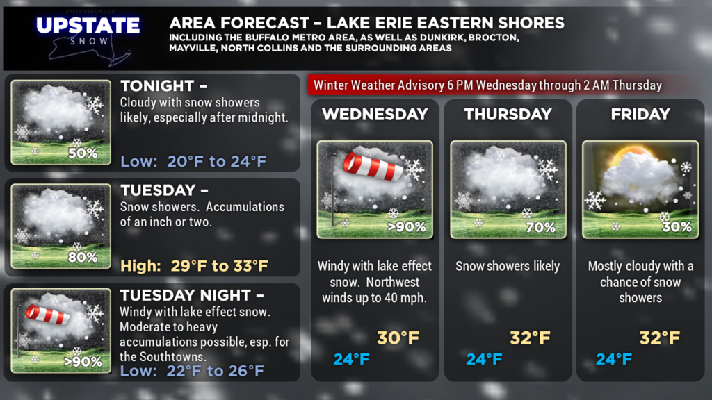
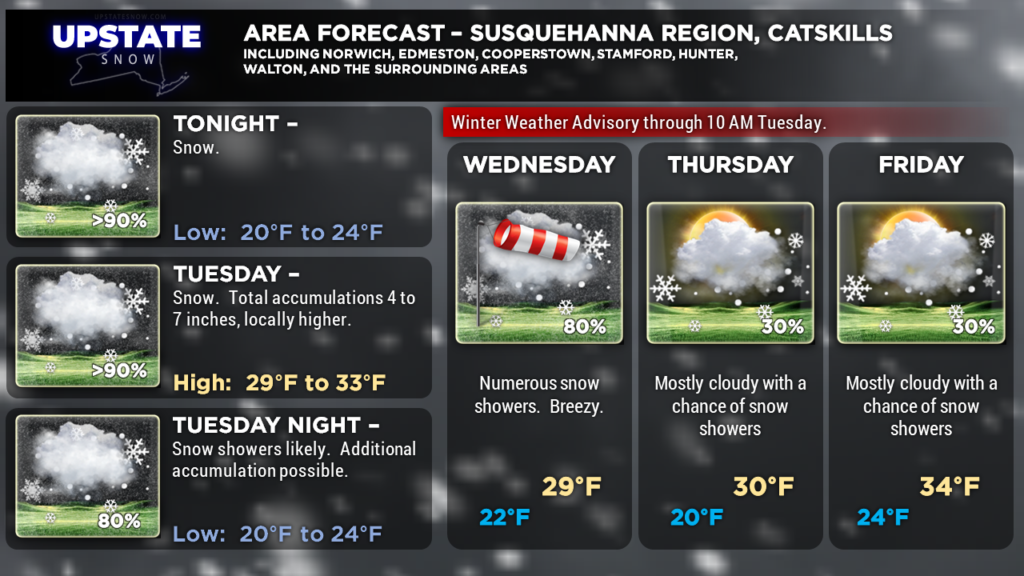
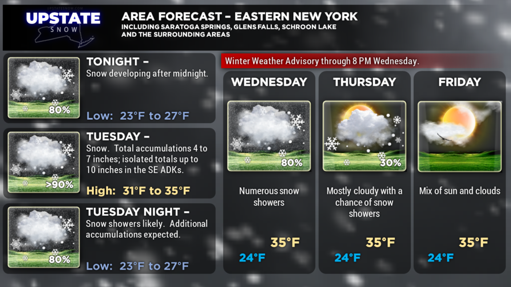
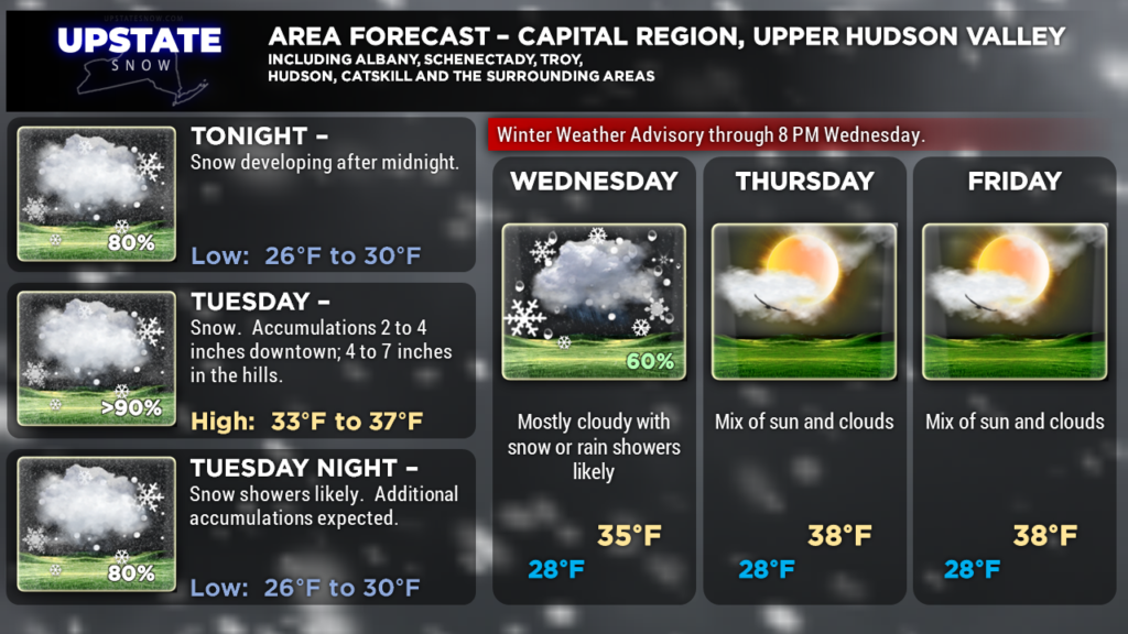
The third nor’easter this month will bring accumulating snows to just about all but western New York tonight through most of Tuesday. A westward shift in the models means that more snow is expected farther west than we thought yesterday, and have gone up… quite a bit… on our snowfall forecast.
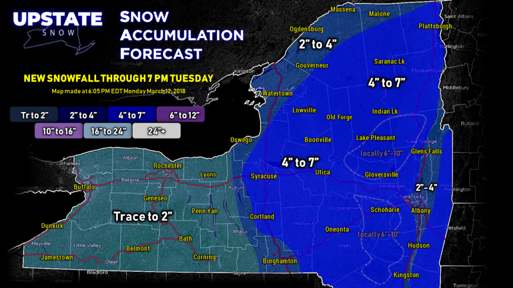
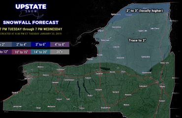
Our snow map tonight represents a “split-the-difference” between the high-res models, the global models, and past experience.
We painted in 4″-7″ for all of central, eastern, and northeastern New York for this event… and there may be some ISOLATED 6″-10″ totals in the highest elevations of the Catskills and the southeastern Adirondacks. Lower amounts for the Hudson Valley. Lower amount also as you get west of I-81, but the vast majority of Cortland and Onondaga counties are painted in the 4″-7″ given the terrain… we weren’t going to try to get too fancy with the ridges/valleys.
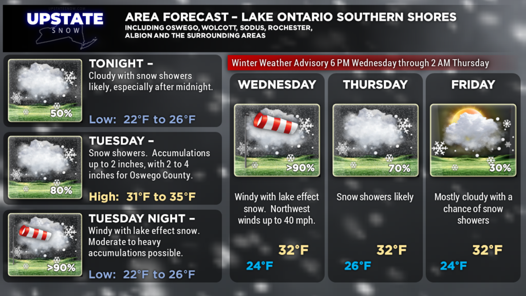
West of a line from Fair Haven through Auburn to Ithaca and Owego… we’re going with trace to 2 inches, but again, one or two locations close to that line may see a rogue 3-inch amount.
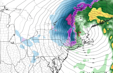
A strong nor’easter (970 mb!) will push northward and absolutely blast New England with wind, snow, coastal flooding, the whole 9-yards. As for us, once the immediate effects of the nor’easter are over, the effects of the deep trough and upper-level low will continue to bring cold northwesterly winds and unsettled weather for Tuesday afternoon into Thursday. On top of that, the lake machines give it one last go and conditions will be favorable for DECENT LAKE EFFECT snows ESE of Lake Ontario especially Wednesday and Wednesday night. This would be especially true on the Tug thanks to upsloping flow. How much? That depends on the usual features such as where the lake bands get established, persistence, etc., etc., but it stands to reason that a good foot of snow is possible from Tuesday evening through Thursday morning in the favored lake effect areas.
A brief warmup comes this weekend, but models aren’t as “robust” with warmth. We’ll see milder temperatures Friday and the weekend before a cold front will move through the region early next week. The other day we mentioned that the Second-Chance Winter was pushed waaay back to the defensive end of the field, but a long pass on 3rd down kept the SCW in the game for the time being. Whaa? The longer-term models are suggesting that temperatures may remain, on the whole, colder than average through the rest of the month.
Here are your zone graphics, and as always, THANK YOU for supporting the site and our sponsors!


