Hi everyone, a technical glitch on our end kept us from posting an update last night. Sorry about that.
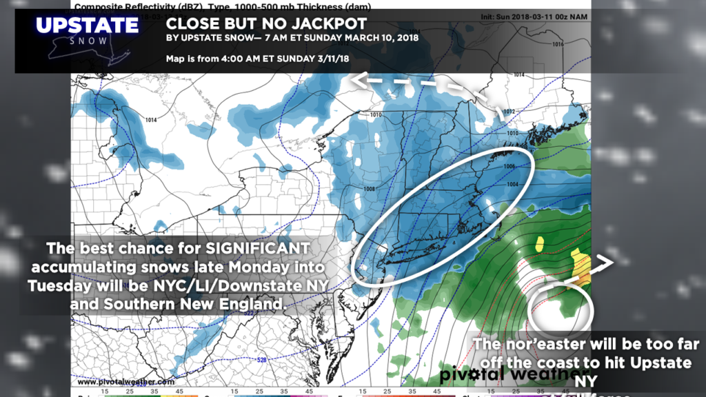
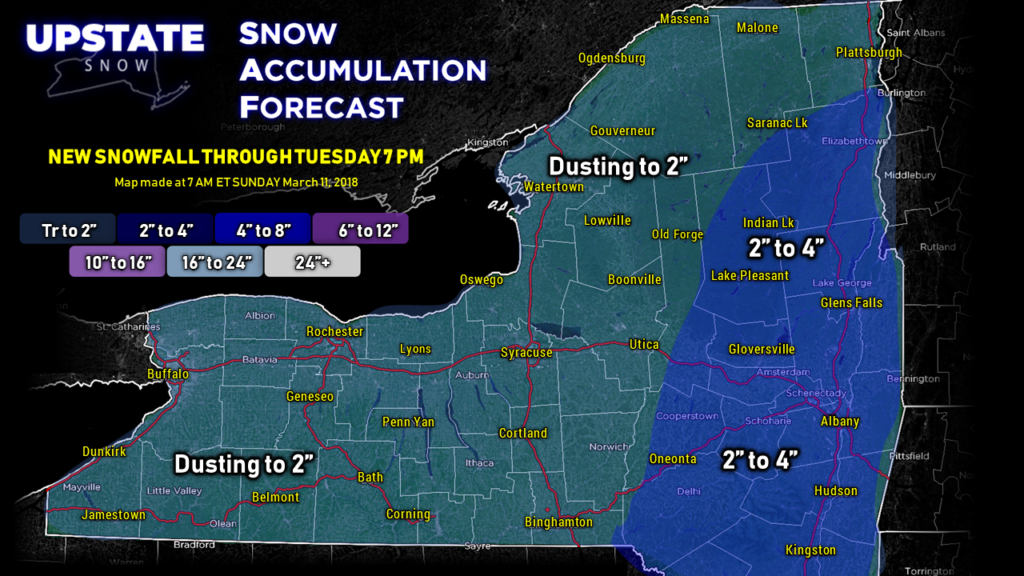
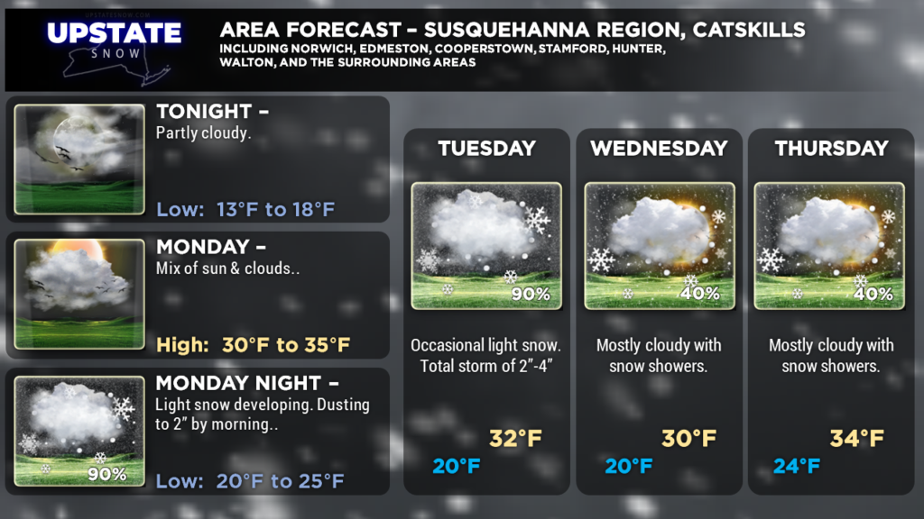
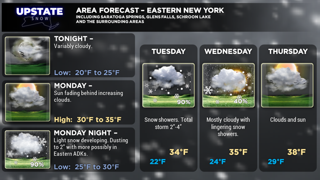
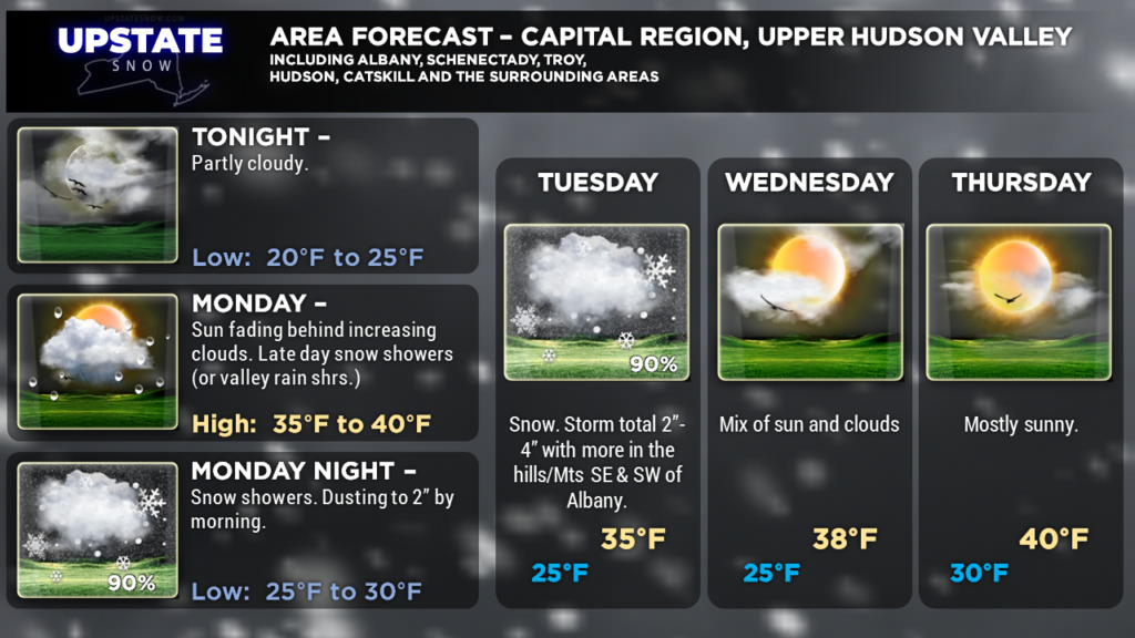
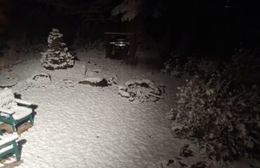
This afternoon’s briefing is … well … brief. The third nor’easter is going to bring a good snowfall to New England… and just deliver a glancing blow to eastern New York. Shovelable snows are possible for all of eastern New York — we’re pretty confident on a good 2″-4″ snowfall for Oneonta, Albany, Gloversville, Lake Pleasant northward to Elizabethtown, with trace- to 2-inch amounts farther west with scattered to numerous snow showers. That being said, any shift in the actual storm track could change things pretty dramatically… if the storm pushes closer to the shore we can bring some heavier snows back into the Upstate. An eastward shift would pull the 2″-4″ amounts farther east as well.
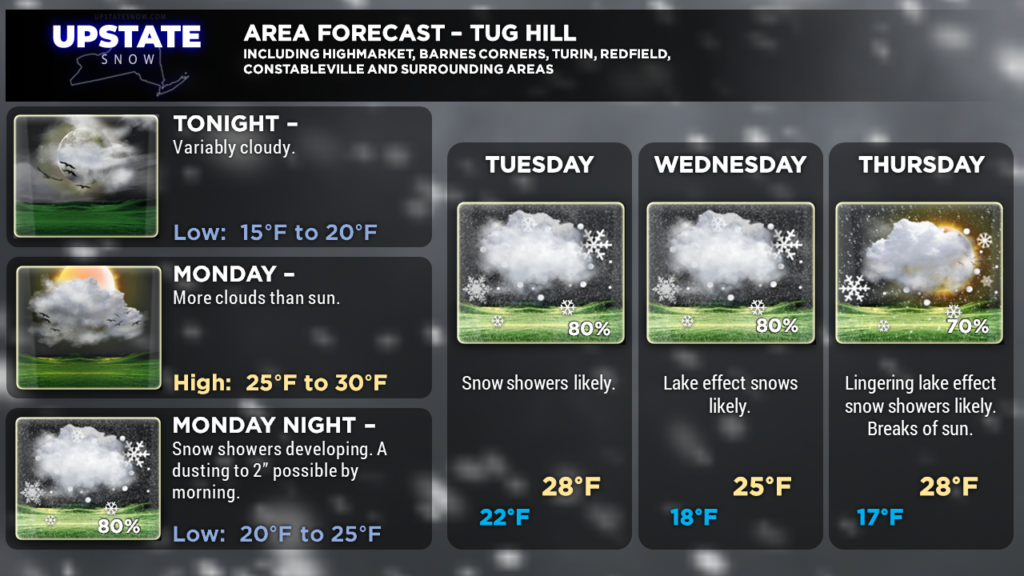
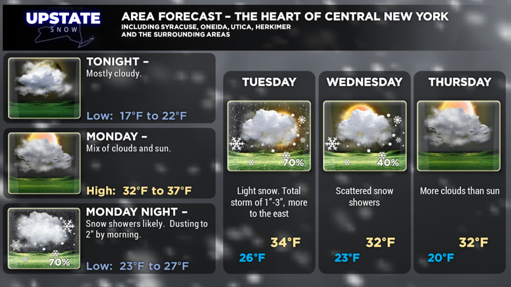
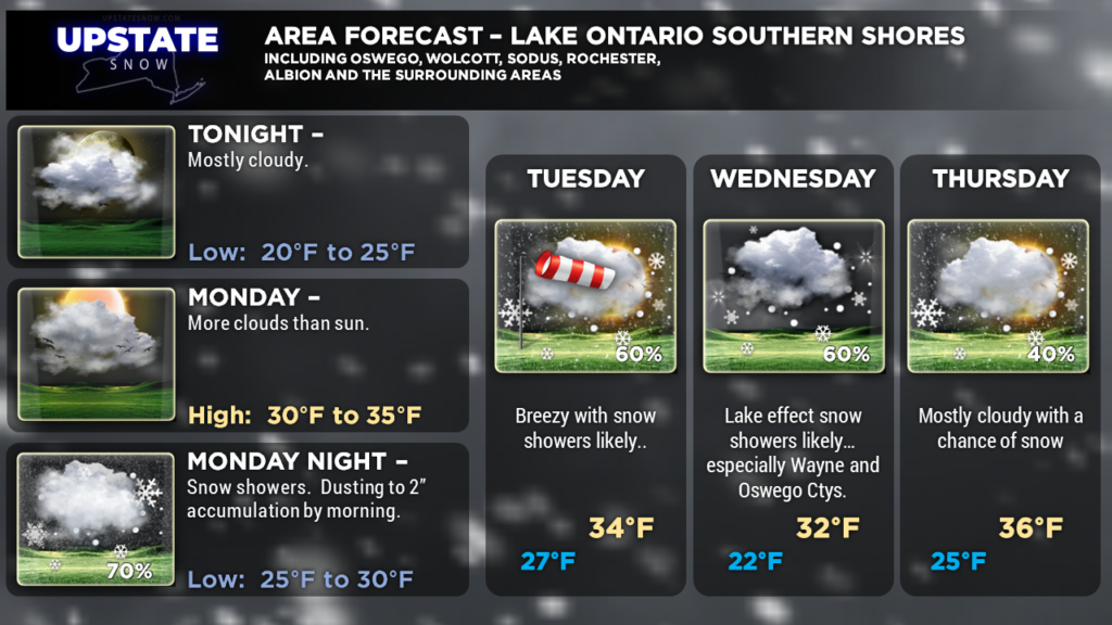
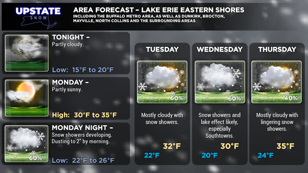
Much of the work week will feature lots of clouds, a cold northwest flow, and numerous snow showers. Accumulations will be the luck of the draw, the more snow showers you get, the better the accumulations will be. On the whole, not looking like an awful lot.
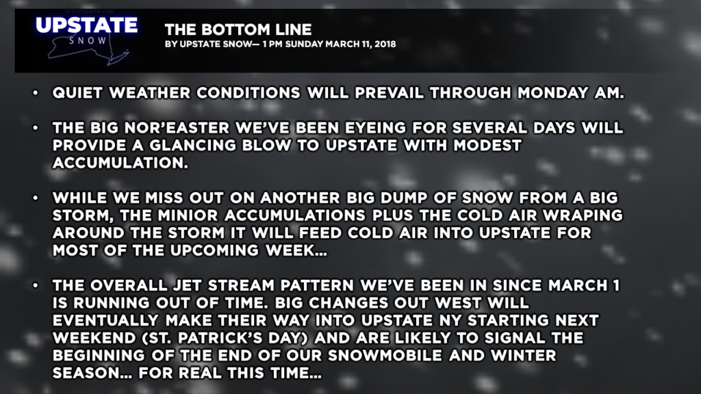
As noted on the bullet-points graphic, our Second-Chance Winter is at the 10-yard line on the wrong end of the field, we’re in the 4th quarter, and there’s not much time left on the clock. Changes are coming after this week…
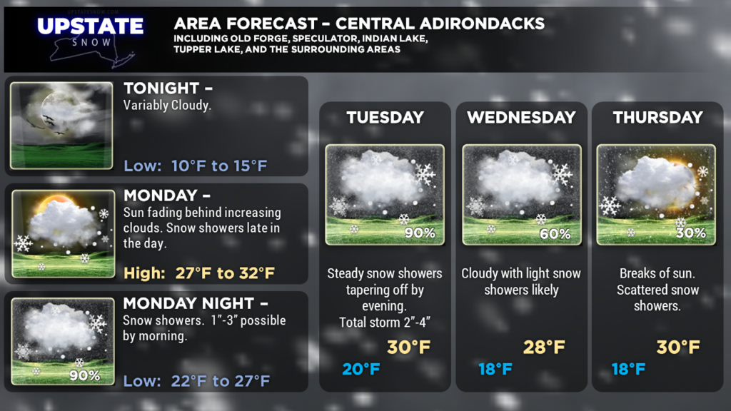
Here are your zone forecasts, and as always thanks for viewing and supporting the site!


