Good evening snow lovers. Tonight’s story is about good news and bad news.
The bad news? The system for Tuesday night through Wednesday night, at this point (7 pm Sunday) looks much weaker than what we had Friday.
The good news? We’re not done with storm chances as there’s the chance at yet another nor’easter by the end of NEXT weekend (March 12-13 timeframe).
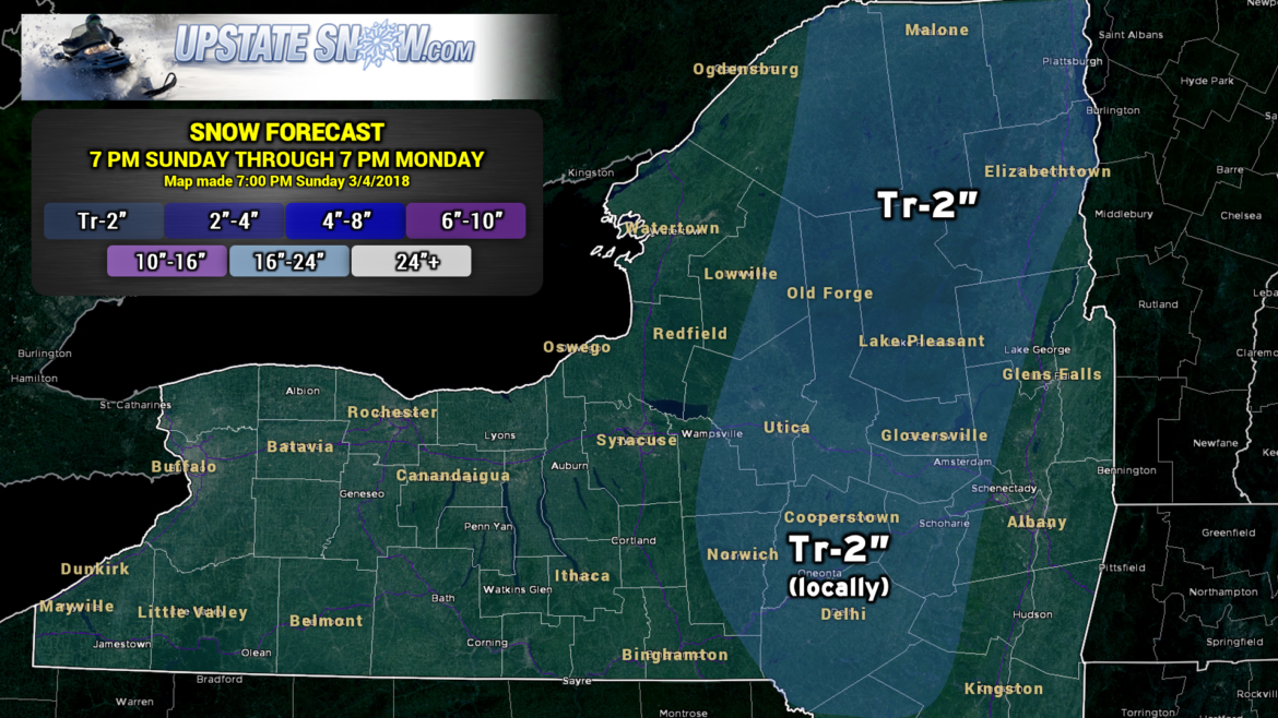
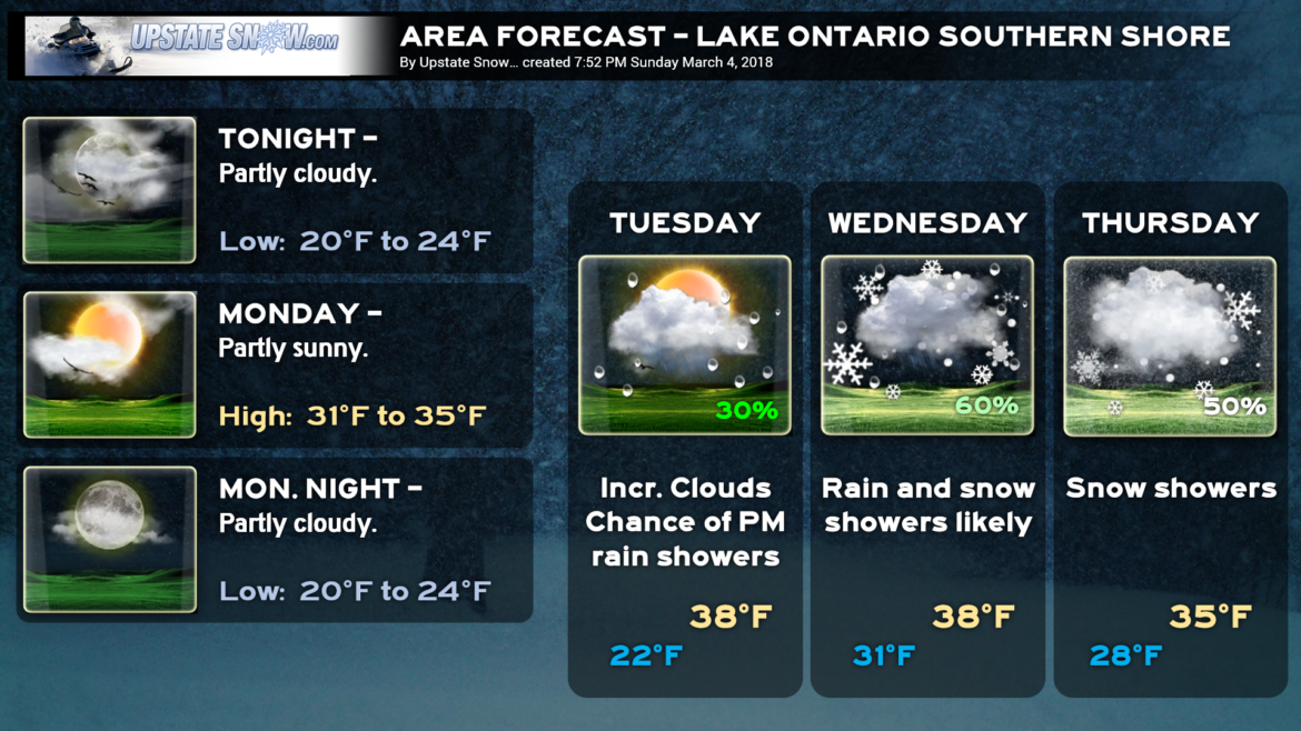
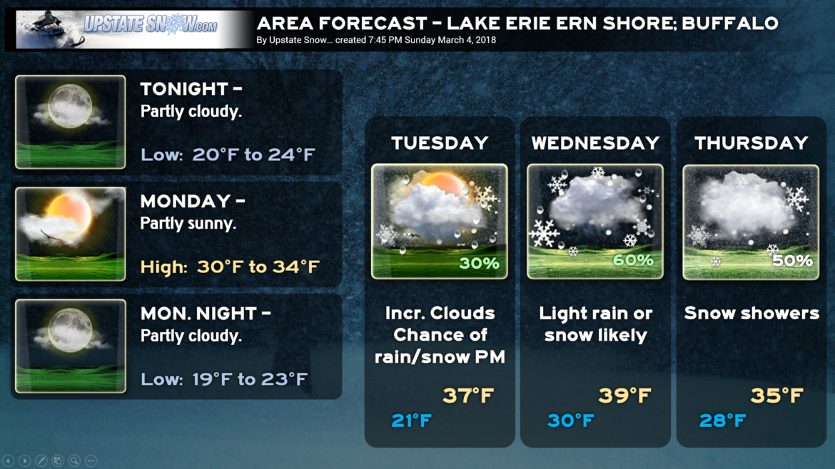
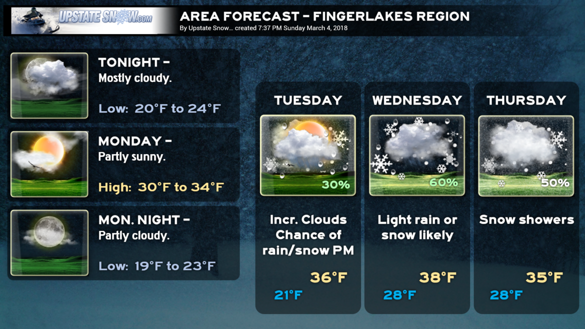
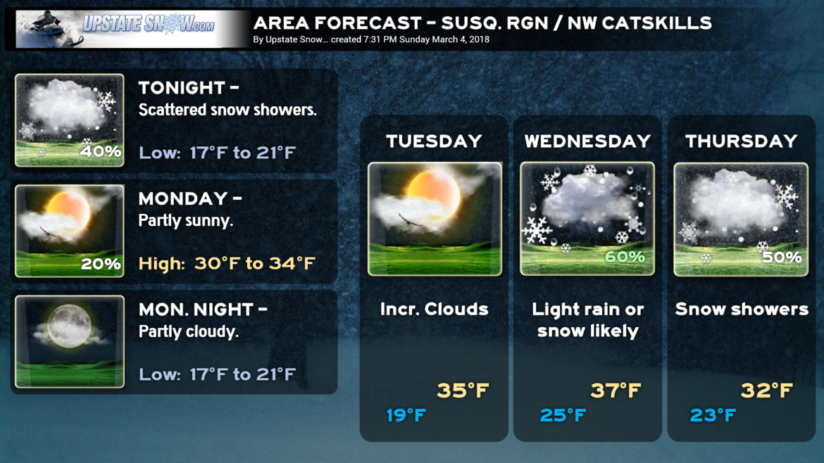
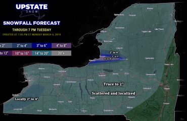
In the immediate / short-term, a northwest flow will continue through Monday. We’ll see scattered snow showers mostly in the North Country, near the International Border, extending into the Susquehanna Region and northern Catskills. As for accumulations, an inch or two near the Border, but just a trace possible in some areas farther south… you might need to dust off the car in the morning, but that’s about it.
As we go through your Monday, you’ll probably need the sunglasses by Monday afternoon as the last influences of that monster storm finally pull away. There looks to be a fair bit of low-level moisture around, at least according to the model soundings, but we think at worst you can expect a mix of clouds and sunshine for Monday afternoon.
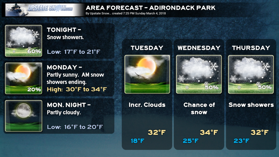
Our area will be in the southern periphery of high pressure Monday night, which will bring clear skies and temperatures in the upper teens for most of the area.
A complex area of low pressure over Nebraska will bring blizzard conditions for the Dakotas and Nebraska for Monday. While blocking high pressure remains over Greenland, this system sets its sights on The Empire State by Tuesday evening and Wednesday. It appears at this time that the storm track takes a similar path to what we just had Friday. The initial low moves eastward to the Ohio Valley, to a point somewhere in northern Ohio by Tuesday evening. Energy will then transfer to the coast and low pressure develops. That’s where all of our nice, neat agreement comes to a conclusion.
The European model consensus is that the nor’easter component of this will be a bit farther east/south than the one last week, as well as considerably weaker (989 mb as opposed to about 970 mb), and spins the low northeastward, and then northward into eastern Maine. This scenario means a New England snowstorm… but not a New York State snowstorm. Eastern NY might get in on some heavier / more persistent snowfall, but on the whole… not a lot from the initial storm. A weak surface system over the Great Lakes kind of digs southeastward toward the coast into Thursday which would bring snow showery conditions to the state.
The GFS moves low pressure into northern Ohio by Wednesday morning, as low pressure develops and strengthens off the Cape Hatteras, NC coast. This becomes the primary low, and moves northeastward and strengthens to a 987-mb low just south of Long Island by late Wednesday night. The storm then spins northward into Newfoundland by Friday, with a weak surface and upper level low spinning southeastward from the Great Lakes to the NJ coast.
So what to make of all this?
This will be a quick-moving system, with a relatively short window of opportunity for accumulating snows. AT THIS TIME it appears that the highest likelihood for any “shovelable” snow accumulations would be east of a line from say Malone through Tupper Lake through Dolgeville, Cherry Valley, Delhi. Even that’s a bit of a question because temperatures will be a degree or two milder than our last system… some rain will undoubteldly mix in for Wednesday, ESPECIALLY in the Capital District and Hudson Valley, and probably the valley along the Montgomery/Fulton County line.
That all being said, there’s model disagreement. The GFS throws a bunch more snow back into the state than does the Euro or NAM at this point. The NAM juuuuust misses NY with heavy snowfall… pounding western Vermont, Massachusetts, and Connecticut… but does keep some decent color over NY. Just not enough color to make us jump out of our chairs. On the complete opposite end of the spectrum, the Canadian model brings nothing to us… nothing, nada, zilch, zero. It shows our weak surface low over the Great Lakes dissipating into oblivion, with just a few snow showers here and there.
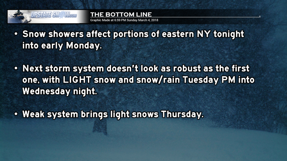
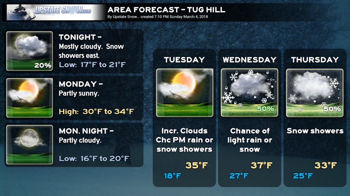
Hopefully by this time tomorrow we can give you a “first call” snow map (if necessary) with some degree of confidence. Until then, our forecast is going to be that of a weak system, with some generally LIGHT snows Tuesday night, light snow with rain mixed Wednesday, and light snow Wednesday night and Thursday. There are about 37,925,712 asterisks attached to that (in other words, “highly subject to change”).
A little bit of a breather by Friday and Saturday allows us to catch our thoughts… before the NEXT storm threat arrives by the end of next weekend. There is ZERO model agreement this far out (not surprising). The European, GFS, and Canadian all show low pressure crossing North Carolina during the weekend, and then strengthening off the NC/VA coast. Where it goes from there is a tossup. The EC bombs the storm and takes it slowly up the coast, to a position off of the southern shore of Long Island by NEXT Sunday night. The GFS is slower in timing, and pushes the storm much farther eastward before bombing out. The Canadian takes a weak, disorganized low well out to sea.
Are patterns favorable for another storm? All three models show the strong Greenland Block holding firm and strong. They also show strong surface high pressure stretching from Hudson Bay southward through the midsection of the US. The Euro shows lower heights over the Appalachians at 500 mb (18,000 feet) which extends upward to 30,000 feet. In other words, yes, the pattern does appear favorable. Will all the ingredients come together to make the perfect meal? …or will it be a case of the wanna-be chef who doesn’t even know how to work the blender?
RIDING UPDATE — We have “mint” conditions north of Holland Patent, at the power lines by Steuben and northward. The ride up to Dutchers Run is the best we’ve ever ridden. South of that… tough mudder. Lots of open water and ruts everywhere, even in the fields. So use caution.

