This has been an amazing snowstorm that overperformed in many areas, underperformed in only a few areas, has left a blanket of white over much of the state, and has left over a quarter million households in the dark.
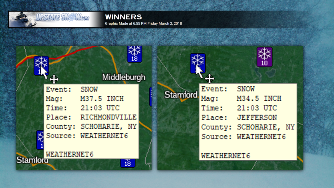
Otsego and Schoharie County appears to have won the Gold Medal (or white medal) tonight… Richmondville with a whopping 37.5 inches as of 4:02 PM, followed by Jefferson (34.5 inches), Cherry Valley (33 inches), Schoharie (30 inches), Charlotteville (25.5 inches), and North Blenheim (24 inches). Many, many other reports of 12-20 inch reports from across the state, most of these being south of the Thruway.
We have a couple 22-inch reports — Perrysburg (Cattaraugus County), Forestville (Chautauqua County). A 24-inch report by a co-op observer 3 miles west of Wyoming (Wyoming County), and that was from 7 AM this morning! Double-digit snow totals as far north as Point Rock (Oneida County) (19 inches), and Northville (Fulton County) (16 inches).
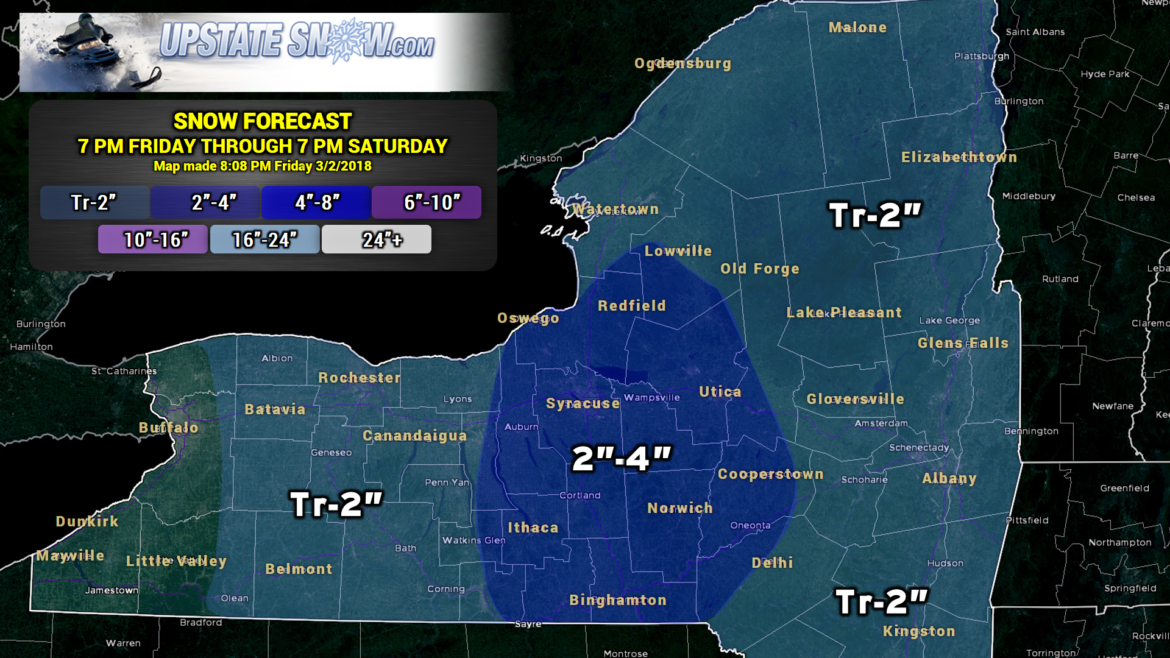
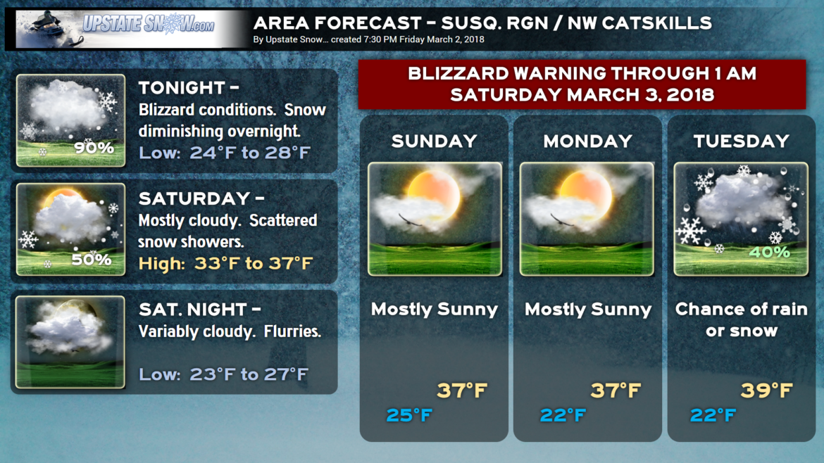
Ongoing areas of light to moderate snow will continue to diminish through the evening and overnight hours, with, at most, 2-4 more inches expected.
Blizzard Warnings remain posted for Otsego, Delaware, and Sullivan Counties through early Saturday morning. You don’t have to have falling snow to have criteria-blizzard conditions… sustained winds of 35 mph or more with reduced visibility one-quarter of a mile or less for 3 hours constitutes a blizzard by NWS definition.
Sustained winds out of the northwest at around 20 mph will continue to gust to 40-50 mph through the early overnight hours. The winds will diminish only slightly as we go into Saturday… gusts to 30 mph at times. This will only exacerbate the widespread blowing and drifting snow we’re experiencing across the state.
Travel is disrupted statewide. Damage is incredible. Don’t go anywhere unless you absolutely have to. States of Emergency remain in effect throughout Utica, Rome, Milford, Cooperstown, New York Mills, Herkimer, etc., etc.
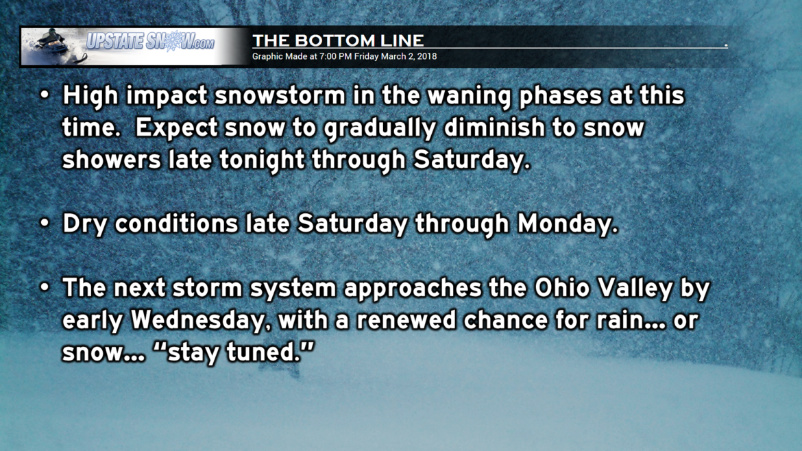
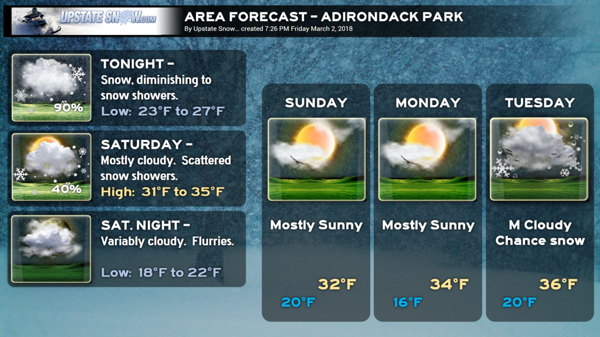
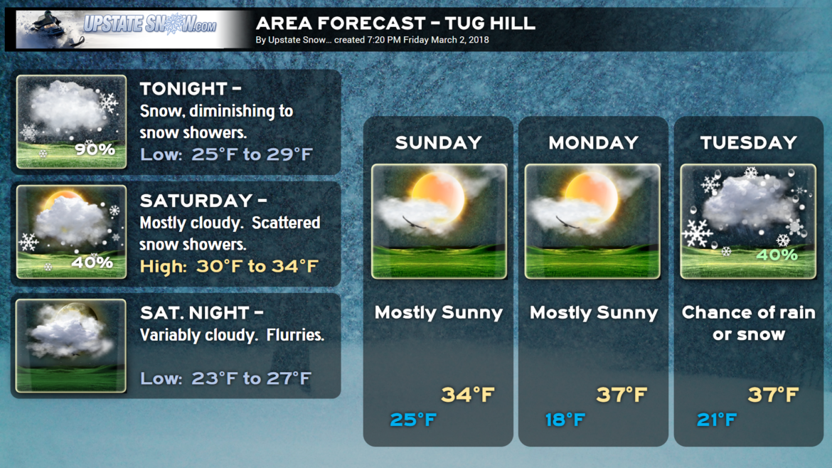
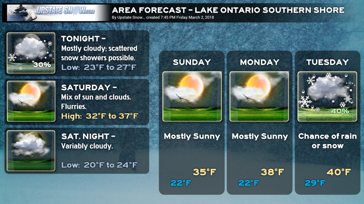
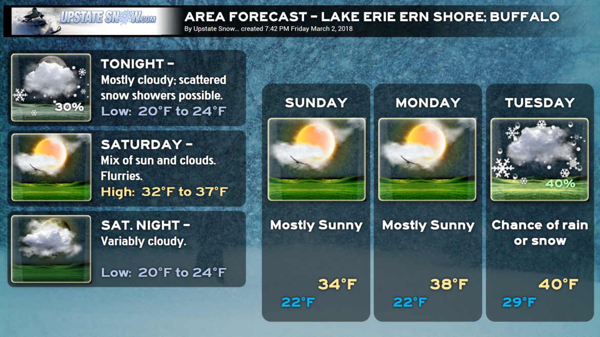
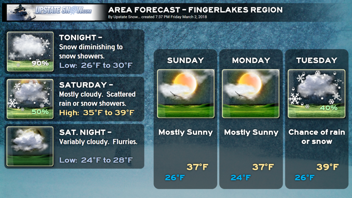
Snow showers are expected to continue through Saturday, diminishing Saturday night. We’ll have dry conditions Sunday and Monday thanks to high pressure pushing in. Temperatures should remain right around seasonable norms.
The next weather system moves in for the middle of next week… low pressure tracks to the northern Ohio valley with a transfer of energy off the Delmarva coast Wednesday.
Yep… you read that right.
——————————–

SO WHAT ABOUT RIDING???
1) Check with the clubs before you go riding anywhere this weekend.
2) Be watchful for downed trees and limbs. Please be helpful to local clubs as they have hardly any time to react before the weekend.
3) Watch out for mud holes and areas of standing water.
4) Our spotters have observed soft and open ice along the edges of lakes in the Adirondacks. Even though there are tracks on the lakes, it does not mean it’s safe to cross. We recommend you DON’T RIDE THE LAKES.
5) Be respectful, as many families will be trying to get their last rides in for the season. Go easy on the throttle.
6) Because temperatures will not be very cold, and because there was no base, groomers will have a difficult time working with the snow. Many clubs may choose not to groom.
Here are your “area forecasts” —

