Good evening!
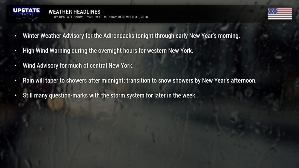
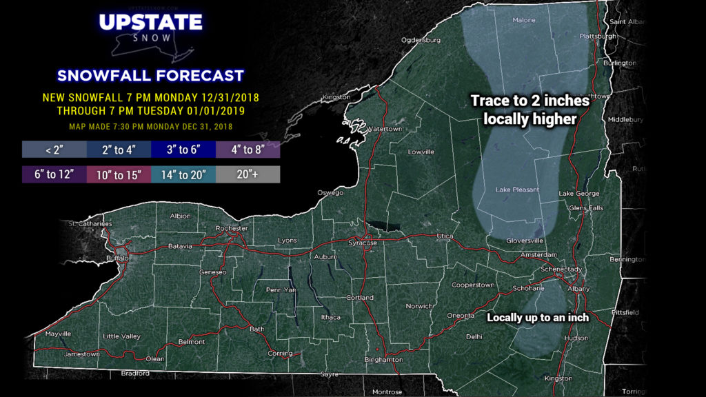
We’re just going to kind of hit the highlights here tonight. It’s going to be a windy, rainy night for much of the state, with snow, sleet, and ice for portions of the Adirondacks.
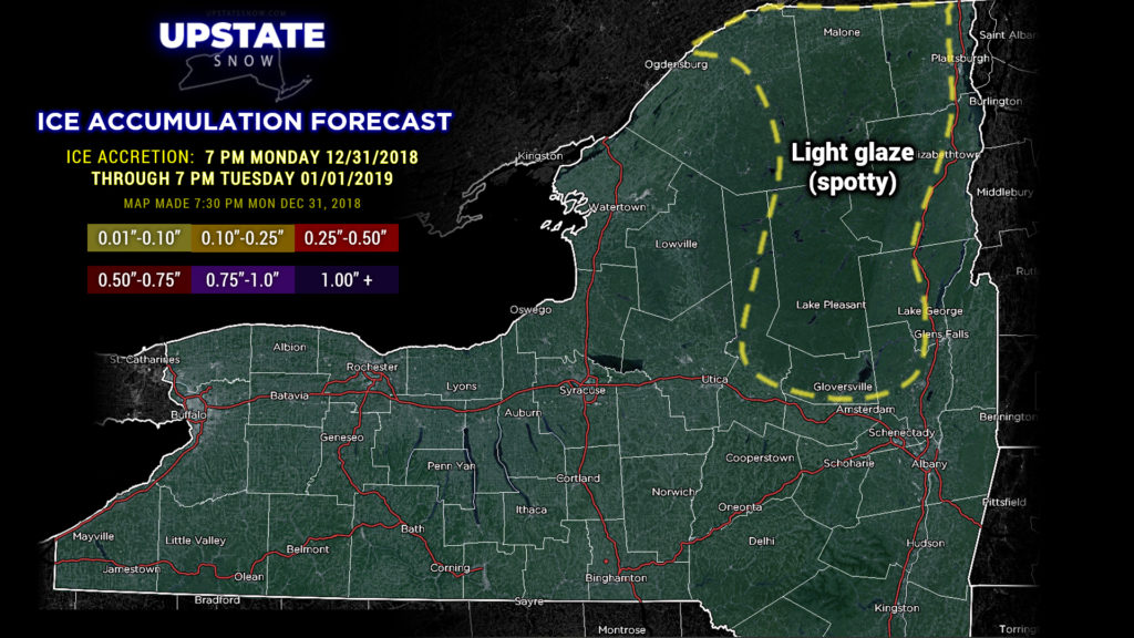
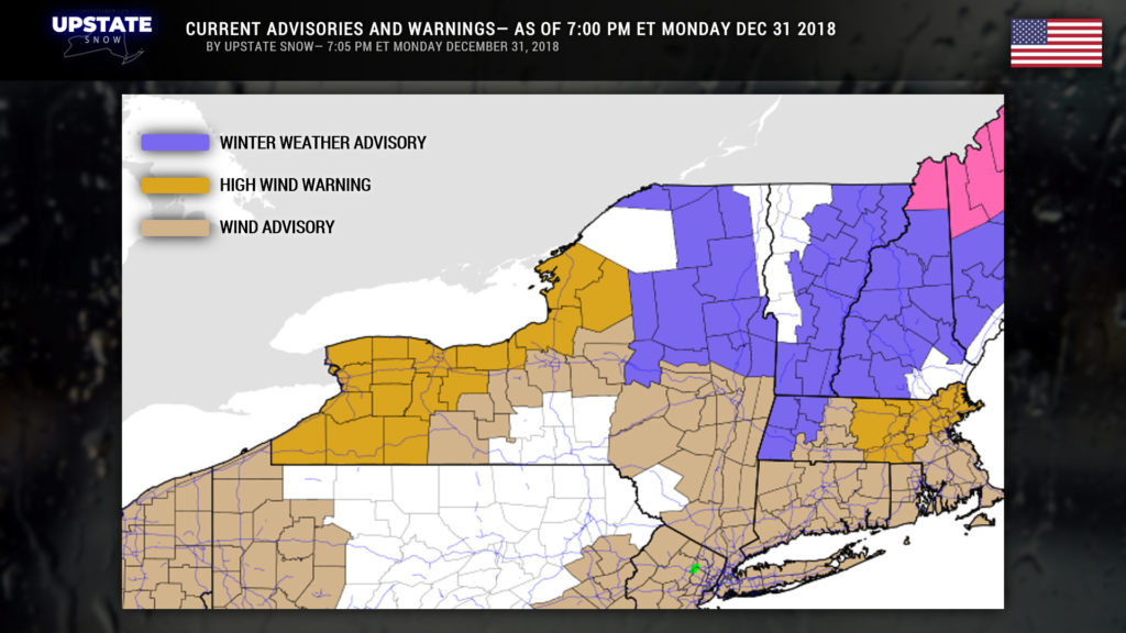
Winter Weather Advisories are up for a large chunk of the North Country through early New Year’s morning. Several inches of snow, especially in the highest elevations, along with a glazing of ice in the mountain valleys, can be expected. Colder air is hanging tough over this area which will allow for some snow and freezing rain, before going to all rain during the morning.
High Wind Warnings have been posted for much of western New York through New Years morning. Sustained winds of 25-35 mph will gust as high as 65 mph at times during the overnight. This will make driving exceptionally difficult during the night, and could also result in power outages and property damage. The highest winds will come during the overnight hours, primarily from Rochester through Batavia, Warsaw, Geneseo, to Cattaraugus, Little Valley, and Jamestown, and along the Lake Erie shoreline.
Wind Advisories are up for the eastern Fingerlakes as well as the Susquehanna region, Catskills, Capital District, and lower Hudson valley. Sustained winds of 20-30 mph with gusts to 50 mph are expected… and the prime time for these winds will be between 3 AM and noon. Difficult driving, some property damage, and scattered power outages are possible.
And then the rain. Our radar shows copious rainfall across the state and this will continue through the evening. We’ll see a fairly rapid tapering off after midnight from west to east as the storm center plows into Michigan and then takes a turn toward and over Lake Ontario. The center of the low will essentially ride the International line toward Maine by time you have breakfast on New Years Day, with just a scattering of rain showers across the state. The first of two cold fronts will also drag through around sunrise, which will allow for some colder air to begin funneling in. A second front will come chugging in closely behind the first, crossing the state during the mid-morning hours, and whatever showers remain should transition to snow.
A weak little boundary will drop across the state Tuesday evening and this will provide the area some snow showers, enhanced a bit by the lakes.
Dry weather is expected on Wednesday, but our flow is zonal and fast. A weak disturbance rolling through southern Canada will brush the upstate Wednesday night with some light snow / snow showers, with temps in the teens Wednesday night.
The zonal flow continues through the end of the week. Models still can’t get on the same page with regards to a potential storm system for the end of the week as well… today they’ve all hit the brakes on the whole thing… and all are trending a bit warmer. With so much uncertainty in our solutions, a safe bet would be to say rain or snow showers Friday and Friday night, transitioning to snow showers Saturday.
That’s it for now.
If you have plans this evening, please be smart, be safe, and we’ll catch you on the flip side. HAPPY NEW YEAR!


