Good evening everyone…
Another warm, dreary day has come to an end. Another one.
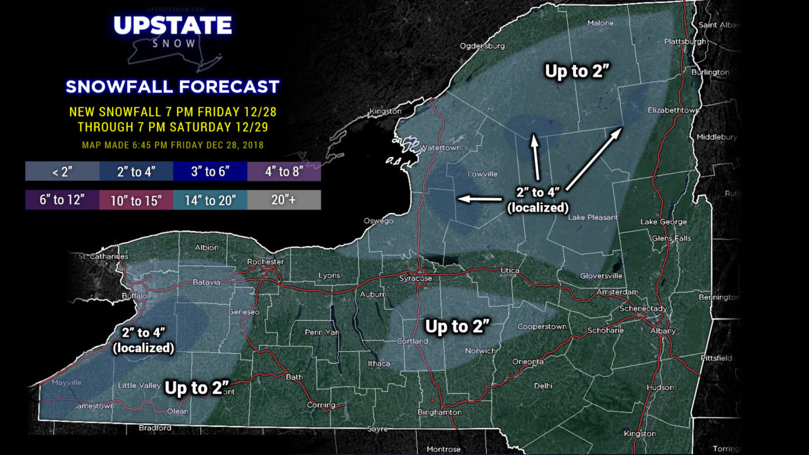
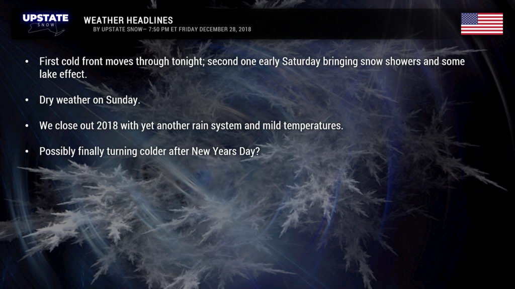
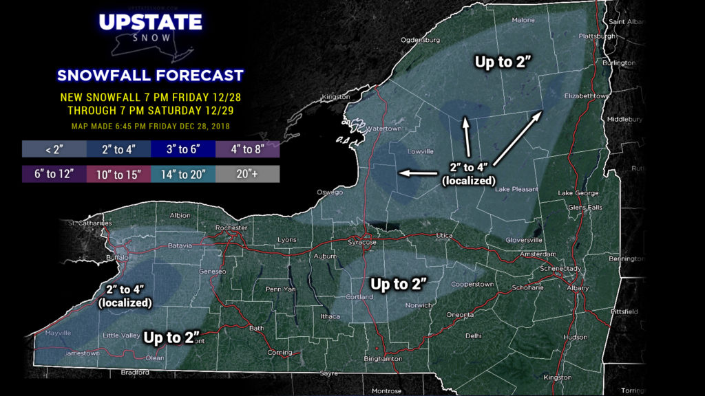
The first of two cold fronts will sweep across the state tonight… with the second one crossing the area from NW to SE during the day Saturday. This will finally change any leftover rain showers over to snow by tomorrow morning, with some snow showers and lake effect hanging around into the early evening hours. Trace amounts to a couple of inches of snow are expected as highlighted on our map.
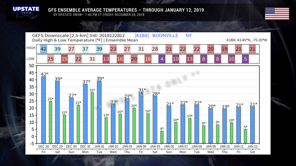
High pressure builds over the state for Sunday bringing quiet weather and I guess relatively seasonable temperatures, just a tad milder than normal. The cooler weather doesn’t last long though as a southwest flow becomes established once again on New Years Eve.
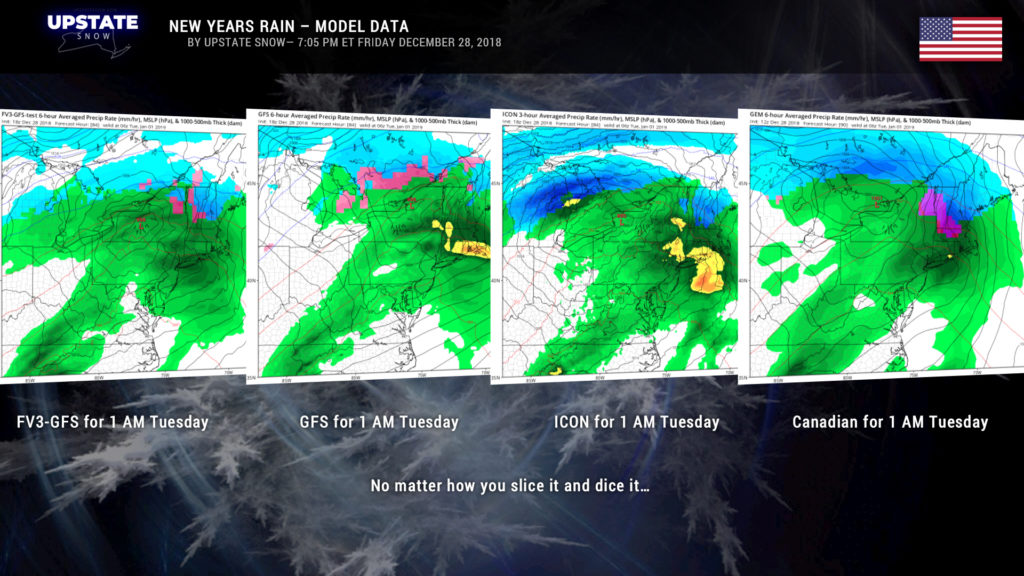
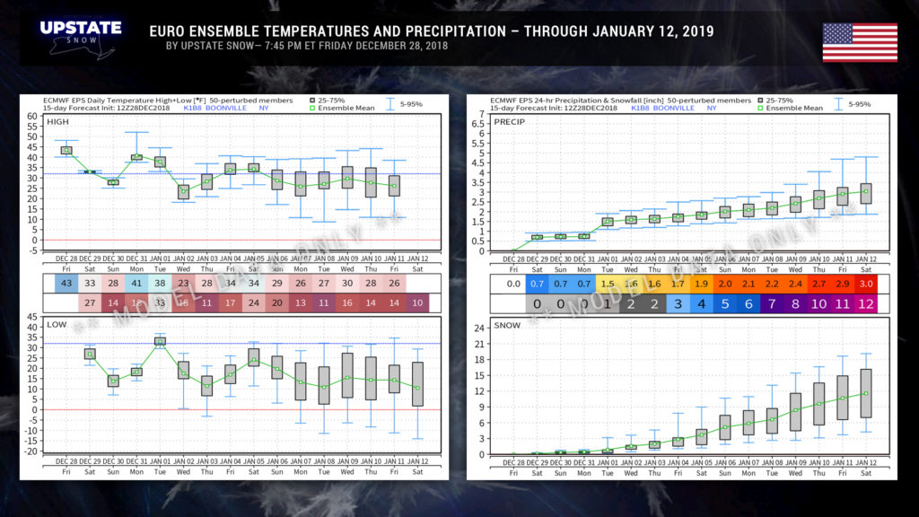
Mid-level high pressure near Bermuda expands and flexes its muscle, while at the same time a deep trough digs over the front range of the Rockies. These combined will create a southwest-to-northeast conduit for our next storm system. Low pressure will spin off of the trough and quickly advance to central Ohio by suppertime on New Years Eve. Modeling is pretty tight on sending this either directly across the Upstate or just north of the International Border through the morning on New Years Day. This will bring a slug of … yep … more rainfall to the region as the ball is dropping to ring in 2019. It’s too early to tell how much rain at this point… an early guess by the GFS model paints another 0.5 inch to 1.5 inches across the Upstate, but I’m not going to put much faith in these numbers until we get on the backside of the weekend.
Either way, it’s going to rain again.
As with our current system, a front will cross the area during the day on New Years, causing temperatures to fall. At this point model ensembles (both Euro and GFS) think the colder air is going to stick around for a while… ??
Seems like we’ve said that before though.
It is what it is folks, but there’s still a LOT of winter to go. Keep positive, have a good night, and thanks for viewing and supporting the site.

