Good evening,
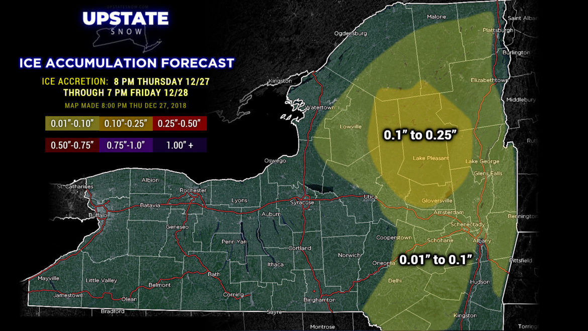
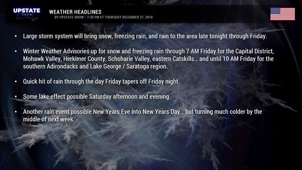
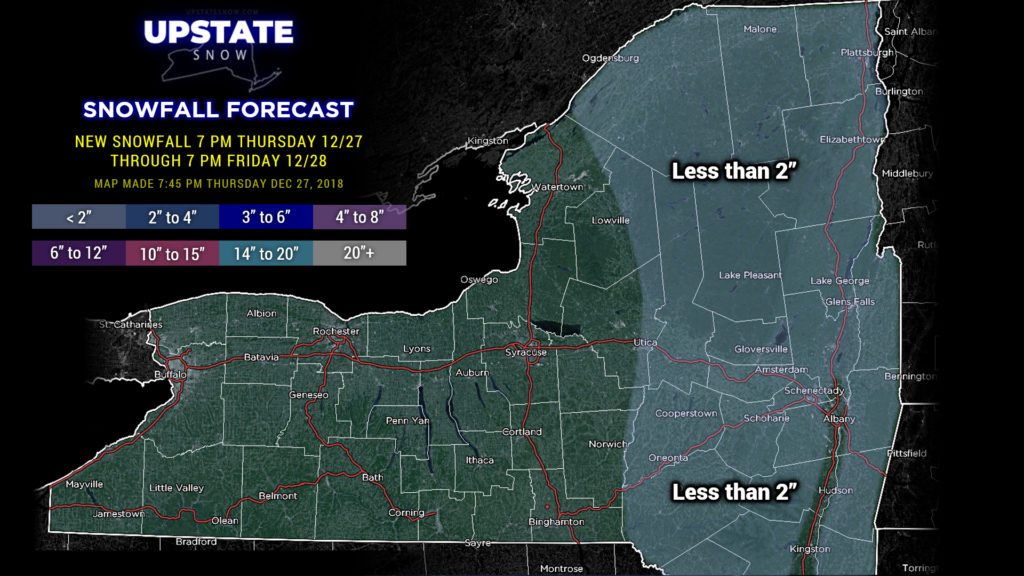
Our next weather system is just about on us now. Look for precipitation to break out from southwest to northeast over the state, beginning within the next few hours for far western NY, crossing the state during the early overnight. Cold air will hang tough across areas of the state east of I-81… which will result in precipitation starting out as a period of snow, quickly transitioning to several hours of freezing rain, and then eventually to rain during the day. Freezing rain should hang on the longest in the southern ADKs and Lake George areas, but even that should transition to all liquid by noon.
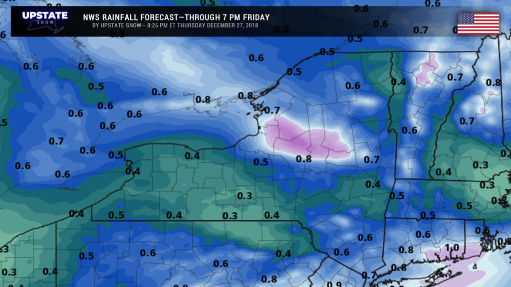
Just as quick as the rain arrives, it will begin to taper off from SW to NE… transitioning to scattered rain showers across WNY in the late morning, and in ENY by mid-afternoon. However, a period of fairly heavy rainfall is expected across areas from the Tug Hill east-southeast through Lewis, Oneida, and southern Herkimer Counties thanks to upsloping. We’ll have a very strong southerly/southwest wind flow at the surface, 5000 feet, and 10,000 feet. This will cause air to rise up the southern-facing slopes, which will “wring out” even more moisture in the form of rain. NWS is going with amounts around an inch in these areas, and I don’t really feel any reason to hate on their forecast. Elsewhere general rainfall amounts between a quarter and half inch can be expected…thanks to the speed this system will move through here.
Some gusty winds expected across western NY and the Tug Hill late tonight and early Friday. I mentioned above about the strong winds just off the deck… and by that I mean roughly 75 mph winds. Downsloping, on the northern slopes, and on the Chautauqua ridge, will bring some of those winds to the surface… probably looking at winds in the 30-45 mph range.
The first of two cold fronts crosses the area late Friday night / pre-dawn Saturday, which will turn our winds west-northwest… and a second, more potent front, moves through during the day Saturday. High-res modeling indicates a period of what could be pretty decent snows for much of western NY, but it will be a quick shot as the whole system continues to chug right along. Still, several inches of snow are possible before things come to an end Sunday.
Later Sunday, a subtropical high pressure ridge… almost a wintertime version of a Bermuda high… will expand over the Atlantic while an equally as impressive trough with an upper level low pressure center becomes established in the Rockies. This creates a southwest-to-northeast “highway” of sorts. S everal “waves” of energy will shoot off of this low and ride the highway… bringing even more warm air into the area… with another rain event becoming likely on New Years Eve into New Years Day.
All hope is not lost though. That trough starts to work its way east by the middle of next week as that subtropical high starts to weaken. Models show that by Wednesday into next Thursday much colder air starts pouring across the state with the POTENTIAL for some significant / heavy lake effect. Fingers crossed.
Have a good one, and as always, thanks for your support.

