Hi everyone….
No major changes in our situation from last evening’s blog post, so this is going to be pretty brief tonight.
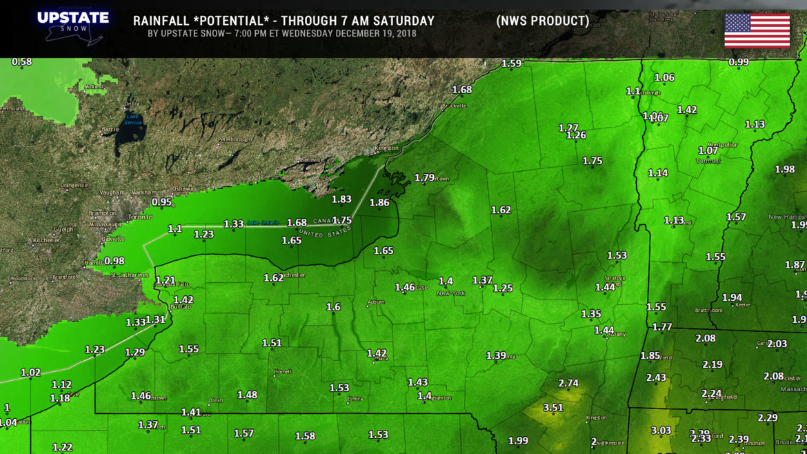
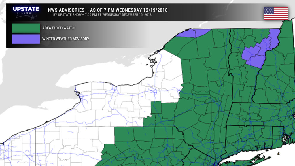
A large portion of the state is under a FLOOD WATCH from late Thursday afternoon into early Saturday. Storm total rainfall of 1-2 inches is likely just about everywhere, with some areas (especially south-facing slopes) seeing 2-3 inches thanks to upsloping.
This map shows POTENTIAL rainfall amounts, and is computer-generated. This is an “early call” and will likely change, but is posted as kind of a benchmark on what we can expect in general.
At this time the flooding threat doesn’t appear to be too widespread. The watches are primarily for flooding of poor-drainage areas, fields, low-lying areas, etc. Some of the main-stem rivers may reach “minor” flood stage.
Rain will develop from south to north late Thursday, with periods of heavy rain Thursday night into Friday. Strong winds at the jet stream level will be right over CNY, but by my eye the model soundings don’t imply that there will be enough instability to bring these strong winds down to the surface. However, the higher elevations of the Cats and ADKs may see some gusty winds at times on Friday.
Temperatures will be in the upper 40s to lower 50s for areas west of a line from Sodus Point south to the PA border, including Buffalo, Rochester, Olean, etc. Upper 50s to around 60 (ugh!) east of this area and south of the Thruway to the VT/MA/CT lines. Generally mid 50s in the ADKs to the Canadian border.
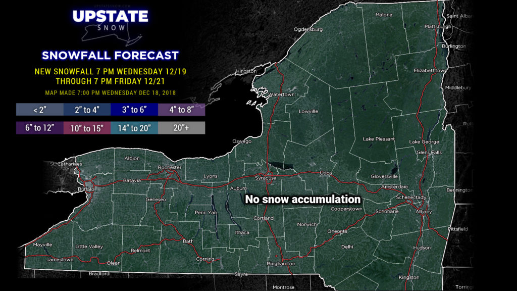
The cold front will push through Friday night / early Saturday and temperatures will fall pretty quickly, and models really are honing in now on a secondary area of low pressure (weaker…don’t get your hopes up) lifting quickly from New Jersey into New England as we go into Saturday. With the colder air wrapping in, precip should transition to snow showers from the overnight hours Friday night/Saturday through Saturday morning. Accumulations will be minor as the ground will be wet and warm.
As all of this mess continues to move north/east and away, continued wraparound moisture riding on a decent west to northwest flow means continued snow showers enhanced by the lakes through Saturday night, and some accumulation is expected across western and central NY, especially in the typical areas off Ontario and Erie. Not an awful lot, but enough to put a fresh coat of white on things.
Temperatures return to where they SHOULD be this time of year by Sunday, and this lasts through Christmas Day. Models imply some weak clipper-like systems zipping across the area — the first one on Sunday night or early Monday, and then the second one on Christmas night. These will bring areas of snow showers with some lake enhancement. Again, not a lot of snow, but at least enough to whiten things up again. We’ll take the small victories.
Have a good night, and thanks for your continued support.

