Good evening,
Well…. Mother Nature must be a baseball fan because she threw us a curve ball. Someone should tell her it’s not baseball season anymore. However, there WAS some uncertainty in the modeling, and I kind of had a feeling last night things were going to change. Well… they did.
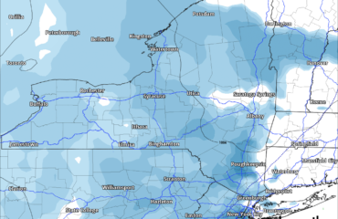
So here’s where we are. A Winter Weather Advisory is posted for a large portion of CNY for Sunday. This is for freezing rain / rain eventually transitioning to snow. This will be LIGHT precipitation. Ice coating… up to about a tenth of an inch, perhaps a bit more in the Catskills, but nothing that will be crippling. Once things transition to snow, perhaps up to an inch in most areas… again maybe a tad bit more in the Catskills.
As we go into Monday, a strong cold front will blast across the state. Snow showers will accompany the front followed by an absolute onslaught of colder air. And, because why not, lets throw in some gusty winds in the wake of the front. So we’re probably looking at a couple of inches of snow Monday afternoon, especially as you get closer to the lakes. Temperatures fall to the mid teens to around 20 just about everywhere Monday night… with some continued snow showers especially east-southeast of Lake Ontario. That will shut off leaving dry weather Tuesday afternoon through Wednesday. It’ll be delightfully cold Tuesday — highs in the 20s and lower 30s — but don’t get too used to that because by Wednesday a warming trend begins again.
By the end of next week, Thursday-Friday-Saturday time frame, ANOTHER significant system will impact the eastern third of the country. Model guidance suggests that low pressure gets organized over the mid-Mississippi Valley and explosively strengthens as it moves along the Appalachians. A really strong southerly flow of warm, moist air would accompany this system. The GFS model parks a 982-mb low over Buffalo by next Friday afternoon… and the European models aren’t too far behind. With such a deep surface cyclone (and an upper low stacked on top of it) moving to our west… we know what that means…
But, this is 6+ days out so we have time to watch it. A lot of factors come into play as far as steering this system, including ridges of high pressure over the Rockies, one over south-central Canada, and one over the central Atlantic.
Ok, that’s all for tonight. Have a great Sunday and thanks for viewing!


