Good evening!
A remarkably complicated forecast for this weekend… and it ain’t great from a snow-lover perspective. Let’s just rip the Band-Aid off and get it done with.
The potential exists that the “southern” Southern Tier picks up a considerable amount of rain while much of the rest of the state picks up very little… but model disagreement throws some doubt into that crock pot. One thing that is nearly certain… temps are going to be quite a bit above normal through the weekend.
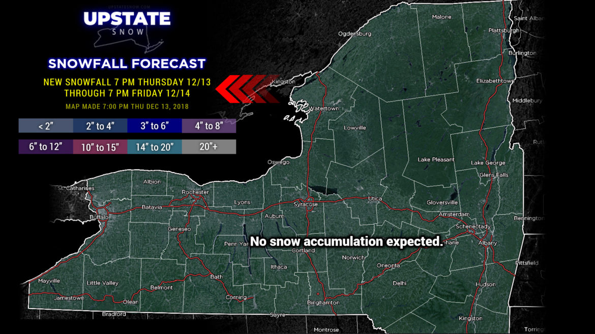
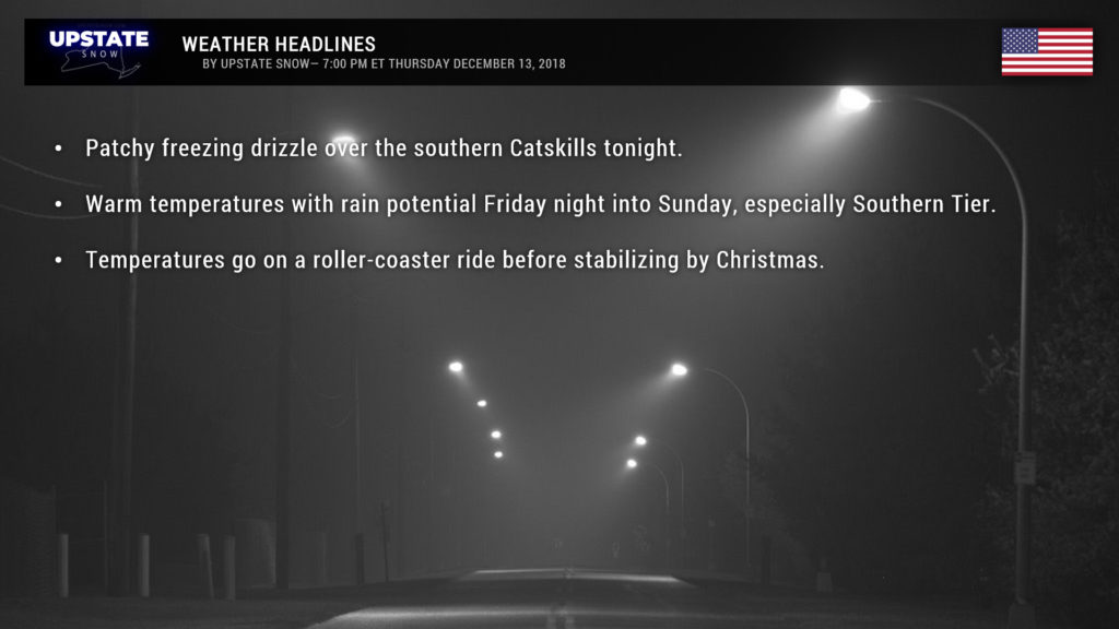
Right now, warmer air is pushing northward toward the Upstate as this report is being written. In the “immediate term,” a moist, easterly flow off the Atlantic will flow over the Catskills, and as this milder air blows over the top of cold air at the surface, precipitation in the form of freezing drizzle will break out. Portions of the Cats may get a glazing of ice, Delaware, Sullivan counties… but even that is questionable.
For Friday, very mild temperatures will be across the entire state, with widespread temps into the 40s (upper 30s in the northern Adirondacks). Modeling suggests that we’ll be dry through the day, with generally cloudy skies. And that’s the end of the easy, straightforward weather forecasting.
An upper-level low will become established over Mississippi by Friday evening. This will really allow the warmer air to rocket up the coast. As we progress through the weekend, this upper low will move northeastward into Tennessee, Virginia, and then off the New Jersey coast by Sunday morning. At the same time, a surface cyclone will also get its act together either just underneath the upper low, or perhaps slightly displaced from it to the north.
A piece of energy will spin off of this stew and fly northeastward, potentially bringing the first shot of rain across the Southern Tier late Friday afternoon into Friday evening. Just how far north the best “forcing” gets will determine how much rain falls from this initial shot. Right now it looks like the best chances for heavier rain, for this part, stays in Pennsylvania, but areas along and south of Route 20 could see a couple tenths of an inch of liquid late Friday afternoon and Friday night.
Business picks up on Saturday. Our upper low, remember, is in the process of lifting northeastward through the Tennessee valley, and TWO areas of surface low pressure will be moving over the mid-Atlantic and southeast. At the same time, an area of high pressure will be centered just north of Montreal. That part is important, because the stronger high will work to keep MOST of the rain pushed off to our south. It’s still going to be unseasonably warm but our area may be spared of heavy rain. That’s a good thing… because as we play our story forward, by Saturday evening THREE separate areas of low pressure will extend from northern Tennessee through West Virginia and the Delmarva… Jack, Janet, and Chrissy. Fans of late 1970s / early 1980s TV will get that reference. Anyway, with the high pressure in place to our north, that information is all entertainment value as the best chances of heavy rain are in Pennsylvania and points south. I’m sure they’re delighted.
Now there are some differences between the GFS and Euro models on the exact positioning of these low centers, and that does have some ramification on how far north the rain makes it. The GFS is showing a bit more rainfall impacting the Upstate, even around a tenth of an inch into the southern Adirondacks… and so I don’t think we’ll see an entirely rain-free weekend… but at this point it’s highly unlikely we’ll see the absolute drenching that our friends to our south will get.
But hey, some colder air starts filtering in Sunday evening… but of course by then most of the interesting stuff is long gone.
Our temperatures take a roller-coaster ride as we go into next week. A sharp, but brief, hit of very cold air will pay us a visit, and with a northwesterly flow there may be some lake effect… the best chances for this come next Tuesday. But after that, a southwest flow returns for Wednesday-Friday next week, shooting our temperatures above normal once again.
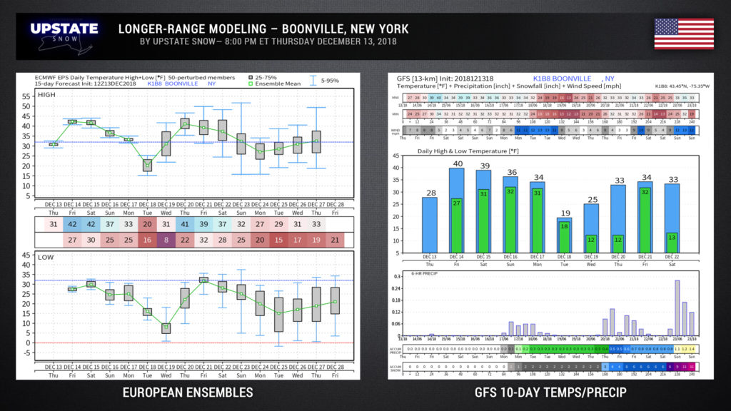
Looking at some longer-range modeling, the 15-day European Ensembles and the 10-day operational GFS for Boonville (the one in New York)… we see that sharp temp drop for Tuesday (GFS says high of 19°F for Boonville on Tuesday)… but a dramatic warm-up by the end of next week. However, as we get closer to Christmas, the modeling is pointing toward “normal” / seasonable temperatures. This is a change over the past few days, and could change again (anything past day 7 is a crap-shoot), so take with a grain of salt. Look at the bottom of the GFS chart, the model expects a fairly significant snowfall NEXT weekend. Again, that’s day number ten, so ……
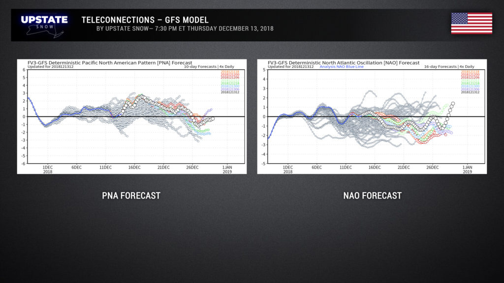
A quick look at the latest PNA and NAO forecast trends, per the FV3-GFS model…
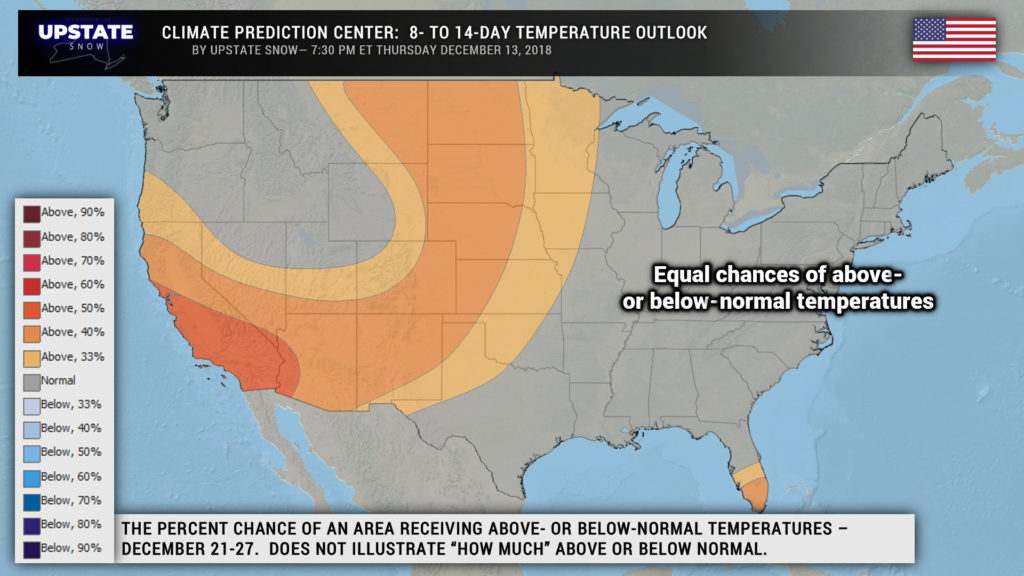
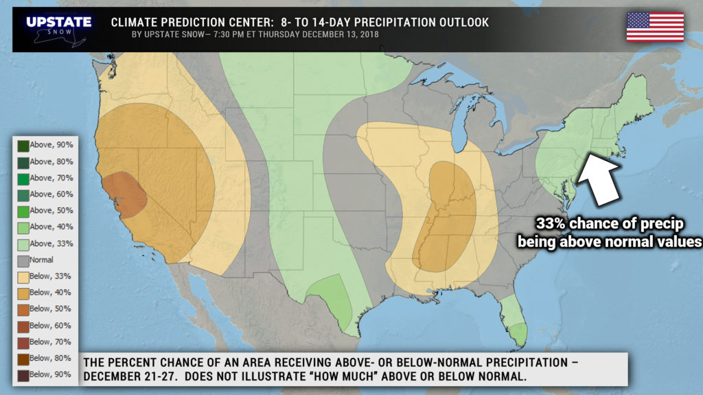
The latest outlooks from the Climate Prediction Center do offer some hope toward Christmastime… showing near normal temperatures, with a slightly higher-than-normal chance of precipitation.
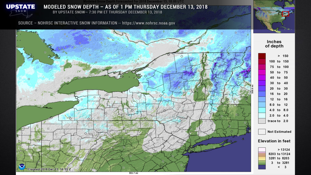
And finally, the latest snow depth map from NOHRSC. There’s a bunch of neat information if you’re interested — go to www.nohrsc.noaa.gov.
Ok, that’s all for tonight folks. Take care, and thanks for your continued support!

