Good evening!
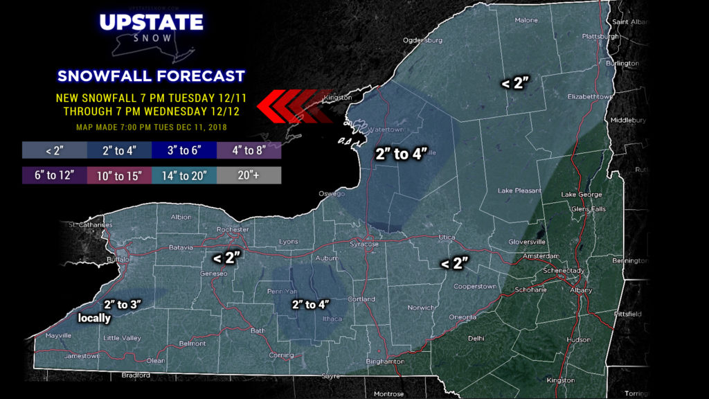
Lots of snow showers scattered about the state but the only thing of any real “intensity” is currently moving eastward across Jefferson and northern Oswego county as of this writing. The high-res modeling showed that pushing farther south across Oswego, then eventually Oneida, Onondaga, and Madison counties before gradually falling apart during the night. In reality this is a bit farther north than our model showed, so I’m extending some “heavier” (relatively speaking) snowfall in that direction. Snow showers are also ongoing across the Southern Tier, particularly from Watkins Glen eastward through Ithaca to Dryden and Cortland, south to the Chemung / Tioga county line, as well as southern Erie county and Chautauqua county off Lake Erie. All of this will drift east/southeast and dissipate during the overnight.
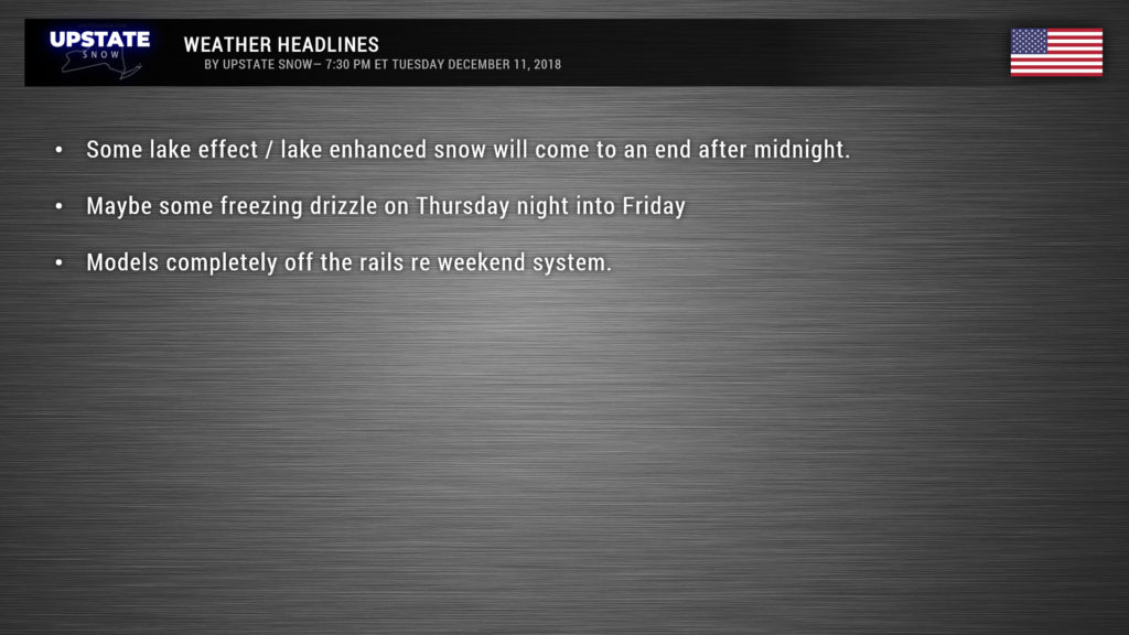
It’s almost bittersweet that we’re getting this… as our weekend storm system is still on track. Warm air in the upper reaches of the atmosphere will start working its way toward the Upstate on Thursday. As this flows up and over cold air at the surface, we could see some freezing drizzle and fog over the Southern Tier Thursday night and early Friday.
Temperatures rocket into the 40s Friday for just about everyone south of the Thruway, with mid to upper 30s in the Adirondacks. Moisture will also be pushing northward.
Where the models were starting to have some semblance of understanding last night, they’ve gone off the rails today. If we believe the Euro solutions, we’ll have some rain late Friday night into Saturday morning, primarily west and south of a line from Corning through Syracuse, Utica, and Queensbury… with the heaviest rain in the Catskills. The rain ends Saturday afternoon as a “cold” front pushes everything off to our east (and a low pressure spawns over the waters south of Maine). The Euro shows that colder air will rapidly push into the North Country, with temperatures tumbling into the 20s.
But the Euro isn’t everyone’s flavor-of-the-day, so we’ll look at the GFS. Initially by early Saturday morning it has a low center over central Tennessee. This moves northeast into West Virginia Saturday afternoon, and sort hangs in place while a second, stronger storm spawns well east-southeast of Cape Cod (much too far away to bring us anything interesting). By time you get up on Sunday morning, the GFS has the original low dissipating of the Delmarva. This solution would bring a period of rain Friday night into early Saturday through much of the Upstate, with precipitation ending Sunday.
Oh lets include the Canadian, because that model believes everyone else is out to lunch. The Canadian keeps the low center even farther south than the Euro, and perhaps some rain showers Saturday but otherwise not a very exciting model run.
And of course, this is 4-5 days out, so the entire thing will probably get flipped on its head tomorrow. At minimum… putting our various models into a blender and turning it on “high” to see the results, I think we can expect very mild air to push northward into the Upstate on Friday, lasting through Saturday. I think we can expect rain to fall for most areas south of the Thruway, particularly the Catskills. Outside of that, not really able to make a firm call based on the current modeling.
As we head into next week, days 6 and 7, a rather vigorous upper low dives across the state by next Monday… this would lead to fairly decent coverage of snow showers, lake effect, and a return to colder air.
After Friday, forecaster “confidence” drops rather precipitously. Even “averaging out” all the models makes it hard to pinpoint where everything will set up, so… stay tuned!
Thanks for viewing!


