Hi snow lovers!
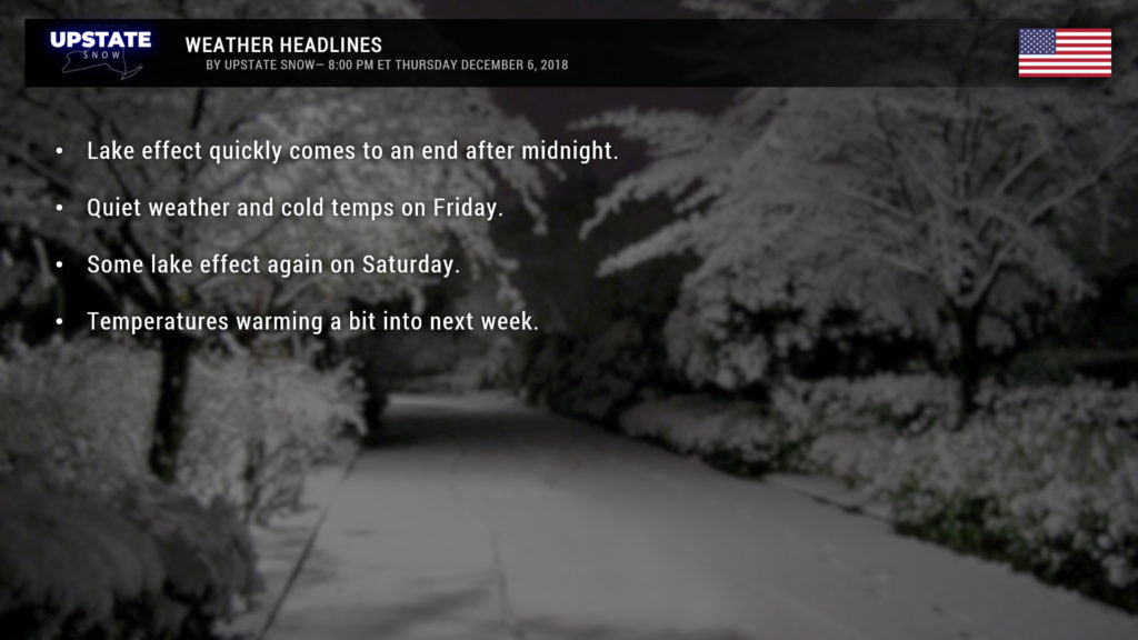
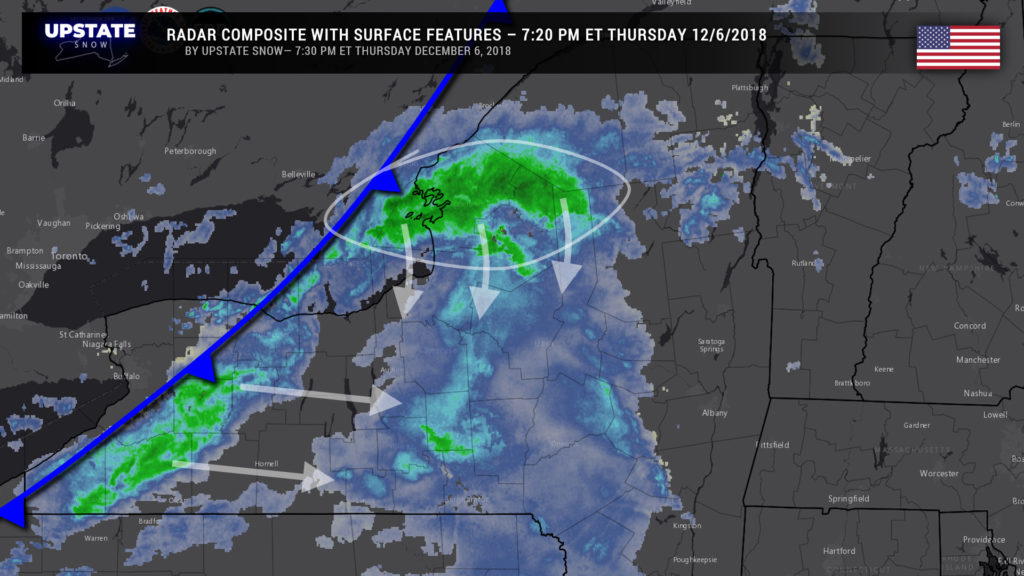
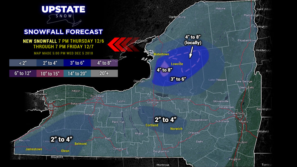
Enjoy it while it’s happening because it’s all done by about midnight or so. A cold front is in the process of sweeping across the state as this report is being typed (about 7:25 PM Thursday). As this front moves west to east, it will pretty much end the snows east of Lake Erie. The heavy snow bands ongoing east/northeast of Lake Ontario will drop southward… with some thunder and lightning possible… accumulate several more inches, but then come to an end around or shortly after midnight. Elsewhere, scattered snow showers may drop a couple of inches across the central Southern Tier, Susquehanna Region, and Catskills.
We stay in a west-northwest wind flow through Friday and Saturday. Friday won’t have much, if any, in the way of snow shower activity because of a very dry atmosphere. More moisture becomes available Saturday as a little disturbance in the upper levels kind of flits across the Upstate. This will bring some light snow and lake effect for some areas Saturday. Outside of that, nada.
Looking forward into next week, things are looking actually unseasonably quiet. We’re coming into what would be the “peak” of lake effect season, but next week will feature little activity at all. A huge storm system will pound North Carolina with unprecedented snows and then move off the coast, but high pressure over us will keep that system well away unfortunately.
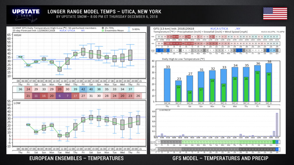
Now… looking at ensemble forecasts… we tried this last night but, hey, mistakes happen. Oops. Shouldn’t have let that go through. Anyway…. looking at European model ensembles (the European model is run 50 times, each time “tweaking” one or more variables), we see our average temperatures for Utica (NEW YORK) dip quite cold early next week, but then warming quite a bit as we move through the 14th through the 20th. Of course, the farther out in time we go, the wider the model spread, so anything after 7 or 8 days we sort of take with a grain of salt.
The GFS model tends to agree with this assessment toward the middle and end of next week. Notice on the bottom, the very bottom… yeah… that’s now much snow the model thinks we’re going to get. Ugh.
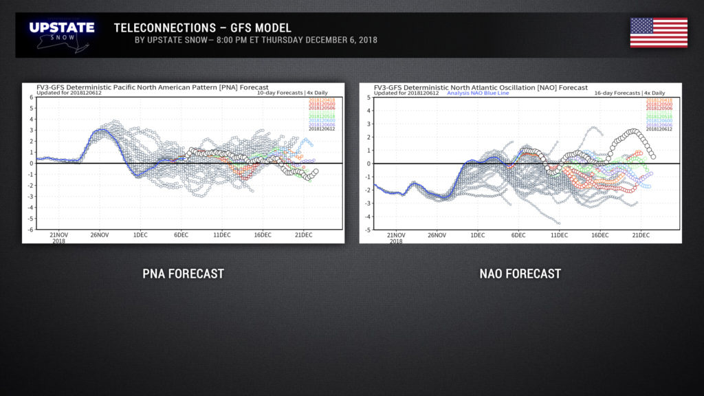
And finally the latest GFS NAO and PNA forecasts. Remember, for cold and snow we want a POSITIVE PNA, and a NEGATIVE NAO. Well……. hm. But look at the very end with the trends…. the script could flip by Christmas.
Alrighty then, that’s all for tonight. Take care, and thanks for your support.


