Good evening!
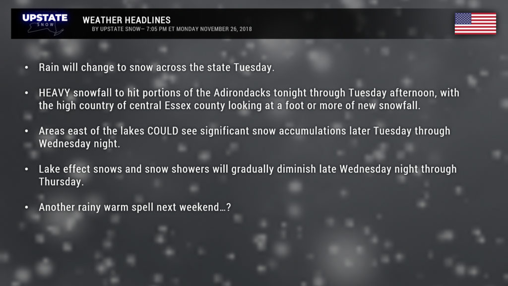
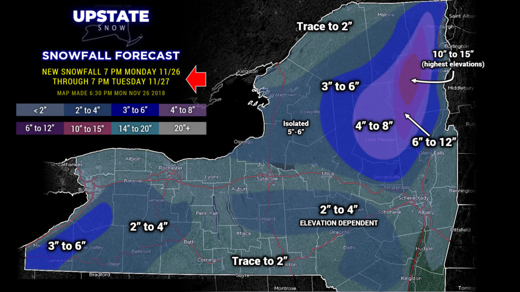
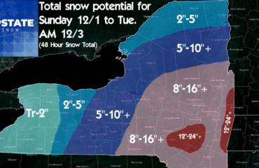
While it’s raining pretty good right now across most of the Upstate, this rain will gradually mix with and change to snow late tonight or Tuesday for the Upstate. It’s already snowing in the Adirondacks, and it’s going to stay in the form of snow, and quite a bit of it is going to accumulate through tomorrow evening…. especially for portions of Warren, Essex, and Clinton counties where well over a foot will accumulate in the higher elevations. This snow will fall tonight through Tuesday, and is related to our original storm system, the details about which you can read in last evening’s blog… no sense in rehashing this here as there’s not really much change in the overall “big picture.”
In determining snowfall totals >>>through 7 PM TUESDAY EVENING<<< (we can’t emphasize this enough–our snow maps cover 24 hours, usually 7 PM to 7 PM; we know others are posting 2-day maps, but we’re not doing that here). Anyway, in determining snowfall totals, we’re going with a blend of three models, the two globals and one of the high-res. All put a crosshairs on central Essex county through 7 PM Tuesday, with lesser… but still significant… snows in Warren and Clinton counties, as well as some decent snows in northern Herkimer County.
That’s just the warm-up act. As our closed low wanders eastward along the International Boundary and our surface system(s) pull off into New England, our flow eventually becomes well-aligned for an elevation-dependent lake effect “storm” later Tuesday through Wednesday night.
Right now it looks like the biggest winner will be south of Buffalo and the higher terrain east of Lake Erie… where over a foot of new snow accumulation looks likely in many areas from Tuesday evening into Wednesday evening. The moisture is plentiful, with cold air blowing over the open waters in a due-west to ever-so-slightly south-of-west flow. It should be mentioned that it’s not going to be snowing all of the time everywhere; there will be periods of light snow or flurries followed by intense snowfall rates. As well, accumulations could vary considerably, with over a foot of snow in the higher terrain, as mentioned, but much lesser amounts in lower elevations, as well as along the lake shore, the Thruway and into Buffalo proper.
There’s a little less confidence, oddly enough, east of Lake Ontario. All the ingredients will be in place, but the magic doesn’t appear to happen, at least according to the modeling, until early on Wednesday. However, once it does get going, the Tug Hill and western Adirondacks could see some pretty impressive snow totals as well. Again, this will be elevation dependent, and when you get into the valleys, you’re not going to see an awful lot of accumulations.
And, of course, with lake effect bands, 10-20 miles could mean the difference between a foot and an inch.
Again… we’re NOT going to draw a multi-day snow map at this point. Why? This is a very difficult forecast with a fairly high bust potential in some areas.
At any rate, the brunt of this event will be felt late Tuesday night through Wednesday… with lake effect snow continuing into Wednesday night, but tapering to just some scattered snow showers on Thursday.
FRIDAY THROUGH THE WEEKEND: Marginally cold temperatures and some “disturbances” in our atmosphere moving across the area on Friday could produce some rain or snow showers, depending on where you are. Nothing of significance.
Model uncertainty abounds as we go later Saturday through Sunday. What is fairly certain is that a large storm system will impact the midwest and Great Lakes, with abundant warm Gulf moisture pumping northward. The European brings a center of low pressure from western Missouri Saturday morning northward through Iowa into southern Minnesota by Saturday evening, and then pretty much spinning in place through Sunday. Deep southerly flow of moist air would filter into the Upstate late Saturday and especially on Sunday, with a period of rain during that timeframe as well.
The GFS model spins up the low over northern Oklahoma late Friday, lifts it into central Missouri early Saturday, to just south of Chicago Saturday evening, to over western Lake Ontario by early Sunday morning… and into the Canadian Maritimes after that. This model brings a period of possibly heavy rainfall to the state, along with a warm, moist, deep southerly flow.
There’s time for this to be fine-tuned, of course, we’re looking at several days out, and an eastward jog in the storm track is probable… but at this time all signs point to rainy conditions once again Saturday night through Sunday…
Ok that’s it for tonight, have a great evening, be safe if you have to travel tomorrow, and thanks for your support!


