Good evening!
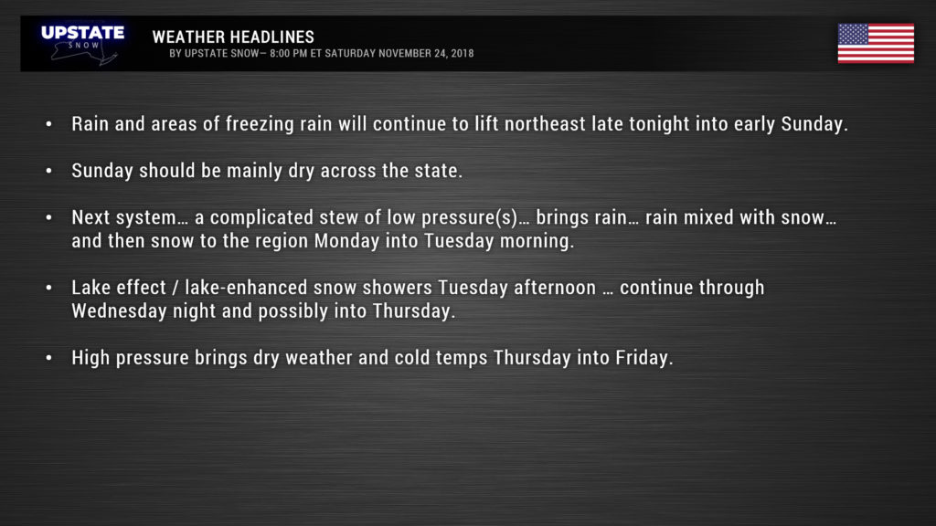
As this report is being written, an area of mainly light to occasionally moderate rain extended from the Canadian border through the Catskills and Susquehanna Region. This is continuing to move to the northeast, and will continue to do so through tonight.
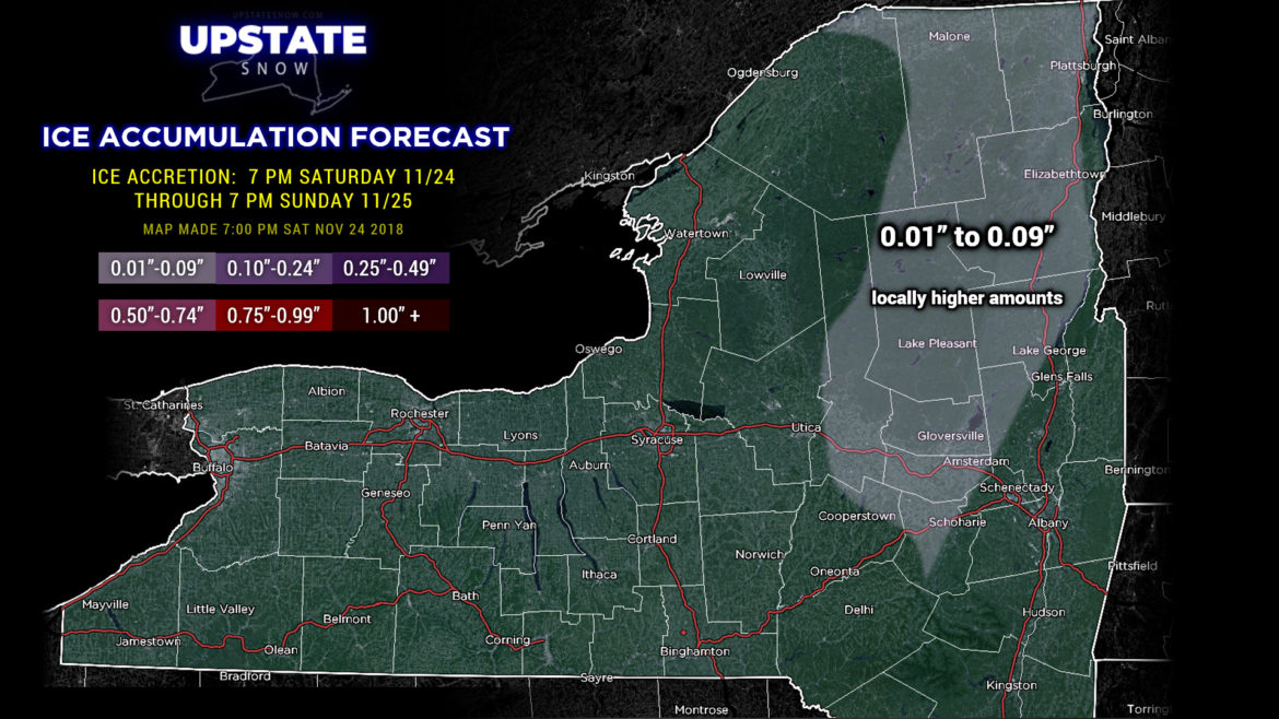
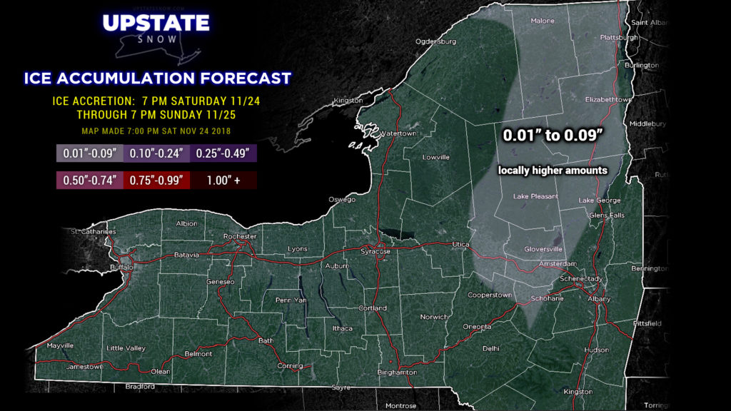
Winter Weather Advisories are up for portions of the Adirondacks as colder air still exists at the surface, being stubborn to scour out. Thus, freezing rain will be the result, with amounts up to a tenth of an inch for most areas … and perhaps a little bit more in some isolated areas. The warm air will win the battle though, and as the precipitation continues to pull off to the north and east, it will end as just light rain.
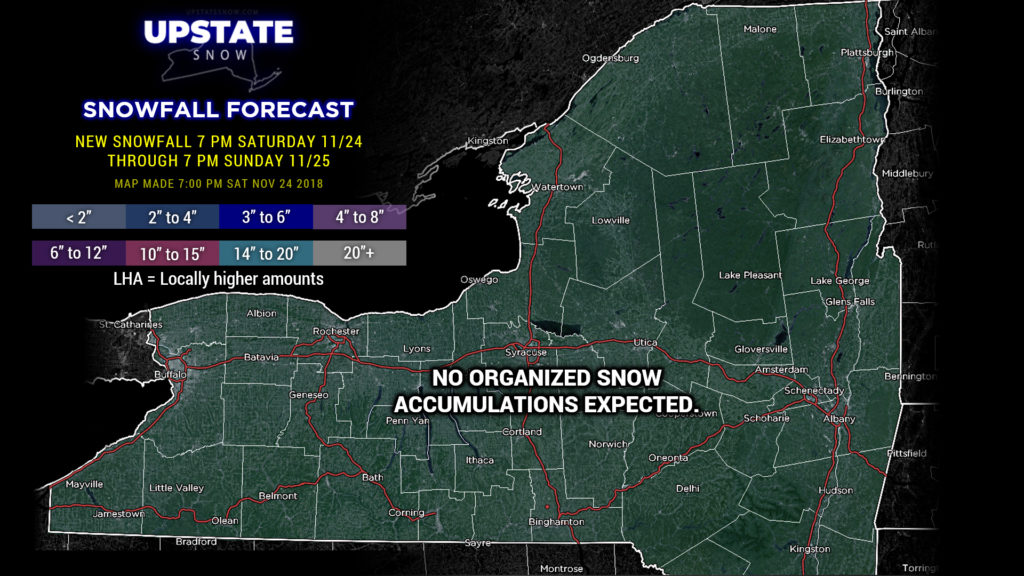
Low pressure moving northeast along the coast is responsible for our precip today through tonight. This will turn east and move well out to sea, taking the precipitation with it… leaving the upstate dry for Sunday.
Sunday will feature mainly dry conditions across the Upstate with temps in the 30s and 40s.
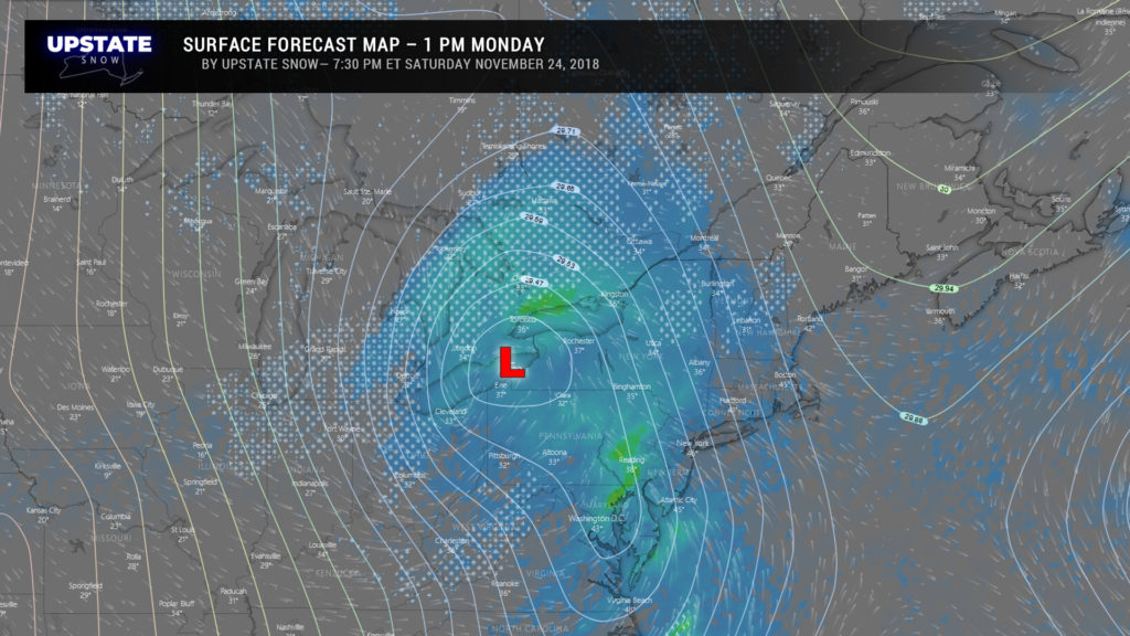
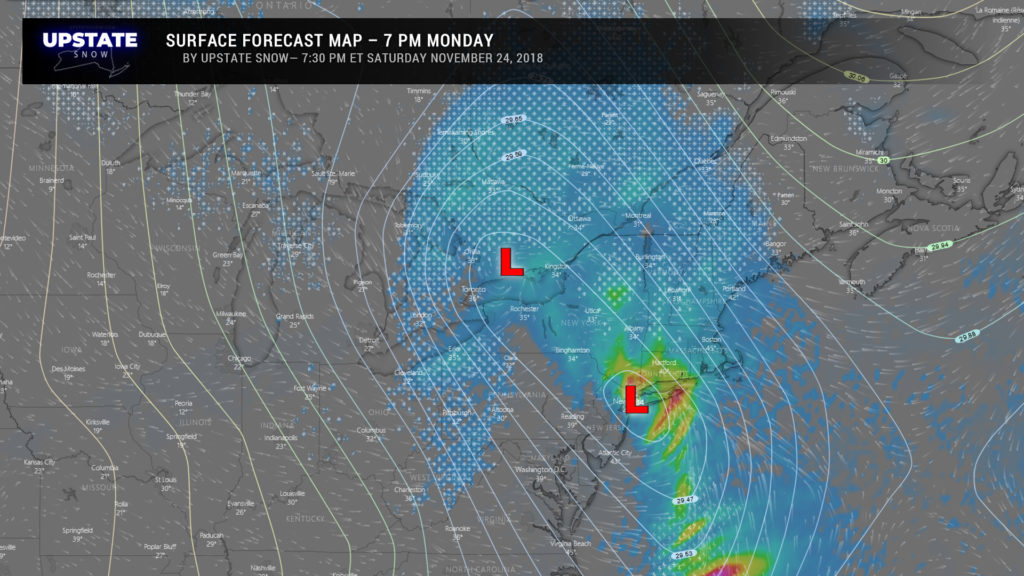
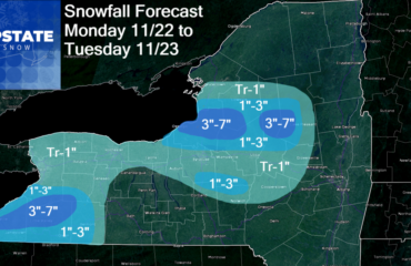
All eyes turn to our next system which will arrive by Monday. This is not a fun forecast, and there’s a pretty high “bust” potential Monday, especially Monday afternoon into the evening. The “big picture” — a southeasterly flow off the Atlantic pumps in plenty of moisture, which means rain returns to the area. Models take a center of low pressure from Lake Erie late Monday morning into central Ontario by Monday evening… while spawning a second area of low pressure either over NYC (Euro) or just south of that (GFS). Now here’s where things get confusing. If the coastal storm becomes the primary, which is usually the case, we’d see a fair bit of precipitation in here Monday into Tuesday. If the original storm remains the primary, lifting toward the border of Ontario and Quebec, the coastal storm would remain somewhat weak… but would still eventually become the dominant player as it moves south of Maine.
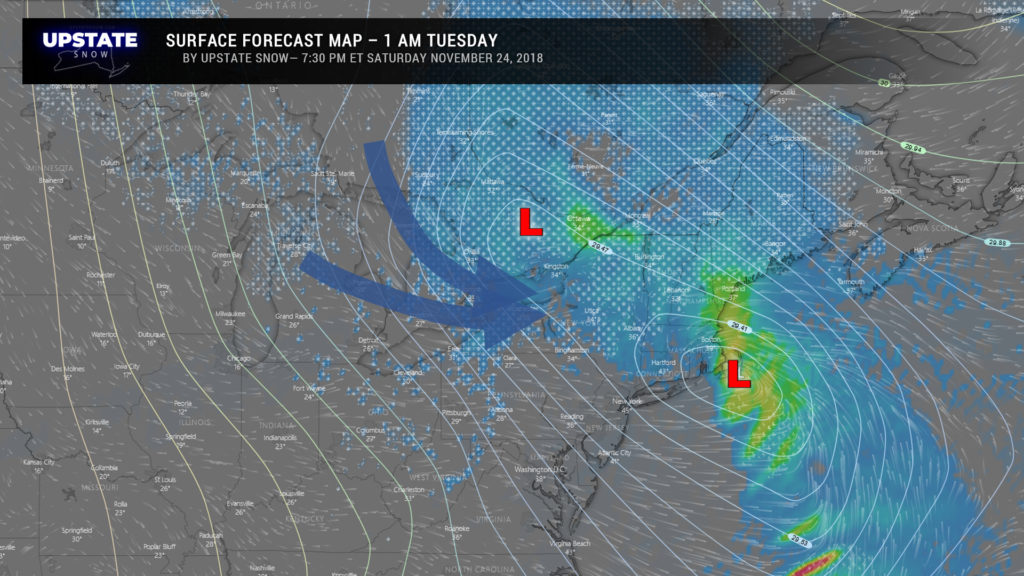
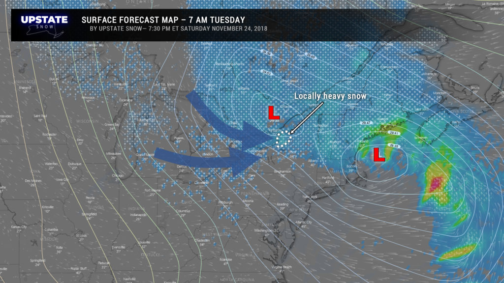
The European model has historically been the best player in the winter ballgame. Year after year. We don’t see any reason to buck the trend now, but the other models, including the GFS, are noted. The maps here are surface forecasts as demonstrated by the European model.
Early Monday afternoon, the low over Lake Erie is still the primary low. That SE flow off the ocean means a general LIGHT rain to most of the Upstate, but the model does show some snow over the Adirondacks. Meh, ok, if you say so.
By Monday evening, the Euro spawns the low virtually over NYC, and again, takes most of the energy from our initial system and slings it to the coast. The model still shows rain over much of the Upstate with snow in the Adirondacks and extreme SW NY. Again… ok… but temperatures are going to be right on the margin. A degree or two drop would mean a changeover to wet snow just about everywhere. I hate it when we’re dealing with things that close, where such a slim temp difference could mean the difference between a rain event and accumulating snow.
ANYWAY….
During the overnight, the coastal low winds up like a top and spins off Cape Cod, while the original system meanders aimlessly along the Ontario/Quebec border. A strong upper low to our north shoves cold west/northwest winds across the state, and by this time most of us, if not all of us, will be seeing precip in the form of snow. By this point, though, it’ll be more snow showers / lake effect / lake enhancement.
By time we wake up Tuesday morning, the coastal low is in the Gulf of Maine, or original system is still searching for a purpose over the Ontario/Quebec border, and it’s snowing for a good portion of the North Country. Again, this is lake effect, upslope-enhanced snow shower activity, even though the model shows some fairly heavy snows just east of Lake Ontario.
This is essentially placing all our cards down on the European model being our star quarterback once again… and if Euro throws an interception (that being a one- or two-degree change in temperature Monday afternoon and Monday evening)… this forecast becomes an absolute train wreck.
Once we get through the Monday/Tuesday timeframe, a big “closed low” will be moving quite slowly over the northeast US. A closed low is essentially one that is “stacked” — lows at each level from the surface through the upper levels. Because it’s “closed,” you don’t get much forcing or organized areas of heavy precip with it, but you will get cloudy conditions and, in our case, lots of snow showers ongoing through Wednesday and into Thursday. This will give way to high pressure settling in Thursday PM into Friday with dry… but cold… weather to close out the month of November.
Have a great evening, and thanks for viewing and supporting the site!

