Good evening…
Well that was some kind of cold front that blasted through today. Numerous snow squall warnings, whiteouts, treacherous travel, etc., etc.
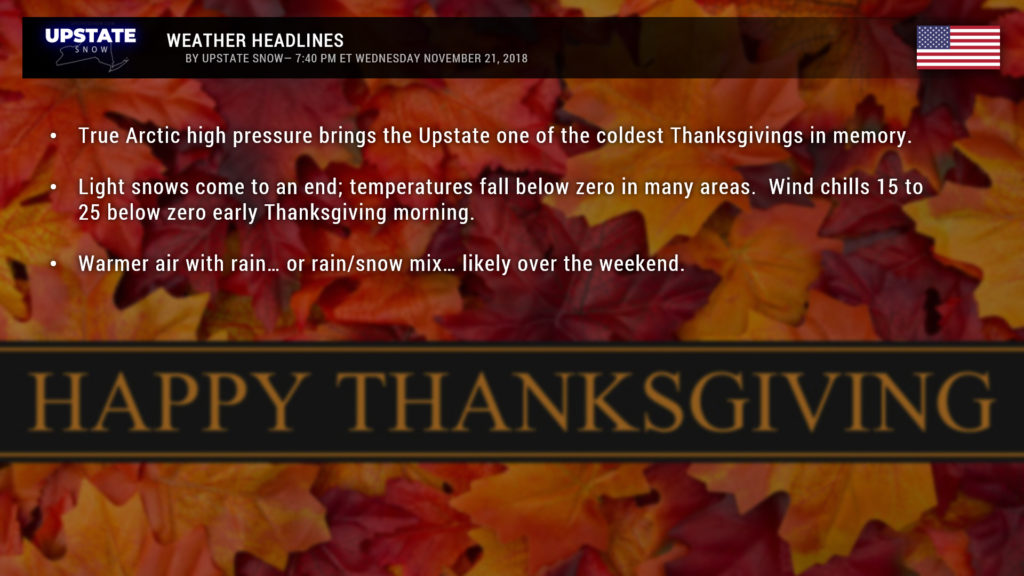
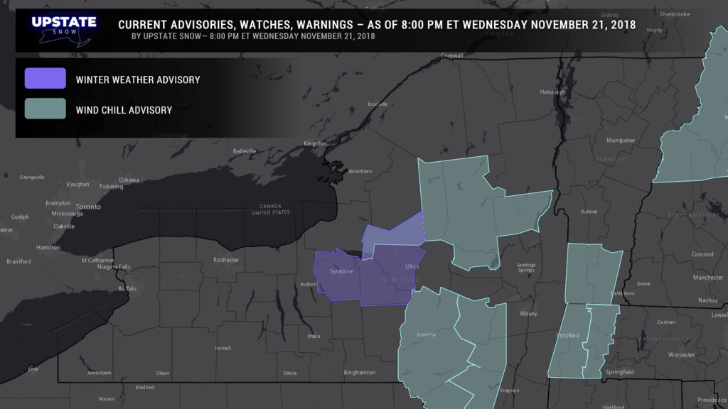
Now the COLD sets in. I can’t remember ever seeing Wind Chill Advisories being posted in November. But we have them. Portions of the Adirondacks and the Catskills will see wind chills 15 to 25 below zero early Thanksgiving morning. Actual low temperatures will be around zero for many areas… 5 to 10 below zero for the Adirondacks and portions of the Catskills. Records are going to be absolutely smashed tomorrow morning and again on Black Friday… and we’re definitely looking at record-low high temperatures for Thanksgiving day.
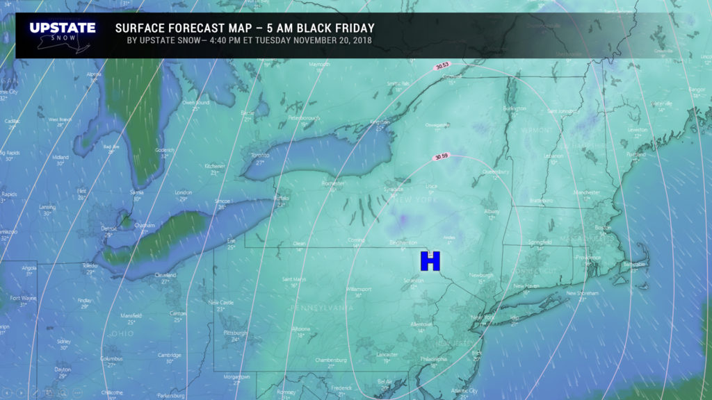
A large dome of Arctic high pressure will move from central Ontario by tomorrow morning to central New York by Thanksgiving evening… to a position over the Catskills by time folks head out for the Black Friday early sales. Temperatures crash … by time you get up for breakfast tomorrow, look for temps below zero in the Adirondacks and portions of the Catskills… with highs ranging from the single digits in the North Country to the teens in the Susquehanna Region, western Catskills, to maaaayyyyybe the lower 20s in the bigger cities.
As the high settles down over the NY/PA border southwest of Binghamton during the pre-dawn hours on Black Friday, we’ll see temps actually start to bump up a bit across far western NY — lower 20s in Buffalo and Rochester… while readings a few degrees either size of zero can be expected in the Catskills. It’ll actually be a touch milder in the Adirondacks as well. At least the winds will die down so no wind chill flags are expected for early Friday morning.
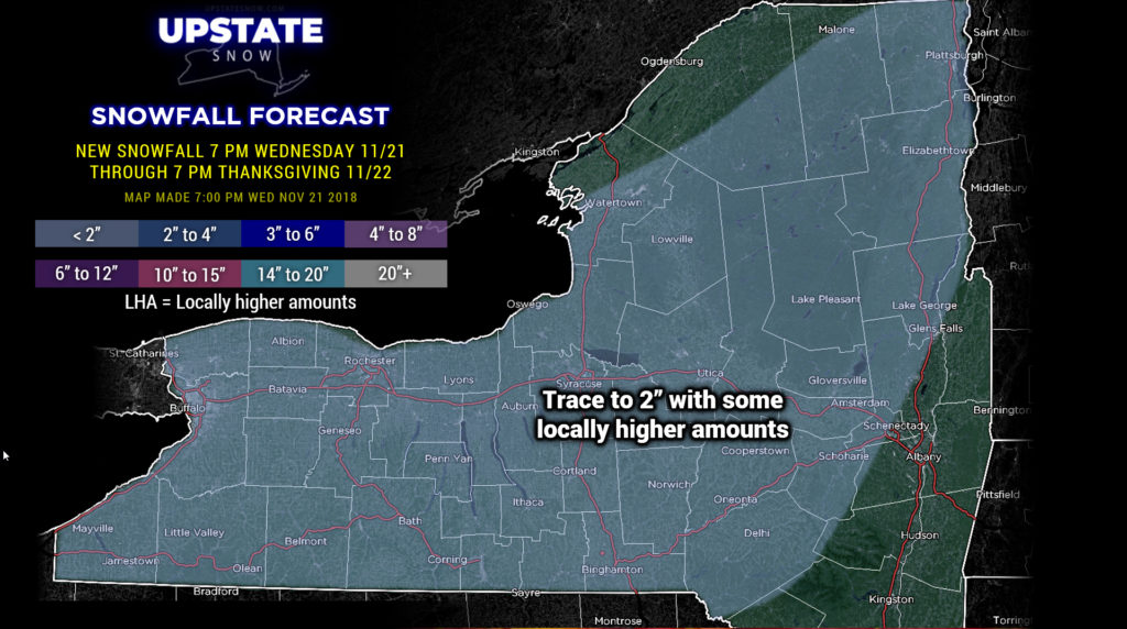
We still have some snow showers and thin bands of lake effect across the state. This will tend to die down this evening and early overnight. We’ve painted a fairly large swath of “trace to 2 inches” on our snow map… no, not everyone is going to see this, but it was better to just kind of “broadbrush” the map instead of trying to get cute with each individual band.
Then… just as quickly as the bitter cold comes in… it will exit. Models show that high pushing well offshore by early Saturday morning, with temperatures jumping on a fairly strong southerly flow ahead of the next weather system. Looking at temps going into the 40s for many areas south of the Thruway on Saturday, with rain pushing in from southwest to northeast. This rain may start off as a period of mixed precipitation, especially in the deeper valleys as cold air stays relatively “trapped” at the surface, but eventually that scours out.
Modeling suggests two storm systems will impact the Upstate this weekend and into next week. The first one will bring rain south of the Thruway later Saturday into Sunday from southwest to northeast, with probably a mix of rain and snow to the north… this is an area of low pressure will move off the mid-Atlantic coast. The second one will move from the northern Ohio Valley north-northeast up the St. Lawrence valley by Monday night. This will bring in colder air… we initially start out with rain and snow showers but should transition back into the colder air regime and snow showers late Monday into Tuesday. From there we resume a west/northwest flow of colder air across the upstate with lake effect snows returning once again.
The warmup we experience this weekend, while somewhat dramatic when compared to what we’re going to experience for Thanksgiving, shouldn’t be too devastating to our snow cover, especially up north. At this point it doesn’t look like we’re going to see widespread heavy rainfall over the weekend… but several hours of rain look fairly certain late Saturday through Saturday night south of the Thruway, with again, rain/snow mix into the Adirondacks.
From all of us at Upstate Snow, we wish you a very happy and joyous Thanksgiving. Thank YOU for supporting our site and making it what it is today. Without you supporting us and our sponsors, we wouldn’t be here.


