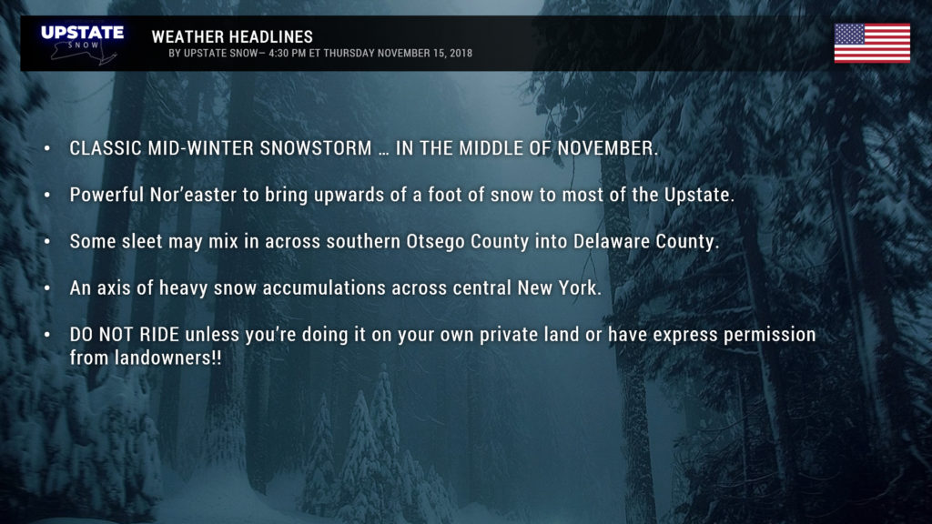
Good afternoon snow lovers! We are now ALL IN on a CLASSIC mid-winter snowstorm for New York… in mid-November!
Winter Storm Warnings are up for just about ALL of New York, except the far western/northern sections.
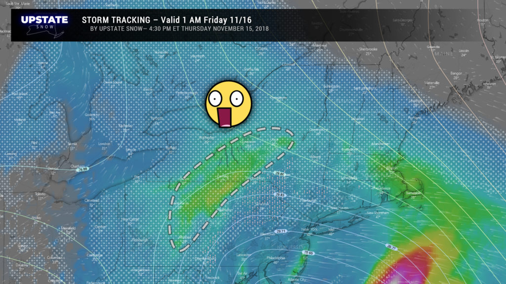
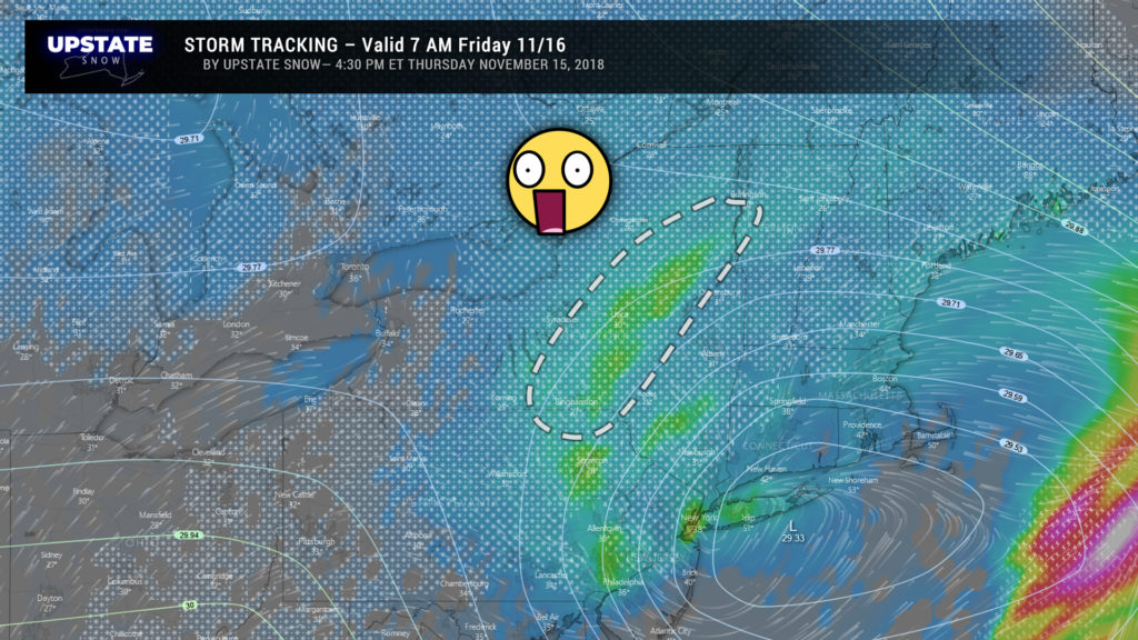
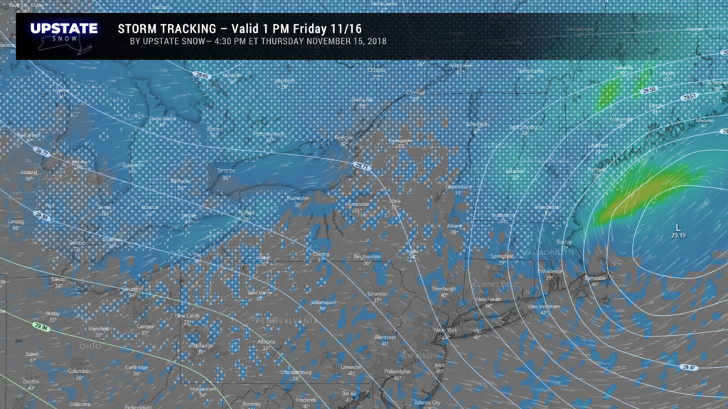
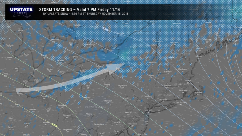
A very strong, deep area of low pressure will move northeast from just off the Jersey coast during the overnight tonight to the Atlantic waters south of Maine by Friday afternoon. Snow has overspread much of the Southern Tier as of this report being written (5:05 PM). This will become steadier and heavier throughout the evening and overnight hours. The height of the storm will come between roughly 1 AM and 10 AM Friday with impressive hourly snowfall rates.
Ok so as we see, an impressive band of VERY heavy snowfall is expected to set up across central New York. This is called a “deformation zone,” and where this sets up, look for snowfall rates possibly up to 2 or more inches per hour… and this is where we have our heaviest snow totals. SOME MIXING is shown on our maps during the overnight as a warm nose tries to push into the Catskills. This is up to some debate but could cut down on snow totals particularly in portions of Delaware and maybe southern Otsego County. We’re doubtful on this though, as profiles indicate cold air winning the battle thanks to troughing to our northwest.
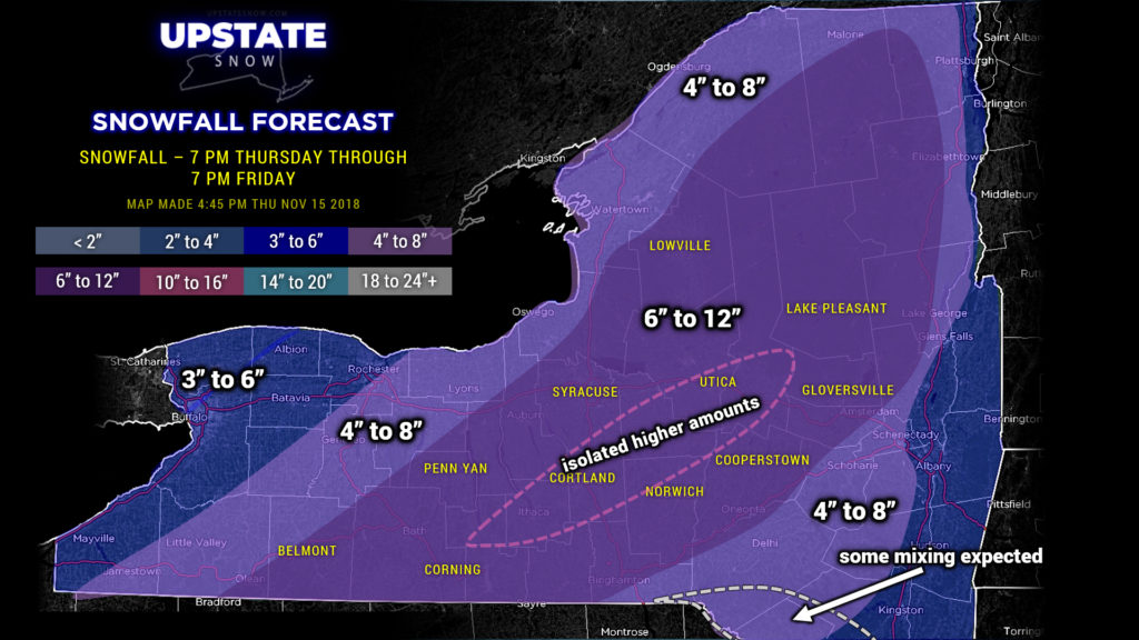
Remember yesterday’s post where we said the snow map was subject to change? Well… it sure has changed! Today alone it has been drawn and redrawn three separate times. Here is our final call for this system:
We’re all in on this. A large portion of the state looks to see between 6 and 12 inches of snow. We’ve highlighted the area MOST LIKELY to be impacted by the deformation zone. This could waver though… if the storm tracks just a bit farther south/east, this deformation zone (and the rest of the snow totals) will shift in-kind. If the storm tracks closer to us or perhaps staying over land, well, this forecast goes down the tubes… the heaviest snow totals go much farther west, with much less amounts east of I-81 caused by warmer air pumping in. The chance of this happening is very low, but not zero. We have a fairly high confidence in these totals.
As was pointed out the other day on the Facebook page, DO NOT RIDE, as tempting as it may be. ONLY ride if you’re doing it on your own private land or that owned by a very good friend or relative. For now just enjoy this somewhat unusual mid-November snowstorm.
Lake effect snow (and possibly some rain) showers will take over behind the system late Friday night through the day Saturday with some additional accumulations expected… we’ll worry about those details for tomorrow’s report.
BE SAFE if you have to travel tonight. Conditions are deteriorating and will only continue to do so. Don’t travel overnight if you don’t have to.
Enjoy!


