Confidence is increasing in a widespread winter weather event for the Upstate Thursday night through Friday. This afternoon’s post focuses EXCLUSIVELY on that event. NWS has started to hoist winter storm watches and winter weather advisories.
Models have come into pretty good agreement in bringing low pressure up the eastern seaboard. But the devil is in the details. Let’s break it down by Euro and GFS.
EUROPEAN MODEL INFORMATION
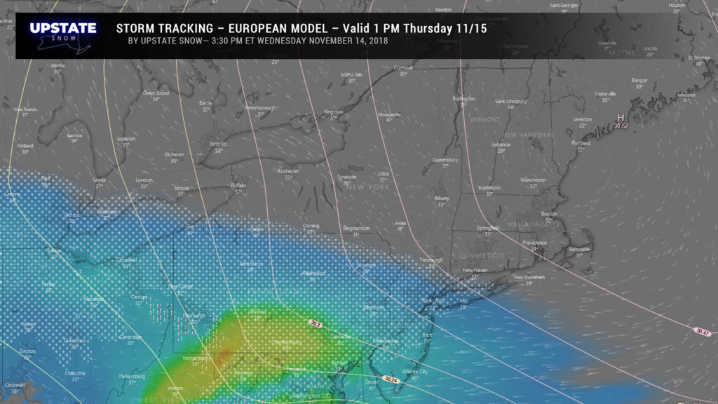
European model brings snow to the NY/PA border counties by early Thursday afternoon… well ahead of our actual storm center. This is pushed forward on a strong southerly flow at about 18,000 feet.
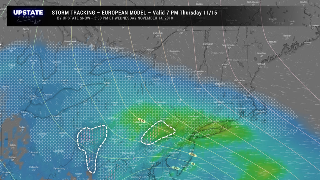
As we play our story forward, by 7 PM Thursday the southern tier of New York is shown to be under steady, accumulating snowfall. As warm air continues to pump in aloft, we see some mixing beginning to occur through portions of Pennsylvania.
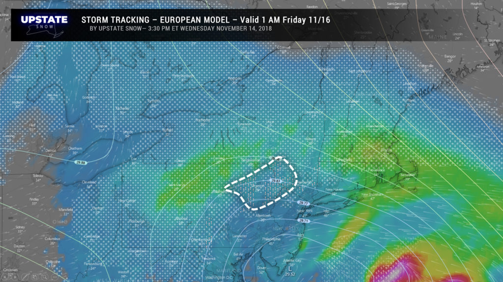
By 1 AM Friday, the European shows the center of low pressure just south of Atlantic City, NJ. Widespread snow occurring over all of New York, with some mixing starting to occur downstate, in the valleys of the southern Catskills, toward NYC. The model also paints something of a deformation zone over the central Southern Tier, southern Fingerlakes, northeastward into the Susquehanna Region.
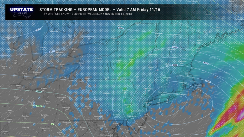
By time we sit down to breakfast Friday morning, the European says we’re at the height of our storm with solid snow across all of New York, heaviest from Binghamton to Syraucse to Utica. Deep, impressively deep low pressure, at 29.37 inHg over the eastern tip of Long Island. Cold air support from the north keeping most of the area in the form of snow.
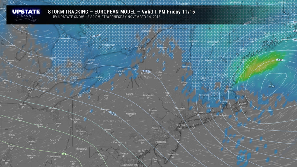
The Euro quickly pulls our storm off to the north and east by Friday afternoon, leaving much of the upstate with areas of light rain/drizzle/mist and/or light snow showers. The model also shows temperatures jumping into the middle and upper 30s across most of southern New York, with temps into the lower 40s toward Buffalo.
NORTH AMERICAN – GFS MODEL INFORMATION
On the whole, the GFS is weaker with regards to the amount of precipitation we experience. Not much weaker, but weaker nonetheless.
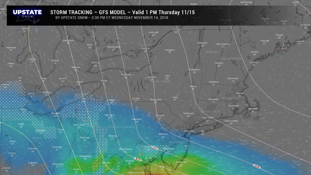
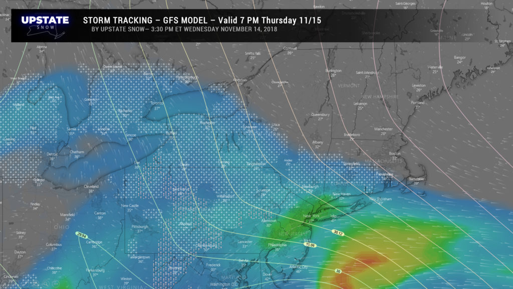
The GFS isn’t as energetic with the push of southerly air aloft, therefore keeping most of the snow OUT of New York early Thursday afternoon. The GFS points to a stronger high over southern Maine which would help suppress the precip to the south. Also note that some of this is in liquid form, according to the model. (Where you see the blue shading without any other symbol, indicates liquid precip.)
Just after suppertime Thursday the GFS breaks out areas of snow for the southern tier, mainly along and south of the Thruway. This should be all snow in all areas save for the far southwestern tip of the state. Note that our storm center is still well off to the south… all of this precipitation is forming on an easterly flow off the Atlantic at the surface, combined with “overrunning” from the south. Situations like these tend toward mixed precipitation… but the model soundings keep everything below 32 degrees at this time.
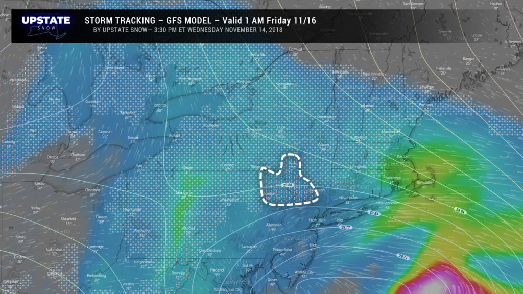
During the night, the GFS brings our storm center to just south of Atlantic City (roughly), with widespread snows across NY… but the model shows mixed precipitation breaking out for the southern Catskills. It also is not as robust or as intense in precipitation over the state.
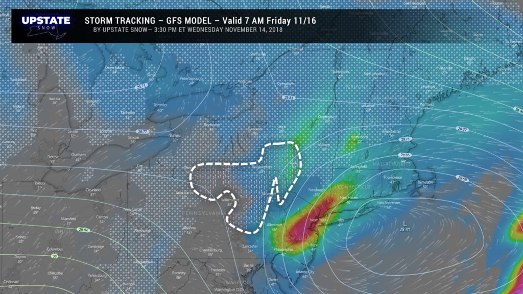
As we’re getting ready for work and school on Friday, our low is just east of Long Island (the wind ‘particles’ and the ‘low’ are somewhat displaced on the graphic). Widespread snow across the state, with a deformation band setting up between Utica and Albany running south into the Catskills… but also a healthy bit of mixed precipitation and ice setting up across the Susquehanna region. The model believes a bit more warmth will push northward “up and over” the colder air near the surface.
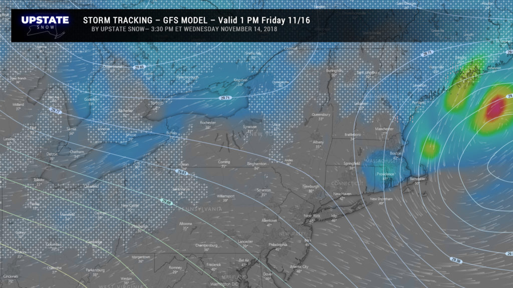
By 1 PM Friday the GFS also signals that our storm is all but over. Temperatures generally in the mid 30s south of the Thruway with scattered rain and snow showers; more snow showers over the North Country with colder temperatures.
Right, so you’re thinking, blah-blah-blah HOW MUCH SNOWWWW????
As far as snow accumulations go, the models have a fairly sizable split… but keep in mind, we’re still a day-and-change out from the event. A snowfall forecast, even now, should be taken with a grain of salt.
The European and ensembles are far more robust, painting at least 8-12 inches for much of south central New York — Steuben, Chemung, Tioga and Broome counties northward into Tompkins, Cortland, Chenango, and Otsego counties, with another bullseye over the higher terrain of Schoharie, Greene, and Albany counties.
The GFS says no, calm down on the caffeine, going with amounts generally 7 inches or less across Otsego, Chenango, Cortland counties into Delaware, Broome, Tioga, Chemung and Steuben counties, with generally 6 inches or less elsewhere across the state.
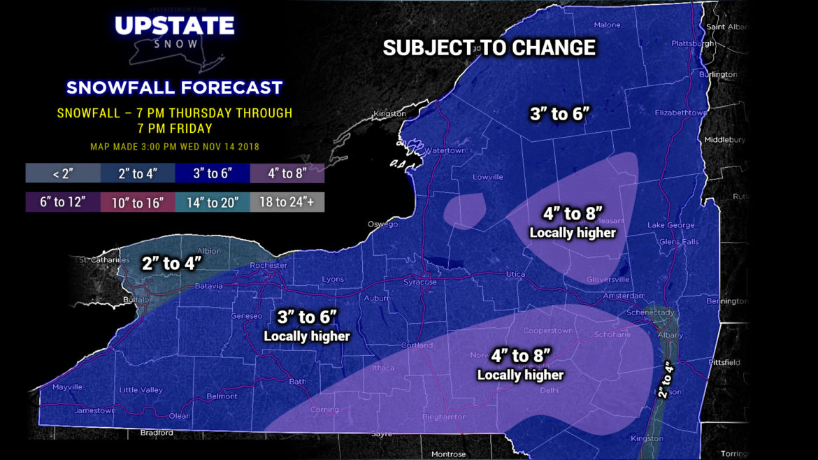
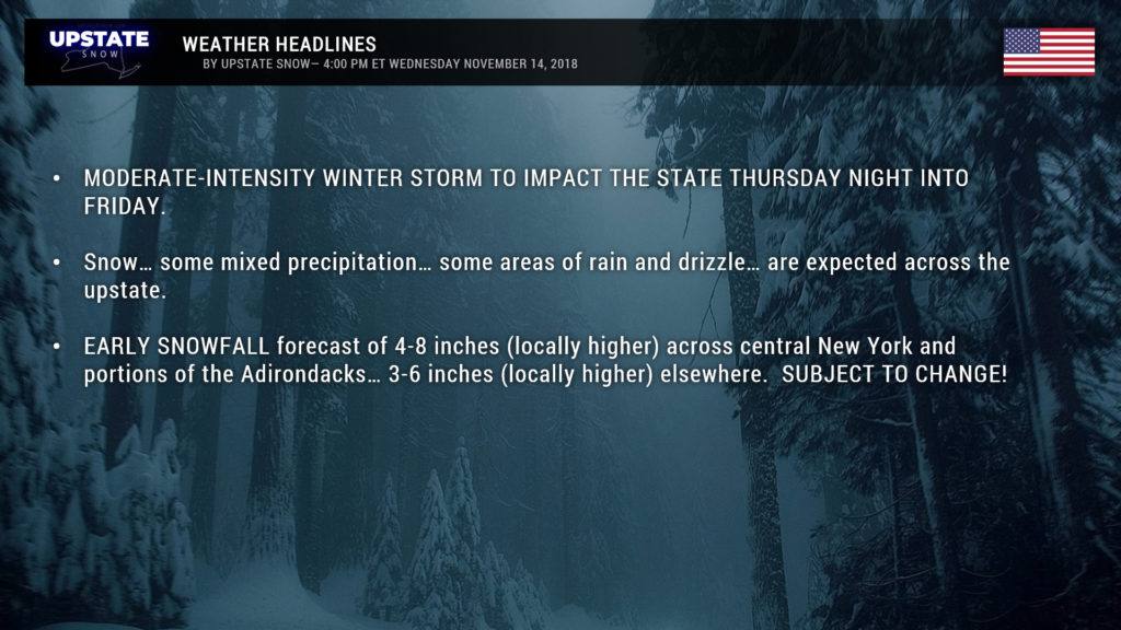
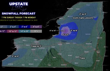
So what do we do? For now — *** AND THIS IS SUBJECT TO CHANGE BETWEEN NOW AND TOMORROW AFTERNOON *** After careful thought, I’m going with a bit of a blend in modeling. I think some warm air will cause a changeover to mixed precip at times, especially across southwest NY, as well as the southern tier, but enough cold air should remain in place that much of the state remains snow. I’m going to paint the heaviest totals in areas similar to the Euro, where it’s possible a deformation zone becomes established. Yes… we’re going conservative on the numbers. Yes… we realize the Euro is hammering this baby home with a foot-plus in some areas. No… we’re not ready to hop aboard that train… yet…
Drumroll please……
Please please PLEASE take this with a grain of salt once again. This is subject to revision by tomorrow’s update… but we will have a FINAL CALL posted tomorrow afternoon/evening.

