Good evening!
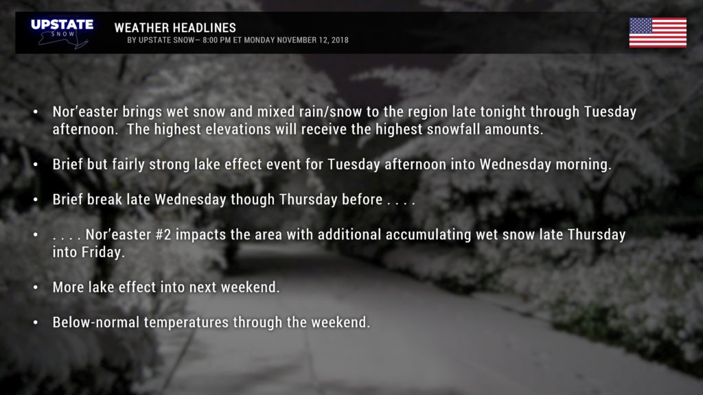
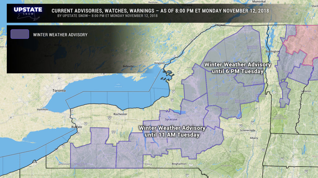
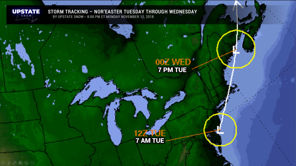
Ok we have Winter Weather Advisories up for a large portion of central NY and the Adirondacks through tomorrow morning and tomorrow afternoon, respectively. Low pressure moving up the coast will bring a classic elevation storm to our area.
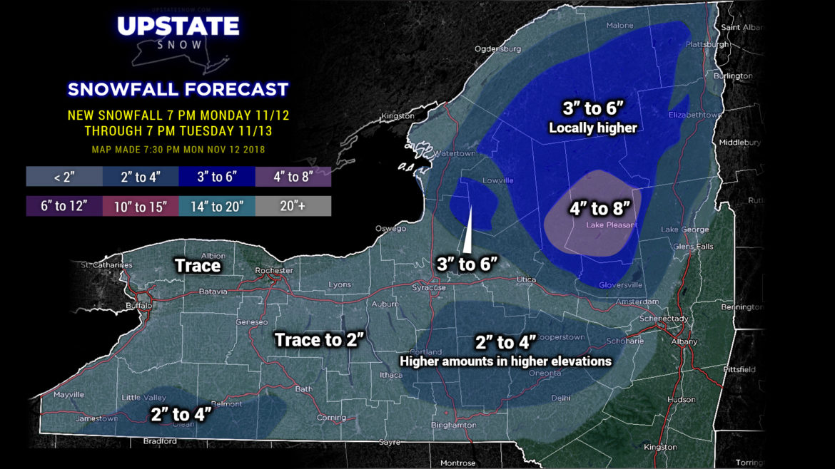
So what are we looking at? We’re painting an area of 4-8 inches of snow for portions of Herkimer and Hamilton counties… with a larger swath of 3-6 inches of snow across the Adirondacks and the Tug … based exclusively on elevation. There may be some locally higher amounts in these areas.
Also painted a swath of 2-4 for the southern tier from Cortland through Cooperstown to Delhi… again this is very elevation-dependent with the highest totals occurring in the highest elevations. Trace to 2 inch amounts elsewhere… mostly in the “trace” amounts.
Look for snow to begin after midnight across southern New York, with precip moving northward during the overnight. Most of the precip should be snow, but look for rain to fall in the Valley. The widespread precipitation will begin to taper off to snow showers Tuesday afternoon as our Nor’easter rocks the New England coast.
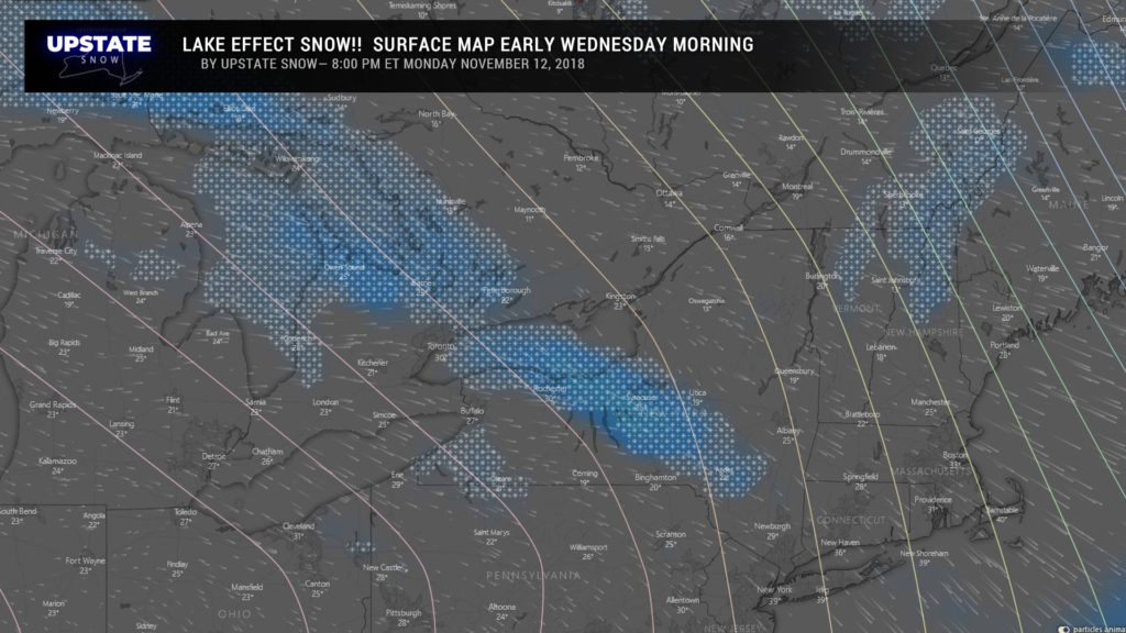
Then the lake effect machines fire up. Tuesday night through Wednesday will feature a fairly intense but brief lake effect storm.
We’re looking at a connection with Lake Huron for areas off Lake Ontario… which will lead to a heavy band of LES focusing southeast of Lake Ontario, possibly as far southeast as Delaware County! Easily 6+ snowfall coming for the areas impacted by that band… especially through Syracuse, Cortland, Norwich, possibly even to Cooperstown. Look for more “diffuse” or multi-banded LES off lake Erie thanks to the winds flowing over less open water, but several inches of LES are likely off lake Erie as well.
We get a brief reprieve late Wednesday through early Thursday before Nor’easter number two impacts the area. Modeling points to a mostly snow event… but some rain can be expected in the valleys as usual. At this early juncture, a similar set of snow accumulations look probable with this second storm.
After the second Nor’easter moves away, more lake effect looks to be on tap as a nice west/northwest flow becomes established…. but temperatures near the surface may be above freezing on Saturday leading to lake effect rain and snow. It’s too early to really nitpick those details. Another push of colder air looks to move in later in the weekend, eliminating any chance for liquid precip.
As for temperatures, through the rest of the week we continue looking at below-normal temps through at least Sunday.

