Good evening!
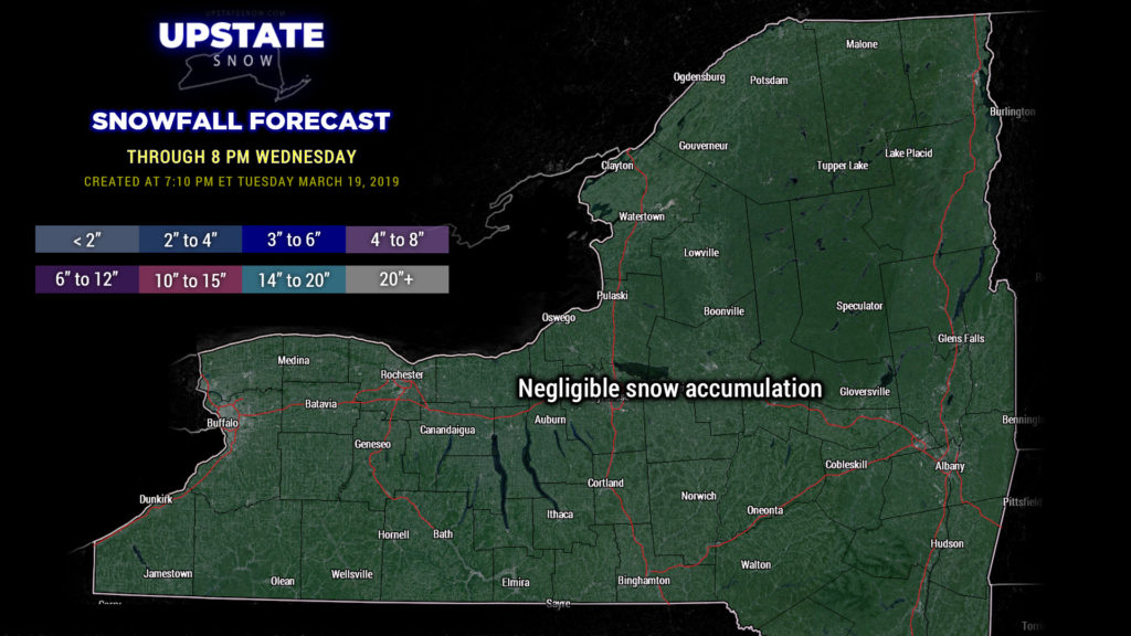
Quiet weather and fairly cold temperatures expected across the state tonight thanks to high pressure building in just to our south. As this high moves to the southeast on Wednesday, a “return flow” sets up — southerly winds mean temperatures climbing into the 40s and 50s for a good portion of the state — colder over the Tug and in the Adirondacks, and immediately northeast of the lakes. There will be little, if any, snow accumulation through 8 PM Wednesday.

Modeling has slowed down a bit on the arrival of our next weather system, which will bring fairly widespread rain showers late Wednesday night and on Thursday… colder temperatures in the eastern part of the state, in the higher terrain, will mean snow showers, but on the whole, this will be a rain system. Not an awful lot of rain though. A cold front will cross the state later Thursday, ushering in some colder air and a changeover BACK to wet snow in some areas, particularly high elevations. As the front reaches the coast, low pressure will get wound up from the coastal Carolinas, lift northward, and strengthen off the New England coast by Friday. This will “pull down” some much colder air in a north/northwesterly flow later Friday and into Saturday, resulting in numerous snow showers across the state. We may even see some snow squalls with some gusty winds as some pretty strong cold air pummels across the state Friday afternoon.
Cold and blustery conditions continue Friday night through Saturday as our coastal storm pulls slowly away toward Newfoundland. Snow showers should slowly diminish through the day on Saturday. It is probable that areas north of the Thruway pick up several inches of new snow Friday into Saturday.
The cold doesn’t stick around for very long as a flattening ridge transitions to the east coast by Sunday. Warm air will surge northward … highs in the 30s and lower 40s on Saturday will rise to the upper 50s / near 60 in some areas on Sunday.
That doesn’t last long either as our highly volatile and active weather pattern continues into next week. The ridging at 18,000 feet gives way to troughing (disturbed weather / low pressure). At the surface, models show a cold front crossing the state Monday bringing rain… and then much colder air with snow Monday evening and Monday night. This is quite a bit “out there” in terms of time frame, but scientifically it does make sense given the upper level ridge/trough pattern. Interestingly, and in a ridiculous flip from last night, the latest GFS-FV3 run (from 8 AM today) shows another coastal storm throwing potentially heavy snow toward the Catskills NEXT Tuesday afternoon (the 26th). None of the other operational models agree with that, and honestly neither do we…. but as crazy as the pattern is looking… nothing would surprise us anymore.


