Last chance to ride this year outside of the Adirondacks and Tug Hill is NOW
It’s mid-March and if it’s not now, it’s soon enough. The end is near and time to get your last rides and fuel stabilizer runs in for most of Upstate NY. If you are local to trails in CNY, Southern Tier, Eastern NY and/or Western NY… anything south of the Thruway and/or east of I-87… if the trails are still open where you like to ride locally… THIS IS IT. If you don’t ride tonight, Wednesday or Wednesday night (again if the clubs where you want to ride are still open)… you are on the sidelines until next holiday season. The temps on Thursday are guaranteed to break 50 degrees over all of Upstate both Thursday and Friday… many locations will break 60 degrees along and south of the Thruway, and some Upstate locations with little/no snowcover… if they get enough sunshine and breeze… could hit their first 70-degree day of the season either Thursday or Friday.
CURRENT SNOW COVER:
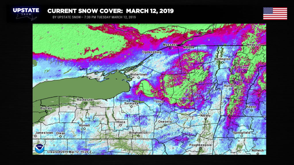
As you see here these temps and wind along with the high sun angle… will take most of Upstate NY out in terms of snowmobiling. All that will be left are areas in the darker purple and green… the Tug Hill and Adirondacks. They’ll survive this warm spell, although plan on the connecting trails through Brantigham between the Hill and the Adirondacks to get severed for this weekend and beyond.
SNOW WATER EQUIVALENT:
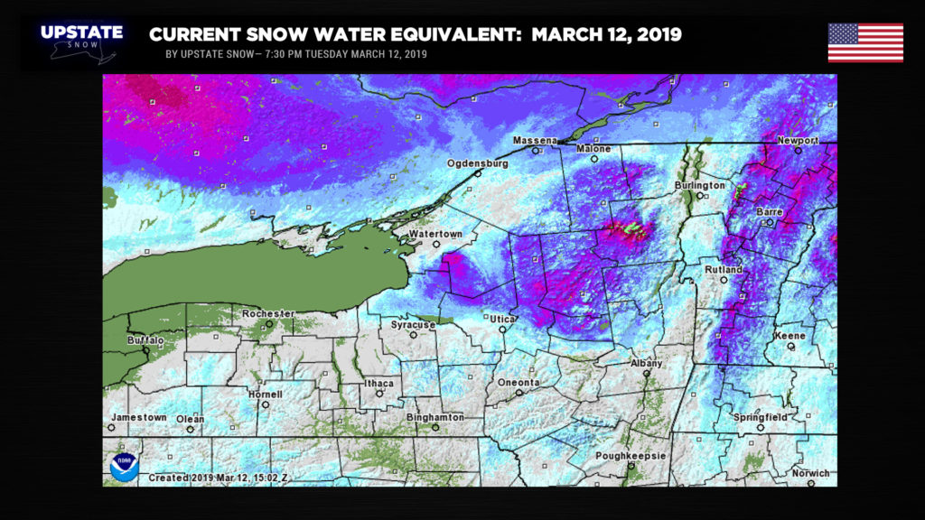
As you see here there is not only a ton of base but a ton of water in it north of the Mohawk Valley. In some places 10″ or more! It will take time to release that water so there will still be opportunities to trailer to the seasonal roads on Tug Hill this weekend and beyond… same for the clubs ringing the blue line like Ohio, Stratford, Trackside, Brantingham… although their lower valley trails may become washed out and/or impassable… we’ll see. In the heart of the Adirondacks… Old Forge, Inlet, Morehouse, Pleasant Riders, Wells, Speculator, Indian Lake, Newcomb, Long Lake, Sabbatis, Raquette Lake and Tupper Lake areas should hang on through this weekend into next week… BUT… lakes may become unsafe to cross by this weekend despite deep ice cover still remaining… slush and glare ice will make crossing a lot more dangerous… not to mention more heaves and leads could open up after this week… so your cruising areas could be limited this weekend into next week. Conditions won’t be as good as they’ve been, but there should be at least another 1-2 weeks of riding on Tug Hill proper and inside the Adirondack Park… steadily getting more die-hard after this big warmup.
So there you go… make your plans…
High pressure will settle overhead tonight bringing clear skies and cold temperatures. The cold isn’t going to last long though as the high shifts east/southeast off the Delmarva coast during the day Wednesday and a return flow of moist, southerly air begins. This moist air will encounter colder air trapped near the surface and there is the potential that some light rain showers break out across western NY, with some mixed precip or snow showers in northern NY later Wednesday evening. This is overall unlikely but the chance is there, so it’s worth mentioning.
A HUGE… storm system gathering strength over the middle of the United States will produce tremendous blizzard conditions across the Dakotas, western Nebraska, Colorado and Wyoming, with severe weather over the Mississippi Valley by Wednesday evening. More and more warm air will pump northeastward as we go into Thursday. As mentioned above, high temperatures really take off — widespread 50s with some 60s … and if there is some sunshine … possibly flirting with the 70-degree mark as we go into Friday.
The low pressure center with this massive storm lifts northward through Iowa into the northern Great Lakes as we move through Friday. Showers should break out across much of the state Thursday evening and overnight as 1) a warm front lifts north over the state, and 2) a cold front approaches from the west.
Widespread showers are expected along and ahead of this cold front as it begins to cross the state early Friday morning. There may be enough instability that some thunderstorms also develop along this front. Modeling suggests winds at the 5,000 foot level to be running about 50-55 knots ; any thunderstorms that develop could mix some of these gusty winds down to the surface. The overall severe weather threat (i.e., thunderstorm winds at or above 58 mph and/or hail 1 inch in diameter or larger) appears very low, but an isolated severe warning isn’t out of the question on Friday.
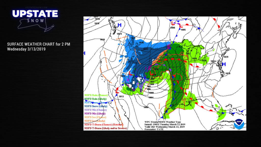
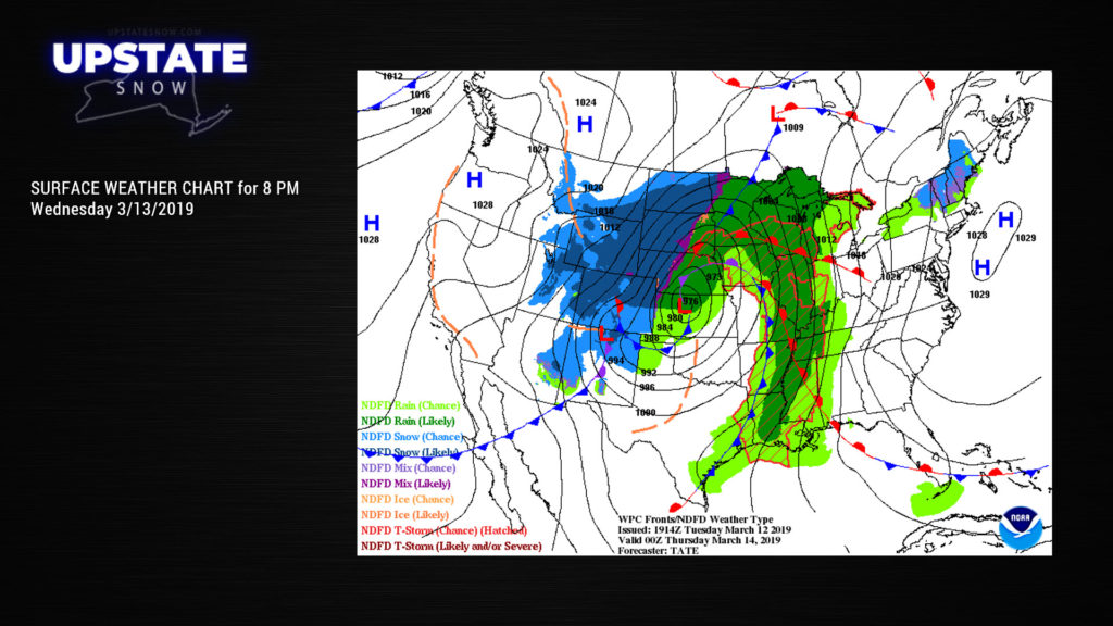
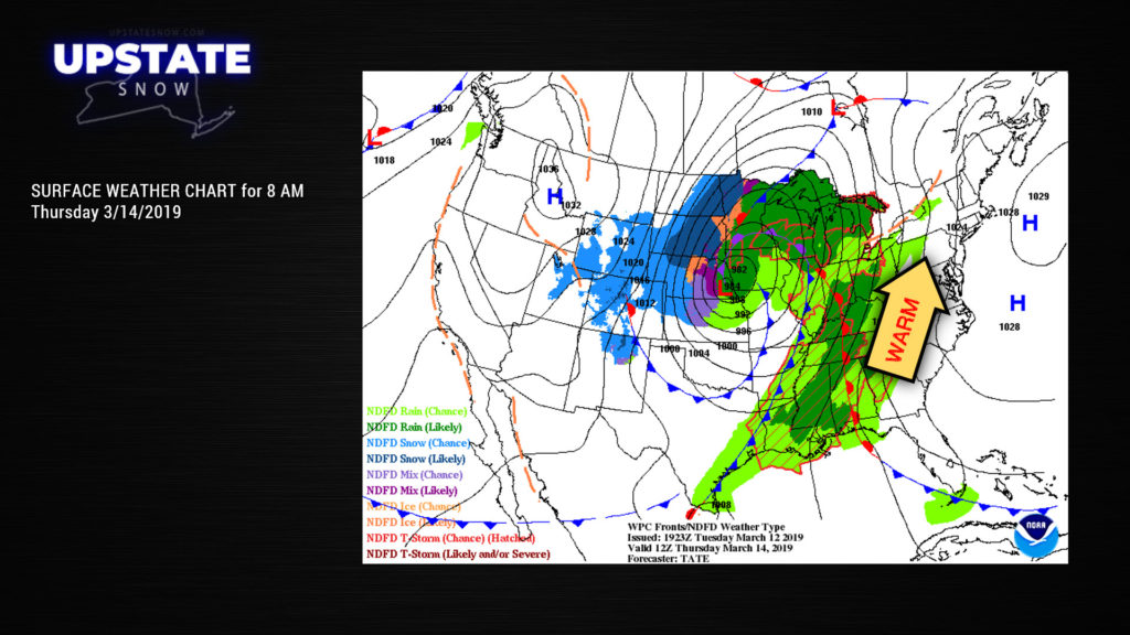
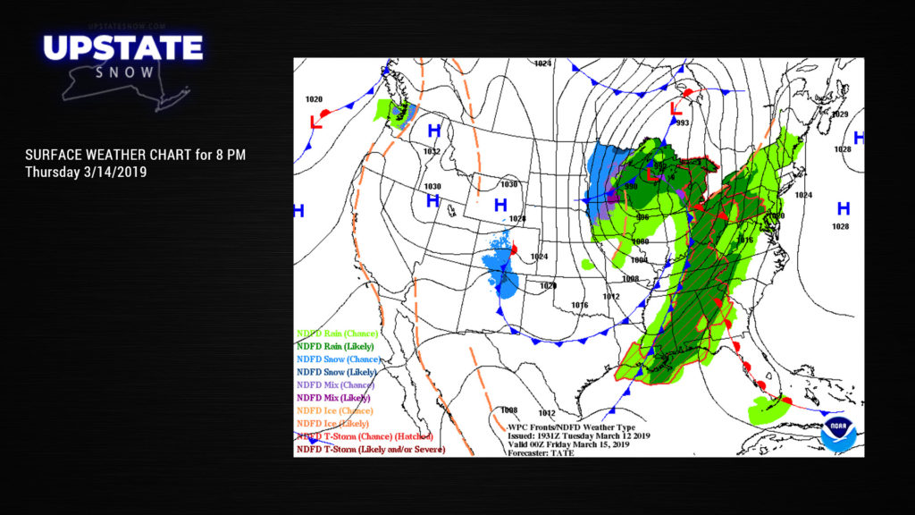
As we move into late Friday night / early Saturday, our surface low moves waaaaay far to our north, but a second cold front will cross the state, ushering in colder temperatures. Rain showers along this second front will quickly transition back to snow showers. A little shortwave (basically a weak frontal boundary) rotates down across the state on Saturday with widespread snow showers across the state… and possibly some upsloping and enhancement on the Tug Hill. This isn’t going to amount to much at all though. Snow showers linger into Monday before coming to an end.
The GFS hints at a reinforcing shot of colder air as we approach the equinox, but by that point even the model is entering the “take a wild guess” territory. The FV3 also wants to drop a frontal boundary across the state on the 21st. This is not shown on the Canadian or the Euro. Either way, no “big” snows are in the outlook through the 23rd or 24th. Temps might run a bit cooler than normal and there may be some snow showers around, but certainly nothing that is going to extend our riding season.


