Good evening!
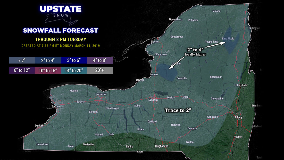
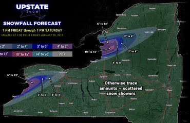
A little cold front approaching from the northwest, on the northern periphery of a large, sprawling area of high pressure, will drop down over the Upstate during the night tonight. This will keep snow showers going across much of the northern half of the state through tonight, into early Tuesday morning. Winds from the surface to about 10,000 feet are quite uniform, blowing in from just north of due-west, from 10-40 knots (surface to 10k feet)… which will allow for some moisture from Lake Ontario to be added to the mix and deposited on the Tug. Like last night this is more of an upsloping / enhancement type of deal rather than true lake effect.
Some snow showers are also occurring over far western NY, from Rochester southwestward to the Chautauqua Ridge. Again, upsloping / enhancement from the Ridge will help squeeze out an inch or two of snow overnight in this area.
Our snow map tonight kind of broad-brushes the state, as there will be scattered snow showers at just about any particular location. That said, not everyone will see snow accumulations. The biggest snowfall winner tonight through Tuesday will be the Tug Hill, where Winter Weather Advisory flags are flying through early Tuesday morning.

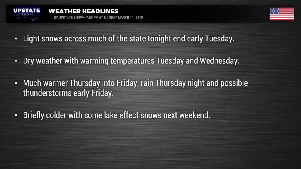
And that’ll be it for any snow accumulations through the remainder of the work week, as a large area of high pressure builds just to our south. Initially we will remain in a colder northwest air flow, but winds become west/southwesterly by Wednesday afternoon as the high shifts offshore.
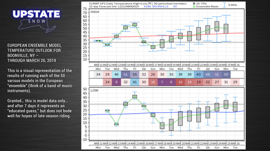
Our next system starts to arrive by Thursday afternoon. Another fairly deep area of low pressure will take shape over northern Kansas and move north-northeast through Iowa into the northern Great Lakes from Thursday morning into Friday morning. As the high pressure ridge builds offshore, a deep, moist southerly flow takes shape and our temperatures take off. Temps in the 50s are a pretty good bet Thursday… some modeling points at 60s for much of the state on Friday. Any areas of sunshine that develop Thursday and especially ahead of the cold front on Friday mean temps could possibly jump to (or exceed) the 70-degree mark.
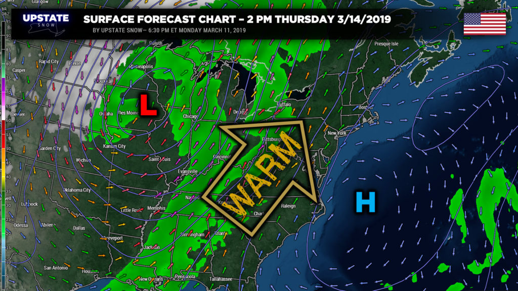
Shower chances will be increasing later Thursday and especially Friday along and ahead of the aforementioned cold front — and it looks like there may be enough instability ahead of the front that we get some thunderstorms rolling as well.
Showers and storms end west to east Friday afternoon after the front crosses the state and colder air will start to wrap in on a northwesterly flow. We are going to see some cold temperatures in the wake of this storm system next weekend, and maybe even some lake effect snow, but in all honesty… that may very well be it for the season.
Long range modeling hints at +10°C (50°F) temps at the 850 mb level (5,000 feet) pushing well north into Canada by the equinox … it really looks like the cold air is going to get kicked out of Canada … probably putting a definitive end to our riding season (which, in all honesty, is more or less over… especially if we get into the 60s or higher later this week). That being said, the FV3 model wants to spin down a lobe of colder air and some snow showers along about the 21st to 22nd, but that’s the only model showing that. None of the models point to any big snow events from this point through the end of the month… and the longer-range Euro ensembles are pointing at temperatures going into the 45- to 55-degree range as we go beyond the 22nd toward the 26th, with some of the ensemble members indicating highs into the mid 60s.
