Good evening once again!
The warm front we talked about never actually really made it through the Upstate. An occluded front is working its way across the state as of the time of this writing (more or less along the I-81 corridor as of 6:50 PM). Scattered light rain and snow showers are ahead of this front, with windy conditions and falling temps behind the front.
Winds are at the peak right now and will slowly diminish through the evening as the main low center moves northeast into Quebec tonight. The High Wind Warning flags are gone (as of 8 PM); a Wind Advisory is up until 11 PM for Niagara, Orleans, Monroe, Erie, Genesee, and Chautauqua counties.
In terms of lake effect snow, that’s not going to be much of an issue tonight as the air mass isn’t cold enough from surface to cloud. There may be a few snow showers over the Chautauqua Ridge… but a better shot of snow showers exists over the Tug Hill tonight where a fresh inch of snow may fall.
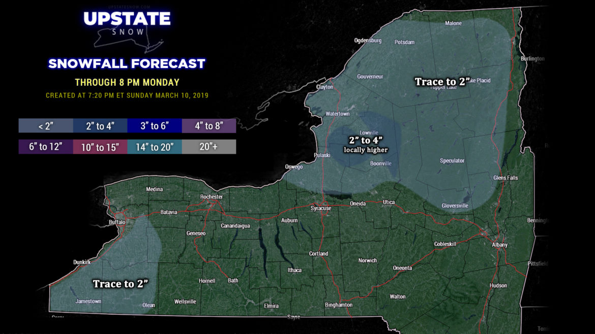
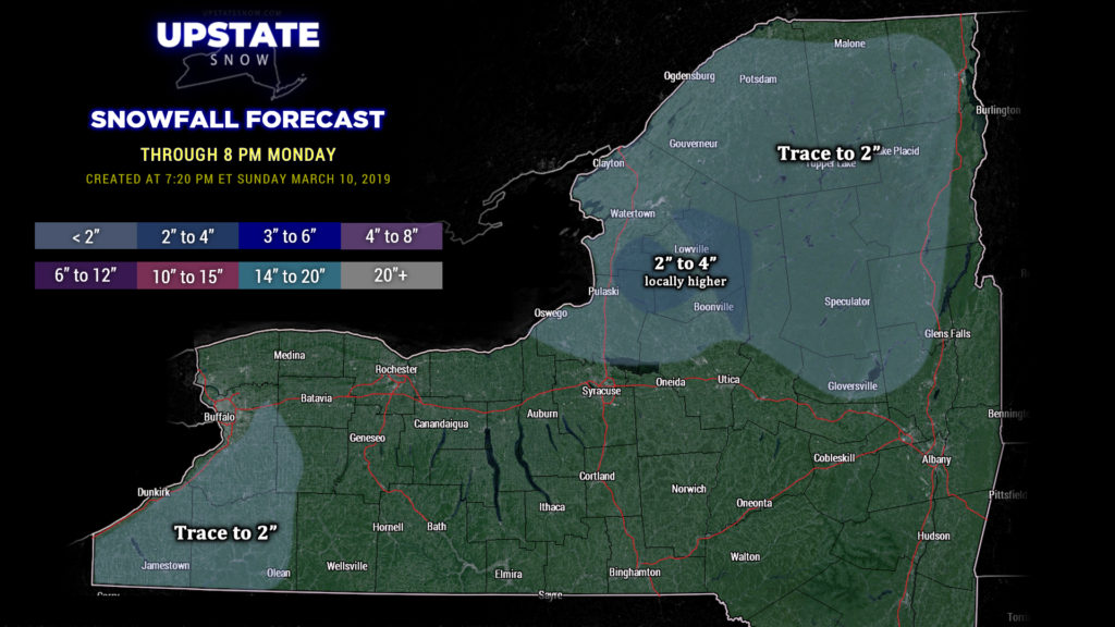
A secondary little boundary will move through on Monday. This brings more moisture into the area later Monday into Monday night, and we’ll see some more widespread snow showers. Lake Ontario will come into play at this point… and it looks like the typical areas east of Lake Ontario will see a fairly healthy dose of new snow through Monday night. It’s not true “lake effect” — it’s more of an upsloping / lake “enhancement” kind of thing. Our snow map illustrates this, with a general trace to 2 inches for the North Country through tomorrow evening, with 2-4 over the Tug and the western Adirondacks thanks to that upsloping… and there could be a local 5 or 6 inch total. Also went with a trace to 2 for the higher elevations east of Lake Erie — not everyone will see accumulating snow, but we’ll put it there to cover the possibility.
Tuesday through Thursday look quiet across the Upstate with gradually warming temperatures. Our next weather system approaches by Thursday night into Friday with a punch of much warmer temps — modeling hints at highs in the 60s across the southern tier by Friday. The questionmark here is how much rain will fall from this system Thursday night and Friday before a cold front crosses the state late Friday or Friday night. Temperatures go back below seasonal norms by next weekend with a return of snow showers.
Short report tonight… once we get through tongiht and tomorrow there’s not an awful lot to talk about until the end of the week. Thanks for viewing, thanks for supporting our sponsors!

