Good evening once again
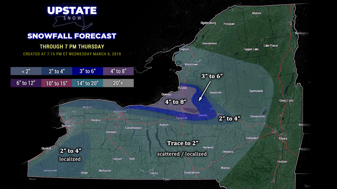
Lake effect snows continue. As of this writing (7 PM) a decent band extends ESE from the eastern shore of Lake Ontario, with the heaviest snows falling from Sandy Creek to Pulaski and extended east-southeast over the southern Tug Hill; lighter snows extend from Mannsville south through Oswego, Parish, Williamstown… east-southeast into northern Oneida county southwest of Boonville and Alder Creek… and even a “finger” extending into Herkimer county north of Cold Brook. This band is relatively consistent but will be disrupted by yet another frontal boundary (and a little wave of low pressure) that will move across the state early Thursday. In the meantime, high-res modeling continues to show this band impacting the same general area through the overnight.
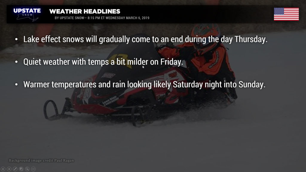
As mentioned, another frontal boundary with a wave of low pressure will cross the lakes early Thursday, and cross the state by Thursday afternoon. This shifts our winds more to the northwest and cause our band to “wag” a little bit, eventually settling farther south along the southern shore, with accumulations dropping back into northern Cayuga, southern Oswego, northern Onondaga, western Oneida, and northern Madison counties early Thursday… but the clock is ticking on the event as high pressure starts to build in from the lower Great Lakes. This will gradually cause our lake effect to start to come part and diminish by the time you read this on Thursday.
Once again our snow map is a collaboration between the various high-res models, as well as looking at the current radar, and throwing in a touch of “gut instinct” for good measure. Once again it’s not the simplest of forecasts as there are some variances within the modeling. Oswego county wins the award, with portions of Wayne, Cayuga, Onondaga, and Madison all getting warning-criteria snow accumulations. Not everyone is going to see the 4-8 totals shown on the map, there will be a good bit of variability depending on how that band dogtails through the evening and overnight. We put a broad coverage of Trace to 2 inches, the vast majority of this will be snow showers associated with that disturbance moving across the state on Thursday. There may be some enhancement / uplift on the Chautauqua Ridge again, so we put in a color for 2-4, although that, too, is more likely to be hit-or-miss / localized.

As stated high pressure takes over by Thursday evening and this will bring to an end this nice blitz of late-season lake effect.
Friday looks peaceful and quiet about the state with one final day of temperatures starting to climb once again… look for highs in the mid 30s across the Finger lakes and western NY, upper 20s to lower 30s over the Susquehanna region and Catskills, upper 20s for the North Country. Even warmer temps on Saturday… highs into the 40s over the NY/PA border counties, mid/upper 30s just about everywhere else except the North Country (lower 30s).
Then things get busy once again as we move into Saturday night. Warm air will surge northward, accompanied by rain Saturday night into Sunday. The amount of rain looks a bit more modest when compared to last night’s modeling, but it’s still a bit far out in time to make that call. Temperatures should rocket well into the 50s over much of the western half of the state on Sunday before a cold front moves through later in the day. This may also bring another round of strong winds to portions of the state, mainly west of I-81 Sunday afternoon and Sunday night. Nothing like the crazy wind storm we had a few weeks ago, but definitely something we need to pay attention to.
So the cold front associated with the system moves through late Sunday, cold air wraps in, and the northwest flow means additional snow showers on Monday… enhanced by the higher terrain of the Chautauqua Ridge and the Tug Hill. Right now it doesn’t look too favorable for any “significant” lake effect, but it’s a bit too early to make that decision. Colder air definitely wraps in behind the departing storm, but as of right now it doesn’t look like it will be nearly as cold as what we’ve had this week.
Get out and ride folks…

