Good evening…
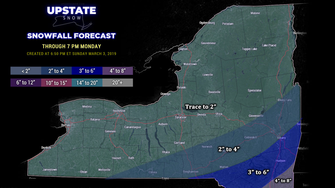
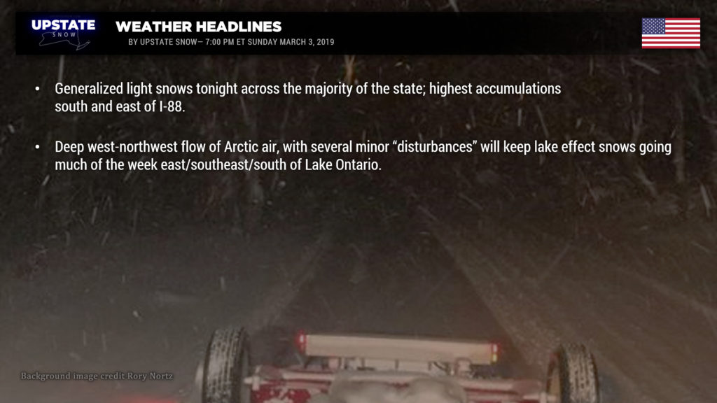
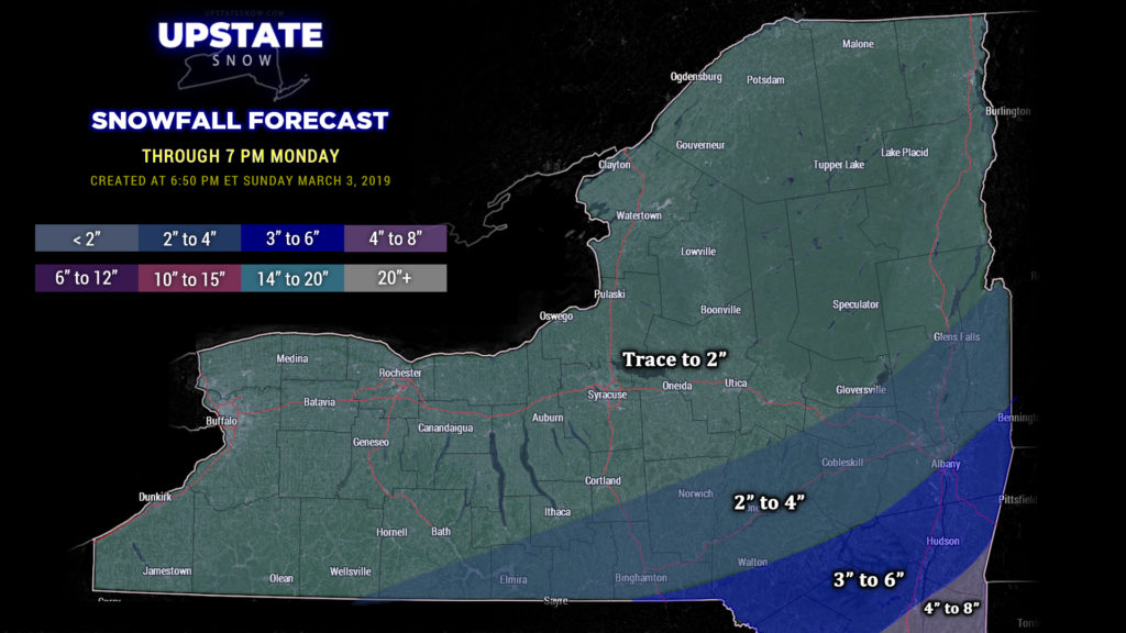
Well our “storm” is going to be more of a generalized light snow event for the vast majority of the upstate tonight. The heaviest snows will stay south and east of I-88, but a burst of some “moderate” snow may impact portions of Broome, Cortland, Chenango, Otsego, Montgomery, Fulton, Saratoga, and Washington counties during the late evening to early overnight. Snow will taper off fairly rapidly from southwest to northeast after midnight, and by breakfast-time on Monday, look for a few scattered snow showers to be dotting the landscape.
We’ve come down quite a bit on our snow map for this event… the vast majority will see between a trace and 3-4 inches (from northwest to southeast… and the 4 inches might be generous). Head south into the Catskills and you’ll see higher amounts, also south of Albany, we’re going with 3-6 inches.
As the system pulls quickly to the north and east, colder air will begin to wrap across the state Monday. Cold northwest winds will become established, but the air will be quite dry initially. Therefore only some scattered snow showers will begin to develop off of Lake Ontario during the afternoon. It’s Monday night that things really start to pick up. An area of low pressure well to the north (northern Ontario) will pinwheel down several “frontal boundaries” (technically we could call them shortwaves or troughs) Monday night through Wednesday night. High-res modeling shows a band of lake effect snows becoming established across southern Oswego county extending eastward through central Oneida county by Monday evening… with the band breaking up by about lunchtime on Tuesday. At the same time, one of these little “boundaries” will glide southeastward by Tuesday evening and kick up several bands of snow showers across central and western NY. An even more robust WNW flow becomes established in the wake of this boundary, and another band of LES will become established, targeting the Tug Hill before drifting just a tad south, once again impacting southern Oswego county into central Oneida county. (This, of course, will be fine-tuned as we move forward in time with new modeling, etc.) Modeling suggests that the LES bands become more diffuse and impact areas along the southern shore of Lake Ontario as we move into Wednesday afternoon… this trend will continue Wednesday night into Thursday night as well, as the Arctic air continues to settle over the region.
Arctic air will also keep temperatures resembling what they should be in early January through the week. Wednesday will be the coldest day, with temperatures probably not rising above 10 degrees through the North Country, with widespread teens everywhere else. Early morning lows on Wednesday will be between zero and 10 below for the ADKs, with single digits to around 10 above zero everywhere else. Expect similar numbers when you wake up on Thursday morning. The Arctic air starts to pull away on Friday, and by Saturday we’ll be looking at highs across the state generally in the mid to upper 30s, with readings around 30 for the North Country.
A small area of low pressure may trek from the Ohio Valley to the coast, with perhaps some “generalized” light snows for the southern tier on Friday.
By next Sunday, models still show a deep, strong low pressure system … moving from the plains through Wisconsin, Michigan, and into Canada… or moving northeast along the coast… depending on which model you want to shop. Too far out in time, and too wide of margin variance, to make any kind of hard call on that one.

