Good evening…
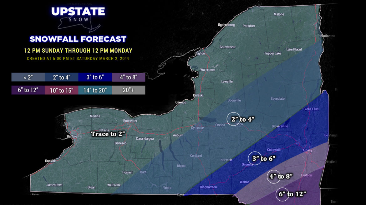
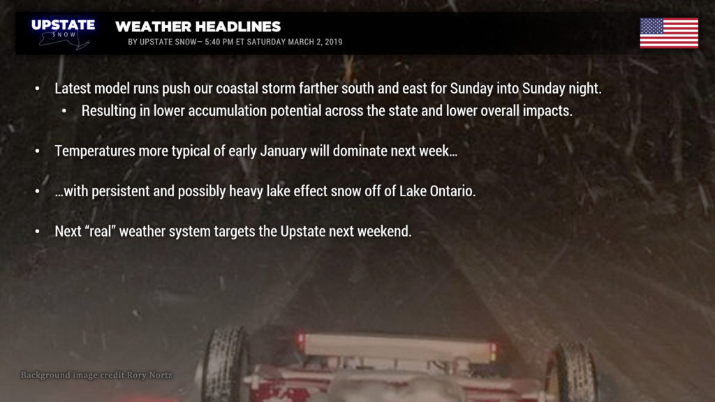
South and east. Regrettably that’s the trend today with ALL of the modeling for Sunday’s storm. Impacts across central New York will be light… with minimal impact north and west. The heaviest snows will fall in the Catskills, toward NYC. The low center is likely to progress northeast through NC Sunday evening and then very quickly to a position southeast of Cape Cod by Monday morning.
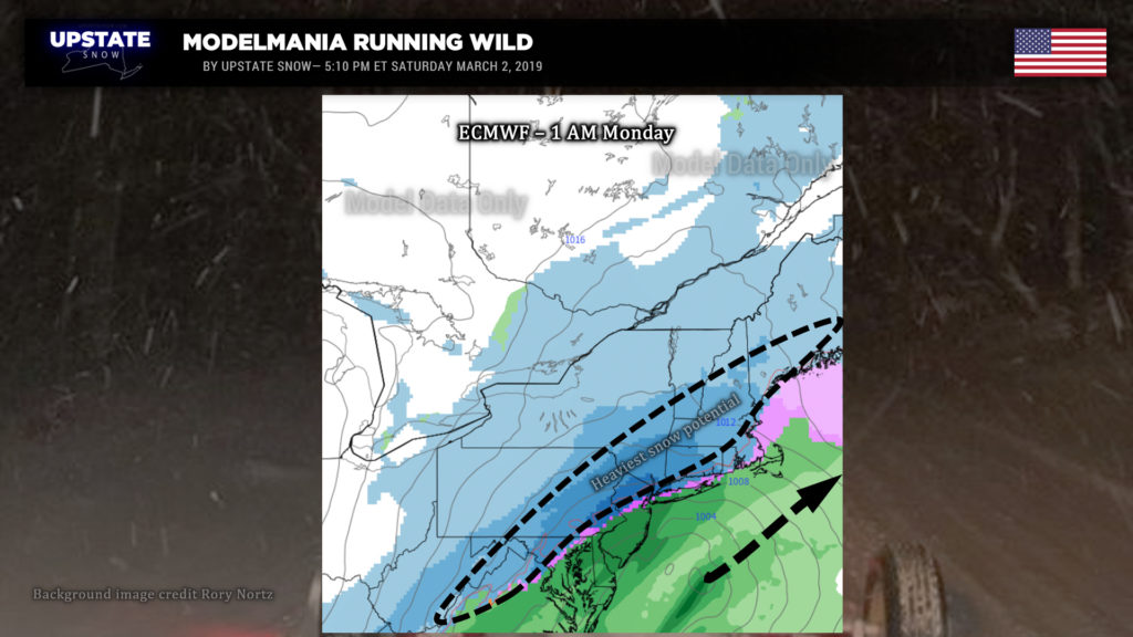
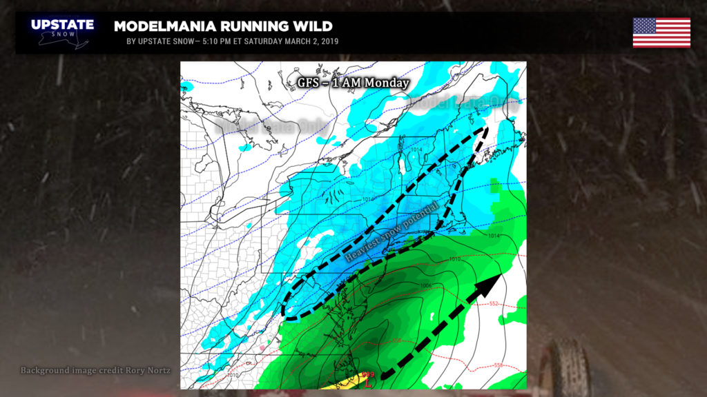
Snow will develop from south to north late Sunday afternoon, probably around suppertime at the NY/PA border… quickly overspreading the state during the evening. This is going to be a quick-hitting storm… snows should start to taper off from southwest to northeast around or shortly after midnight. By time you sit down to breakfast on Monday, it should all be over, with just some snow showers remaining across the state.
Our snow map … ok. These are likely going to be higher-end totals. In other words, the 2-4 zone will probably average out closer to 2 inches; 3-6 closer to 3, etc. (That’s why the numbers are circled.) We went high on the slightest potential (or maybe even a wish-cast) for a jog north/west in the storm track, but honestly that’s unlikely. Ugh.

A cold front will sweep across the state Monday afternoon and unleash quite an impressive Arctic blast for early March. A persistent northwest flow will mean lake effect snows mainly off of Lake Ontario much of the coming week. Multiple little disturbances will kind of spin across the state during the week, enhancing the lake snows. A band is expected to develop east of Lake Ontario by Monday afternoon… and this band will tend to windshield-wiper a little bit through the week as these little distubances flit across the state. This band should enhance with snows becoming heavy at times Tuesday afternoon… possibly lasting into Thursday. Precisely where the band(s) become(s) established… right now it’s a bit too early to call but it seems likely that the “typical” areas will pick up a decent late-season lake storm. Lake effect off of Lake Erie will be much less in coverage due to the considerable ice cover.
Otherwise, it’s going to be cold. Quite cold for early March, with highs typical for early January. Expect highs generally in the teens to lower 20s across the state Tuesday. As you wake up on Wednesday morning, temperatures will be below zero for a good portion of the North Country, with temps between zero and 10 above just about everywhere else. After highs in the teens everywhere on Wednesday… Thursday morning’s wake-up call shows temperatures at or below zero for an even larger portion of the North Country, with single digits above zero the commonality everywhere else. Temperatures will start to moderate Thursday, with highs into the 20s over much of the state, except upper teens across the Adirondacks.
Again, the lake effect east of Ontario will be ongoing this entire time.
Next weekend…. We’ll preface this by saying “next weekend is a long way off.” Modeling shows the next weather system of any significance making a run in our direction. Wide differences in the modeling means very wide ranges in choices from a mix-to-snow event to a soaking rainstorm, and everything in between.
Thanks for viewing our site and supporting our sponsors.

