Good evening…
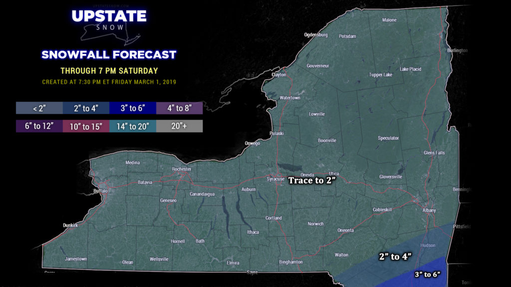
A diffuse little storm system will move well off to our north and west, kicking some light snows across the state for Saturday. A coastal storm will quickly form and zip off to the northeast. Snow accumulations across the state will be light, generally on the order of an inch or so, with higher amounts far south and east, closer to the coastal low. Some warmer air will push into southern NY Saturday and this could cause a mix of rain and snow at times, especially in the valley locations. Colder air sweeps in later Saturday afternoon, and any mixed precip goes back to all snow showers. All of that comes to an end Saturday night, with perhaps some lake effect snow showers. Again, this is the low-impact event for the weekend.
Now for what we really want to talk about. First… some reminders:
“Pump the brakes: Today is only Wednesday. It’s easy to “wish-cast,” especially the way this season has gone. It’s easy to “wish-cast” a repeat of March 2018, with the surprise “second season” and Nor’easters one right behind the other. Today’s modeling is all a very different solution than what modeling showed at yesterday’s update. Yes, the cold air will be in place. Yes, the pattern is favorable. It’s just a matter of IF the low develops, where does it go. “Stay tuned.”” — Upstate Snow, Wednesday 2/27.
“Pumping the brakes: Remember, as we said above, it’s only Thursday. As we said last night, it’s easy to “wish-cast” ourselves into big disappointment, and the way this season has been makes it even more easy. Models will shift and jog back and forth over the next few days. So clinging to one model solution over another this far out… just won’t end well and will drive you nuts. The take-home message: There is the POTENTIAL… for a moderate- to high-impact snowstorm across the state Sunday afternoon into Sunday night. There are no guarantees in weather… there’s no such thing as 0% or 100%.” — Upstate Snow, Thursday 2/28
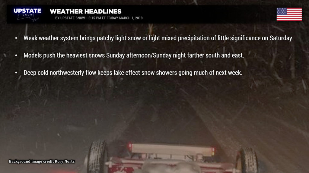
Well… tonight the models have come into somewhat better agreement, although there are still some differences between the Euro and the GFS/FV3/Canadian. The Euro is farthest to the west, while the others are farther south and east. The NAM models kind of split the difference, and that seems a good solution at this point. The chances of a high-impact snowstorm have decreased substantially… “splitting the difference” puts the highest snow totals along and south of I-88, with decreasing amounts as you go north and west. Western NY may have very low impact from this.
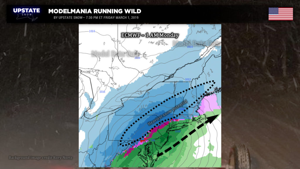
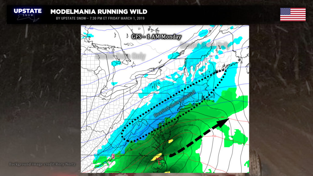
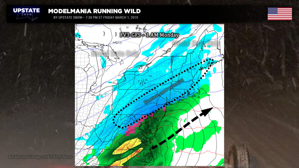
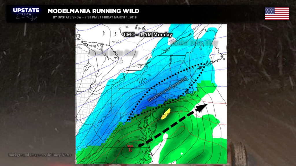
It’s still too early to make any firm calls right now. A “guesstimate” would be 5-10 for the Catskills, 4-7 from Binghamton to Cortland, Norwich, Cooperstown, to Albany… with amounts dropping as you head north and west.
All of this could be turned on its head by this time tomorrow, but we will have a map ready. NWS has not gone with any advisories or watches up because of the continued uncertainty in some of the modeling.
Generally quiet weather will persist behind this system for next week… but conditions will be more like early January than early March. A deep, cold northwesterly flow will persist, with models showing a steady stream of some lake effect snows off of Lake Ontario persisting as well. A cold front will reinforce this during the midweek period with some additional snow showers being kicked up. The next weather system will arrive by the end of the week, with more snow possible and continued cold temperatures.
Thanks for viewing, have a great Saturday.


