Good evening…
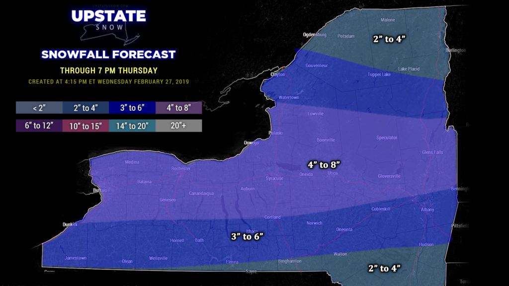
Steady snow falling across much of the upstate as of this writing (5:15 PM). A straightforward snow event as low pressure drifts southeast across northern PA and off the coast overnight. Look for snows to taper off from west to east this evening and into the overnight hours. Expect an additional 4-8 inches for the north of a line from roughly Dunkirk through Cortland, Cooperstown, and Schenectady… northward to a line from Watertown to Schroon Lake, with 3-6 book-ending those. The lowest amounts (1-4) along the NY/PA border and far north to the Canadian border. The cold temperatures means a very dry, fluffy snow with a high ratio, thus the higher amounts.
Mainly dry and cold conditions for your Thursday. Winds will be from the west/northwest, and we’ll have plenty of cold air in place, but lake effect looks to be minimal as there just isn’t going to be a lot of moisture available. Maybe some additional snow showers Thursday morning east of Lake Ontario, but accumulation will be negligible.
Friday looks dry… with temperatures going back into the 30s just about everywhere, with some lower 40s popping up across western NY.
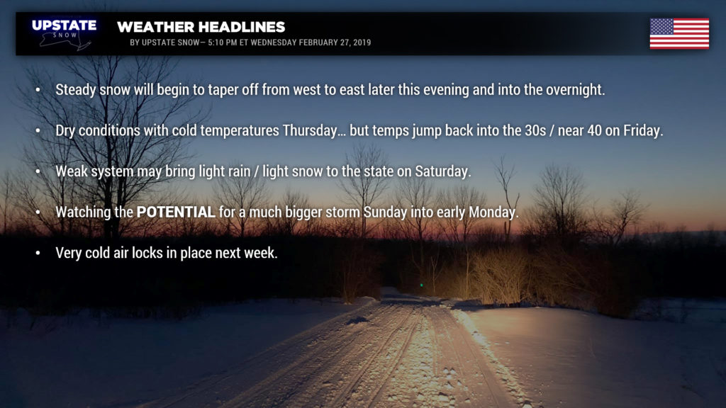
There’s a pretty significant change in this weekend’s outlook. In a night-and-day flip from yesterday, models show a weak system moving over the Great Lakes and northward into Canada on Saturday. This would bring some light snow, or light rain and snow, to the state, particularly the western two-thirds of the state. We’ll go with medium confidence on this for your Saturday.
Now we come to the Sunday into Monday time frame, and what could be … COULD BE … a heavy snow event. The European model develops low pressure over the Tennessee Valley Sunday morning, and lifts this just off the Jersey coast during the overnight Sunday night. The result of this would be heavy snow over much of the upstate, with a transition line somewhere roughly along the I-88 corridor, with heavy rain as you head south and east. The FV3 from this morning is juuuuust a tad farther south and east, but still close enough that a significant snowfall occurs over much of the state. The 7 AM run of the GFS keeps the low farther off the coast… still impacting central, eastern, and southeast New York with snows. The CMC falls in line with the Euro and the FV3, while the ICON stays farther south and east with the GFS.
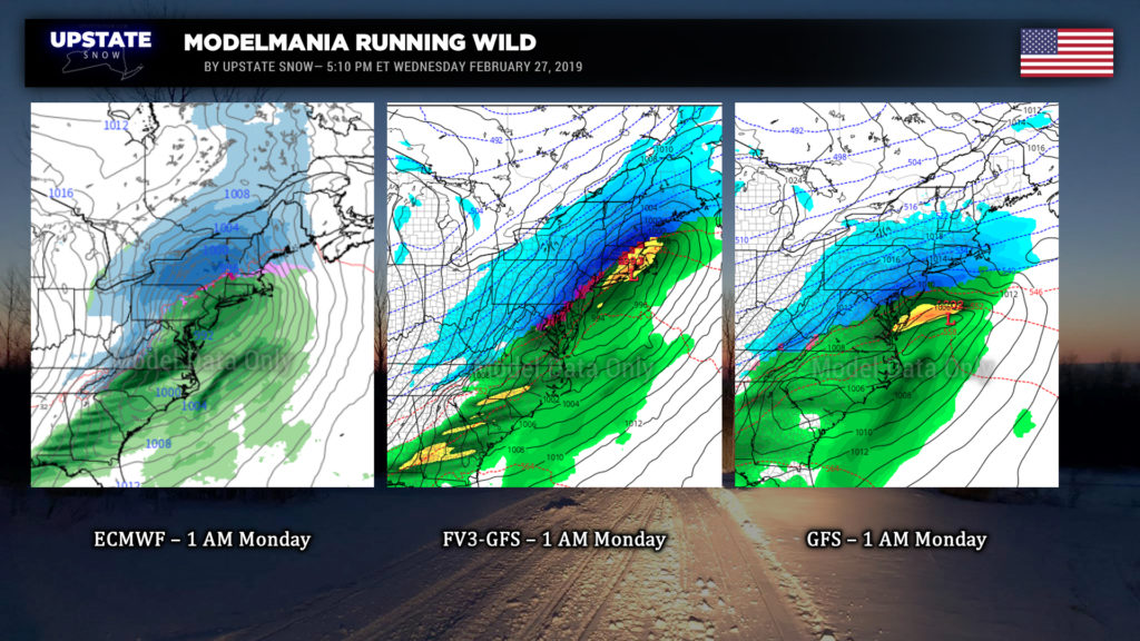
Essentially… if the European or the FV3-GFS verify, we’re in for a significant snowstorm later Sunday through Sunday night. If the GFS verifies, there would still be some snow, but the impact would be much, much less.
Pump the brakes: Today is only Wednesday. It’s easy to “wish-cast,” especially the way this season has gone. It’s easy to “wish-cast” a repeat of March 2018, with the surprise “second season” and Nor’easters one right behind the other. Today’s modeling is all a very different solution than what modeling showed at yesterday’s update. Yes, the cold air will be in place. Yes, the pattern is favorable. It’s just a matter of **IF** the low develops, where does it go. “Stay tuned.”
Unseasonably cold weather continues to be a likelihood for the first full week in March, with the potential for some decent late-season lake effect next week as well, depending on the evolution of our Sunday/Monday storm system.
Ok folks, that’s it for tonight, thanks for viewing!


