
Good evening everyone…
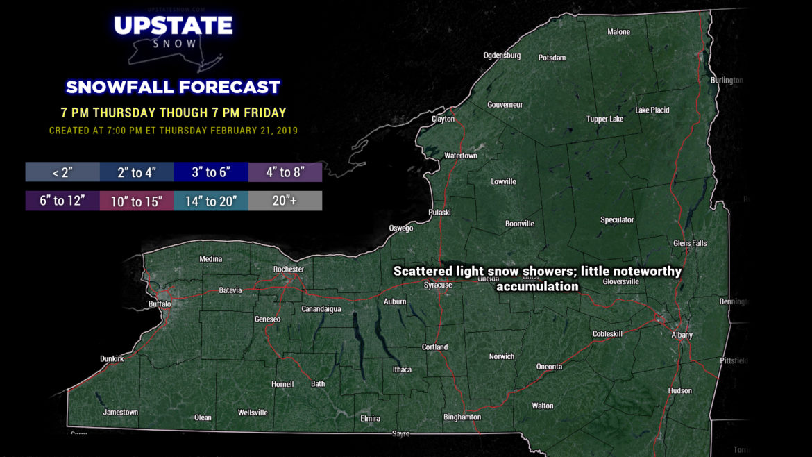
Our storm system is now a memory. Quiet weather will be the rule tonight through Saturday, and if you’re going to get out and ride, THIS IS THE TIME TO DO IT. Get out and RIDE!
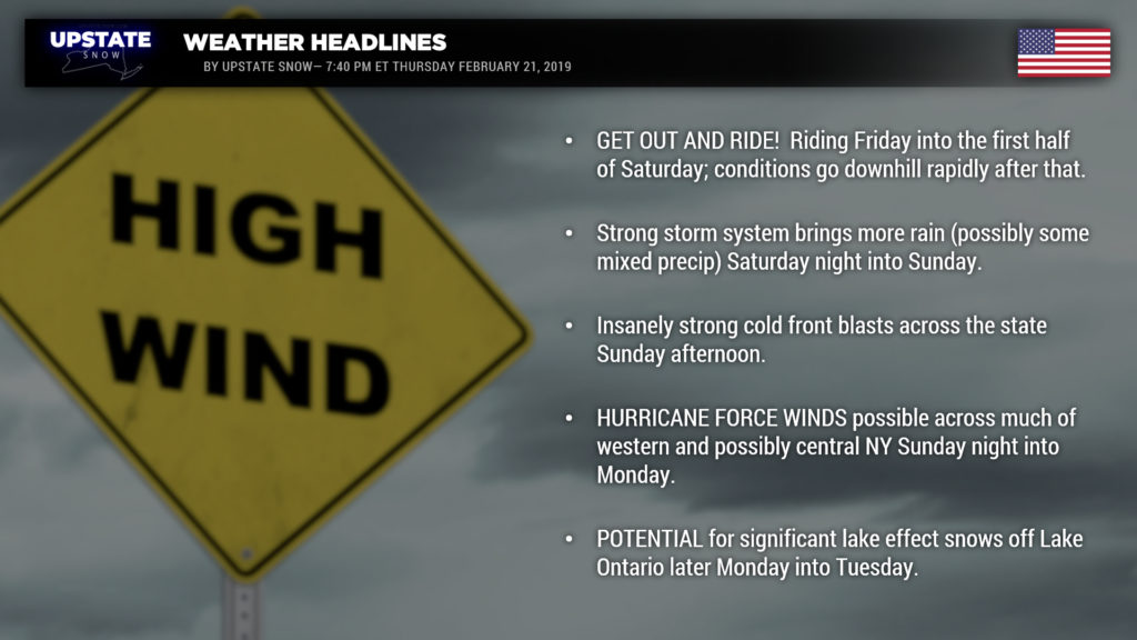
Our next weather system takes aim on the northeast beginning late Saturday night and lasting well into next week with mixed precip, potentially heavy rain, hurricane force winds, and then a potentially significant lake effect event.
The next three images are just a sampling of the model data for 7 AM Sunday, and folks, it ain’t pretty at all. Look for rain to break out late Saturday afternoon from south/southwest to north/northeast. After the sun goes down and temps drop closer to freezing, look for mixed precipitation for at least several hours… the most likely locations include the Catskills and the southern/eastern Adirondacks.
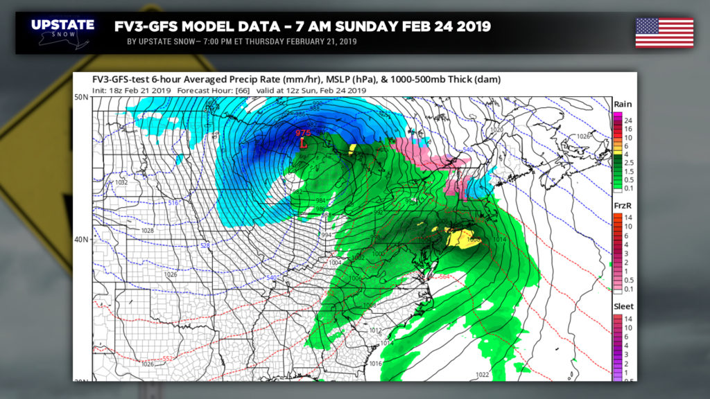
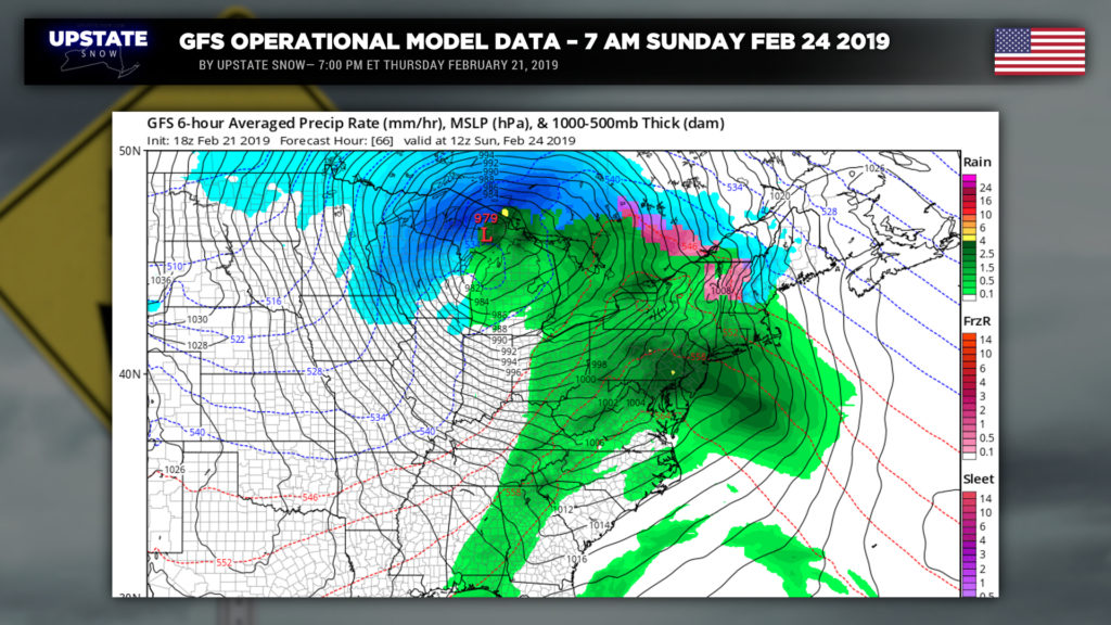
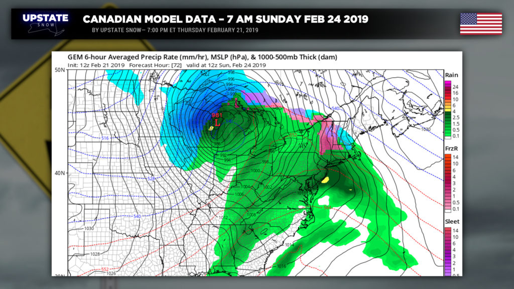
Everyone goes to rain during the day on Sunday. The surface low will spin its way into Michigan and absolutely BOMBS OUT (pressure dropping into the 960-970 mb range – for an overland cyclone). As the surface low continues to move north/east, it will drag a cold front across the state later Sunday. Now, this isn’t going to be just your run-of-the-mill cold front. This front will be jacked up with an IV infusion of Monster Energy. Temperatures TUMMMBLE behind the front with polar air pouring over the state.
As mentioned, our surface cyclone well to our north has exploded. This will bring about WIDESPREAD DAMAGING WINDS TO MUCH OF WESTERN AND POSSIBLY CENTRAL NEW YORK SUNDAY EVENING INTO EARLY MONDAY. The weather service has already issued High Wind Watches for all of western NY. There are a lot of rather unusual atmospheric dynamics that will take place behind this front… we’re not really going to go into all the science here… but the end result will be something known as a low-level jet developing over WNY. Modeling indicates a west-northwest to nearly due-west wind flow … sustained winds 35 to 50 mph … with gusts to 75 mph (that’s hurricane force, folks). Quite needless to say this has the potential of inducing widespread tree damage, damage to power lines, power outages, damage to poorly constructed buildings / trailer-homes, etc. These winds will be coming on the heels of warm temperatures and rain on Sunday… weak/shallow-rooted trees in the soggy ground are certainly going to be in some trouble Sunday night. As well, there is a significant amount of “mobile ice” on Lake Erie. Lake shore flood watches have been posted for ice damage along the shore.
Windy conditions continue on Monday as the main storm system moves far to the north and east. Temperatures will continue to fall Monday into Monday night… setting up the POSSIBILITY… of a significant lake effect snow event off of Lake Ontario. As the strongest winds die back, heavy snows are possible downwind of Lake Ontario late Monday into Tuesday. The setup is excellent for late-season lake effect along and north of the Thruway in this window. Once everything falls and gets cleaned up mid-week… first weekend in March could look great north of the Thruway for riding with colder than normal temps all week behind the windstorm.
Looking at next week, some of the modeling wants to spin a little low southeast across the area from the Great Lakes to just off the Jersey coast during the mid-week time frame, bringing a widespread general light snow across the state.
Ok that’s it for tonight gang. Again, if you’re going out to ride, do it tomorrow into Saturday. Take care…

