Good afternoon / evening!
Winter Weather Advisories remain in effect for nearly all of the Empire State until early Thursday morning, except for Niagara, northern Erie, St. Lawrence, Franklin, Clinton, and Essex counties. Generally light snow or mixed precipitation falling across the state but the high-res modeling indicates a break will occur for a couple of hours this evening. Precipitation will fill back in later this evening across the state, primarily sleet and freezing rain for many areas, with rain far to the west and light snows far to the north. The advisories are up primarily because of this freezing rain threat, where up to a tenth of an inch of ice accumulation is possible in most areas through tomorrow morning.
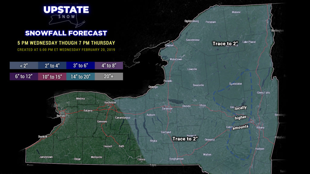
For our maps tonight, regarding snowfall we’re going with a blanket of “trace to 2 inches” for the entire state east of a line from Rochester through Elmira, through 7 PM Thursday. Higher elevations of the southern/eastern Adirondacks and the eastern Catskills may push 3-4 inches of snow through tomorrow evening but confidence is not high enough to actually fill in that color.

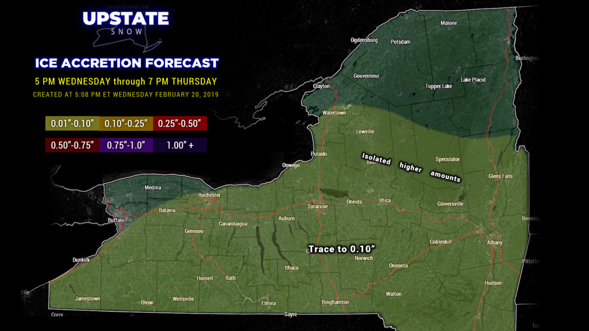
For ice accumulation, honestly loathe drawing these maps because the bust potential is … spectacular. The high-res NAM3k wants to paint half an inch of ice accumulation over the Tug through 7 PM Thursday — not buying that, even with double coupons. (Just a side note, the model is painting PROLIFIC ice totals over central Pennsylvania… inch and a half in some spots.) The HRRR has what are believed to be more realistic amounts… generally around a tenth of an inch for many areas of the southern tier, but does paint a bullseye of higher totals on the southern foothills of the ADKs, southern Herkimer county into Fulton county. FV3 also “averages out” around a tenth of an inch, while the GFS operational comes in much, much lighter in terms of freezing rain. So our map splits the difference, and goes with just the base color, up to a tenth of an inch. This will occur through early Thursday as precipitation will transition to all rain showers by time you sit down to breakfast.

For Thursday… as mentioned everything transitions to liquid early in the morning, and then our high-res modeling shows all precip quickly and abruptly coming to an end. The NAM3k keeps some light lake effect snows east of Lake Ontario as colder air wraps in later Thursday morning behind the cold front, whereas the HRRR does not show this. If there is some lake response it will be a) brief and b) light as high pressure builds back in by Thursday evening.
The entire system is a memory as we move into Friday, with a strong area of high pressure parked directly over central New York. Friday highs will range from the upper 30s for the central Southern Tier, Fingerlakes and western NY, to the mid 30s for the Susquehanna region, upper 20s to around 30 for the ADKs, and around 40 for Albany and the Hudson valley.
Temperatures warm back up… waaaaayyyy up… for the weekend, especially Sunday where readings in the 50s are likely over much of the state, save for the central ADKs, which will be in the 40s.
Speaking of the weekend, hot on the heels of our current system is one that will be just like it, albeit quite a bit stronger. There are some model differences in opinion, of course since today’s only Wednesday, but the gist of the picture is low pressure will lift from central Kansas Saturday afternoon to the upper peninsula of Michigan by Sunday morning. This storm absolutely BOMBS as it approaches the northern lakes, while a secondary low forms somewhere around the Jersey coast. Mixed precip Saturday afternoon or evening quickly goes over to rain… which could be fairly copious… for Saturday night and Sunday. The trailing cold front moves through later Sunday with temperatures crashing and whatever leftover rain we have changing over to snow. As mentioned, ALL of the modeling shows this storm absolutely blowing up; this could set the stage for a high wind event here later Sunday and Sunday night behind the cold front… as well as a potential for some lake effect. Bitterly cold air makes a much-awaited return to CNY early next week.
Be safe if you have to travel tonight. Thanks for viewing!


