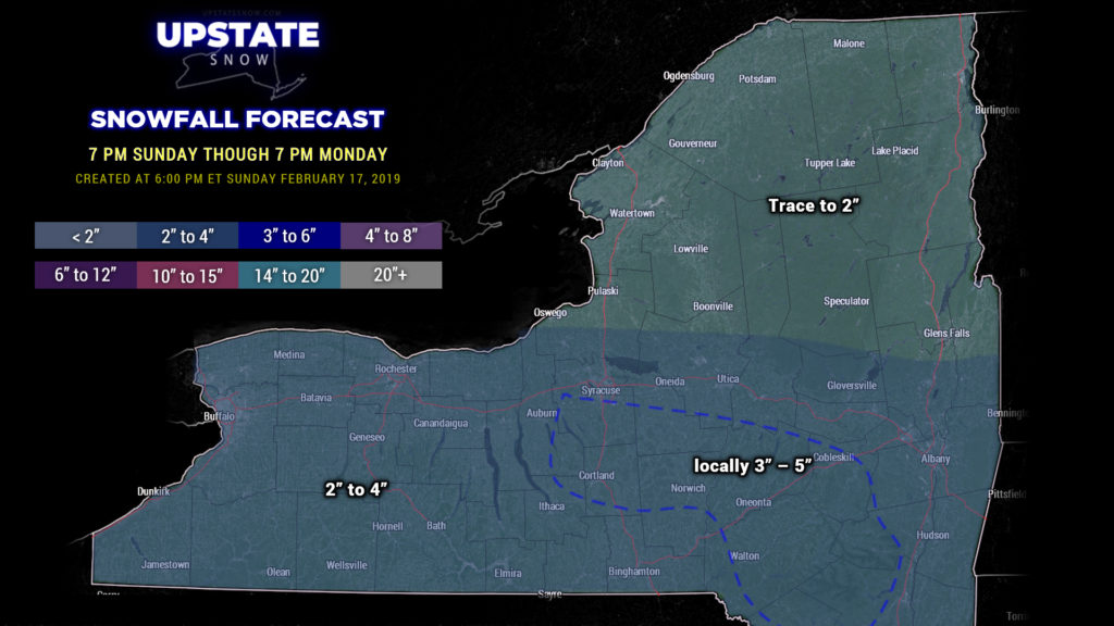
Good evening…
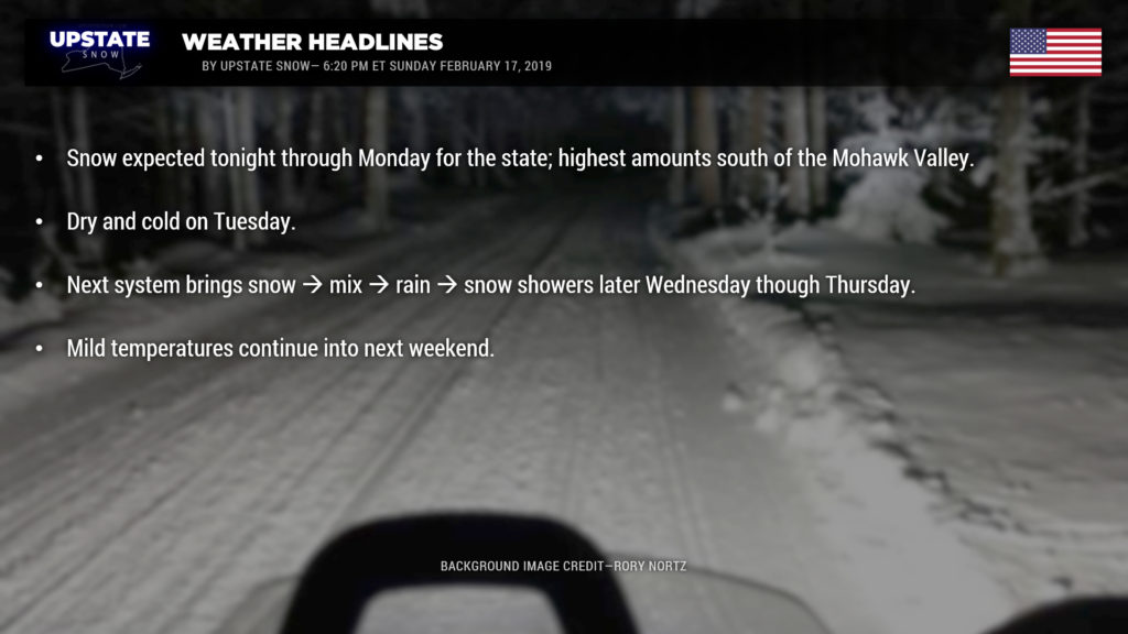
Winter Weather Advisories are up for all of NY south of the Valley. Low pressure will move across Pennsylvania to the coast tonight through Monday morning. Snow will continue to overspread the state this evening and overnight, with a couple-hour burst of moderate snowfall during the night, but light snows and snow showers will continue through the day Monday as the upper level jetstream moves over the area and colder air pushes in behind the main low. Expect snow totals of 2-4 inches across the Southern Tier, with some areas pushing 5 inches, perhaps an isolated 6-inch total. Expect lesser amounts in the North Country; primarily looking at trace to 2 inch totals… maybe a spotty 3-inch amount. This is, on the whole, a straight-forward system and should be all snow everywhere. Some “enhanced” uplift during the night may bump the temperature to 33 or so in higher levels of the atmosphere, especially near the PA border, and therefore don’t be too shocked if you hear some ticks of sleet… but that chance is slim.
Tuesday will be the coldest day of the coming week, with temperatures below freezing.
Focus then turns on the middle of the week and … as has been a recurring theme this winter … another low pressure system will lift north through the Great Lakes bringing a snow-to-rain-to-snow event. Operational models and ensembles are all in fairly decent agreement, especially this far out. There are some disagreements on placement of the low, but this is going to be just like all the others we have had this season. Low pressure moves generally from northern Illinois/Indiana Wednesday evening… northeastward into Ontario, continuing northeastward into Thursday evening. At the same time, there’s suggestion that a second low forms over New Jersey or off the Jersey coast on Thursday morning. This low slides ENE out to sea through Thursday night.
A warm front will lift north across the area Wednesday afternoon-ish, with some light snows breaking out. A southerly flow sets up and the middle and upper atmosphere starts to warm Wednesday night. Snows transition to sleet and then freezing rain. As temps go above freezing down to the surface before dawn on Thursday, everyone goes to rain — the last holdouts will be the eastern Adirondacks and eastern Catskills, as usual this season. At any rate, our modeling shows rainy conditions Thursday morning before the accompanying cold front sweeps through. This sets up a transition to snow showers, but by then, it appears most of the precip will be gone.
Models are not showing this to be a prolific precipitation-producer… spitting out generally a half inch of liquid / liquid equivalent for the event. That would imply a coating of snowfall at the onset, perhaps an inch or two, followed by maybe a light glaze of ice, and then rain. But we’ve heard that before. The modeling this season come in “light” virtually up until the onset of our storms, and I don’t see any reason to expect this will be any different than the many previous other systems this season. The best rain chances will come from before dawn on Thursday through about noon.
There may be some lake response behind the cold front, but the air won’t be “all that cold” — temps Friday may warm back into the 40s once again.
And as we look at NEXT weekend… modeling shows YET ANOTHER Great Lakes system by next Sunday… ugh.


